
Hot and sticky weekend continues; storms likely on Sunday
Go Deeper.
Create an account or log in to save stories.
Like this?
Thanks for liking this story! We have added it to a list of your favorite stories.


There's nothing quite like having Florida weather in Minnesota.
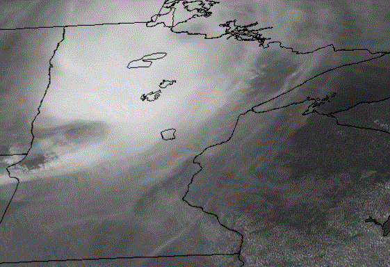
Saturday has been hot and very sticky for most of us, but it could have been even hotter. Severe thunderstorms that produced a measured wind gust of 80 mph at the Fargo airport weakened into harmless cooling showers as they tracked across northern Minnesota. Farther south, including the Twin Cities area, high cloud blowoff from those storms kept out just enough sunshine to hold some temperatures down a few degrees.
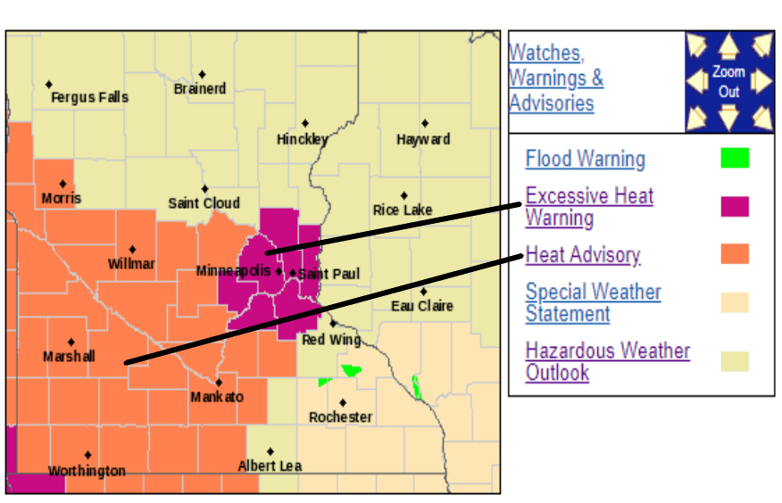
The muggy heat will continue. A Heat Advisory is posted until 9 p.m. this Saturday evening for areas west and southwest of the Twin Cities area. An Excessive Heat Warning will persist until 9 p.m. on Sunday for the seven-county Twin Cities metro area where the buildings and concrete hold heat through the night. The Twin Cities will have an overnight low around 74 and a Sunday high probably in the low 90s.
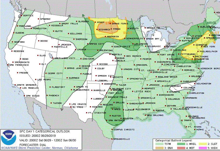
Thunderstorms Saturday night and Sunday
Turn Up Your Support
MPR News helps you turn down the noise and build shared understanding. Turn up your support for this public resource and keep trusted journalism accessible to all.
Thunderstorms should rev up over North Dakota Saturday night in response to a great deal of convective available potential energy (CAPE) and the usual nocturnal low level jet stream. Those storms are likely to be discreet supercells with tornado potential initially and then consolidate into a mesoscale convective system (mass of storms) with the potential for wind damage and maybe hail as they advance across Minnesota during the night. Forecast models are depicting the storms affecting mainly the northern half of Minnesota but models have been wishy-washy on their track. Some storms might become severe.
The risk of strong to severe storms, some probably with heavy rain, will shift to mainly central and southern Minnesota including the Twin Cities area for Sunday and Sunday night as a cold front crosses the state and the sun adds thermal energy.
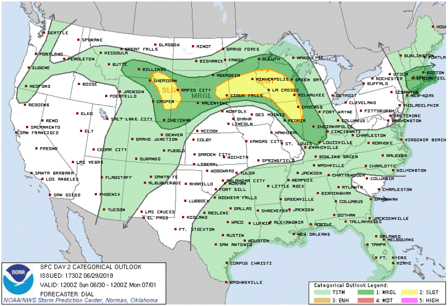
For the Twin Cities area, there will be a chance of thunderstorms late Saturday night and then the likelihood of thunderstorms Sunday afternoon and evening. Some storms could be severe.
Warm rather than hot next week
High temperatures should fall back to about normal beginning on Monday as June turns into July. Look for highs in the Twin Cities generally in the low to mid 80s next week.
Rain gauges at the ready
Next week will continue to be quite unsettled. Be on the lookout for bouts of showers and storms. The most likely candidates will be Sunday night into Monday, Monday night into Tuesday, and then maybe Thursday and Friday.
But there will be nary a snowflake or wind chill to be had.

