
Drying out Tuesday; daytime storms on July 4
Go Deeper.
Create an account or log in to save stories.
Like this?
Thanks for liking this story! We have added it to a list of your favorite stories.


Raise your hand if you are ready for a reprieve from all the recent rounds of rain and thunderstorms.
I will raise my hand and type one-handed as I report that my rain gauge has carefully measured 2.85 inches of rain in Minneapolis since the storms first began Sunday morning. Minneapolis-St. Paul International airport got about 3.1 inches.
Now back to two-handed typing.
Drying out Tuesday
Turn Up Your Support
MPR News helps you turn down the noise and build shared understanding. Turn up your support for this public resource and keep trusted journalism accessible to all.
Tuesday will indeed bring a welcome break in the weather action.
The last light showers are tracking out of eastern Minnesota into Wisconsin. Lingering fog will burn off during the morning. Tuesday might easily turn out to be the driest, most pleasant day this week for the state in general.
Numerous thunderstorms will form across the Dakotas on Tuesday. A scattering of storms could trek into northwestern Minnesota by evening but central and southern sections should remain rain-free.
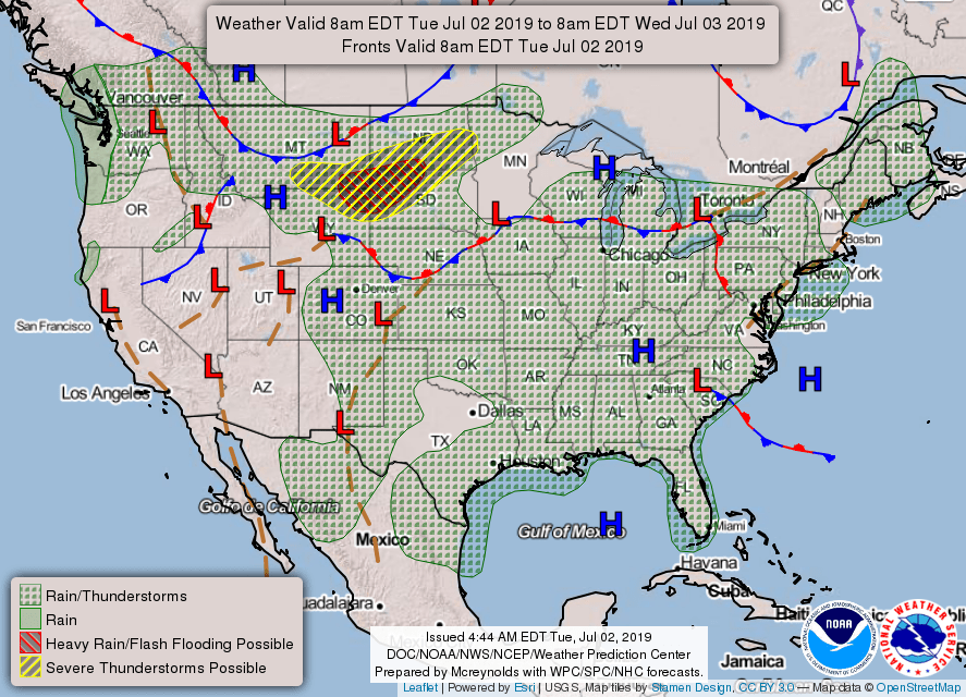
A few thunderstorms could become strong or even severe in northwestern Minnesota late on Tuesday.

Look for afternoon high temperatures from the low- to mid-80s, but much cooler near the North Shore.
Clouds over the Twin Cities should give way to mostly sunshine. The afternoon high should be a muggy 85 degrees with very light winds.
The atmospheric dynamics that will be off to our west on Tuesday will march into the state on Wednesday to begin a string of days with thunderstorm chances.
Here is a look at the next four days for areas around the Twin Cities:
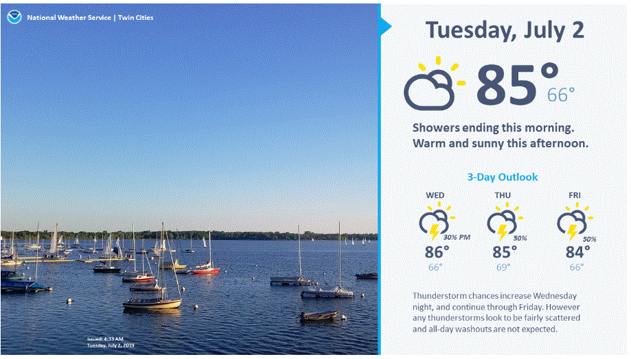
Scattered storms for Wednesday
Expect a scattering of thunderstorms to grow with the heating of the day, mainly across the northern half of the state.
Fireworks for Independence Day
Stronger dynamics are likely to trigger numerous atmospheric fireworks around the state on Thursday for the Fourth of July.
Current forecast models are predicting thunderstorms mainly during the daytime hours with a good chance of clearing before after-dark fireworks. Some storms could become strong or even severe.

End of the week
Friday could be one last day this week with scattered showers and storms.
Cooler, drier air seems to be headed our way for the weekend, especially for Sunday.

