
Shower/t-storm chances on the Fourth, but dry this weekend
Go Deeper.
Create an account or log in to save stories.
Like this?
Thanks for liking this story! We have added it to a list of your favorite stories.


The official rain total at Minneapolis-St. Paul International Airport was 2.02 inches on Monday. Add the .08 that fell before 3 a.m. on Tuesday and the July tally already stands at 2.10 inches. That's more than half our average Twin Cities rainfall total of 4.04 inches for the entire month of July! It was great to have rain-free weather in most of Minnesota and western Wisconsin during the daylight hours of Tuesday.
We've seen a lot of rain across much of Minnesota and western Wisconsin over the past week or so:
Shower and thunderstorm chances
The best chance of some showers and thunderstorms Tuesday evening and overnight Tuesday night will be in the northwest. The Storm Prediction Center of the National Weather Service shows a slight risk of severe weather Tuesday evening and overnight Tuesday night for much of North Dakota and for a small part of northwestern Minnesota, with a marginal severe weather risk for the remainder of northwestern Minnesota:
Turn Up Your Support
MPR News helps you turn down the noise and build shared understanding. Turn up your support for this public resource and keep trusted journalism accessible to all.
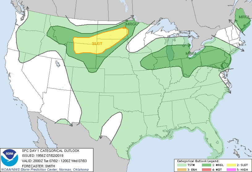
Slight risk means that scattered severe thunderstorms are possible and marginal risk means that an isolated severe thunderstorm is possible:
SPC updates their severe weather outlooks several times each day and night.
As always, updated weather information can be heard on the Minnesota Public Radio Network, and you’ll also see updated weather info on the MPR News live weather blog.
You can see the recent local Twin Cities NWS radar loop here. The northwestern Minnesota radar loop is also available. The southwestern Minnesota radar loop can be found here, and the northeastern Minnesota radar loop is here.
The SPC shows a marginal risk of severe weather in portions of Minnesota for the period from 7 a.m. Wednesday to 7 a.m. Thursday:
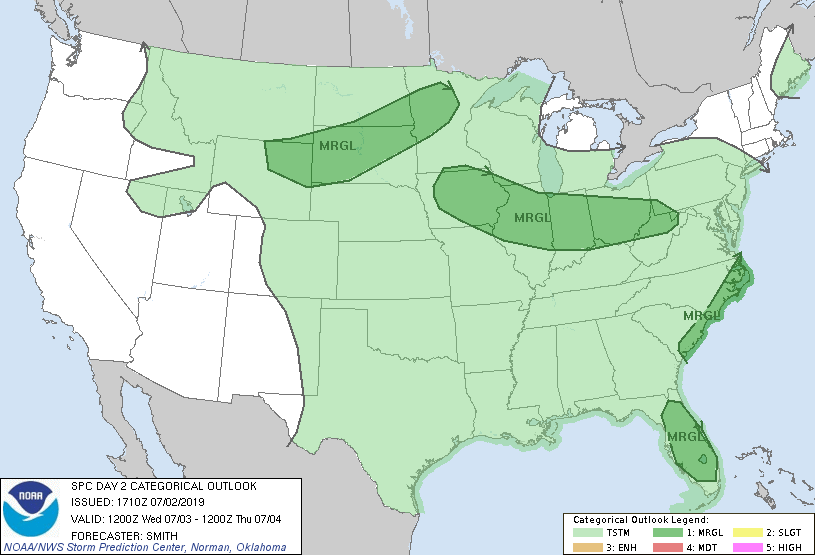
The best chance of showers and thunderstorms Wednesday morning is expected to be to the northwest. As we go through Wednesday afternoon and evening, the shower/t-storm chances will expand to include much of Minnesota and western Wisconsin.
Most areas will have a chance of occasional showers and thunderstorms on the Fourth of July, but the timing of those isn't really clear yet.
The National Oceanic and Atmospheric Administration’s North American Mesoscale forecast model shows the potential rain pattern Thursday through Thursday evening:
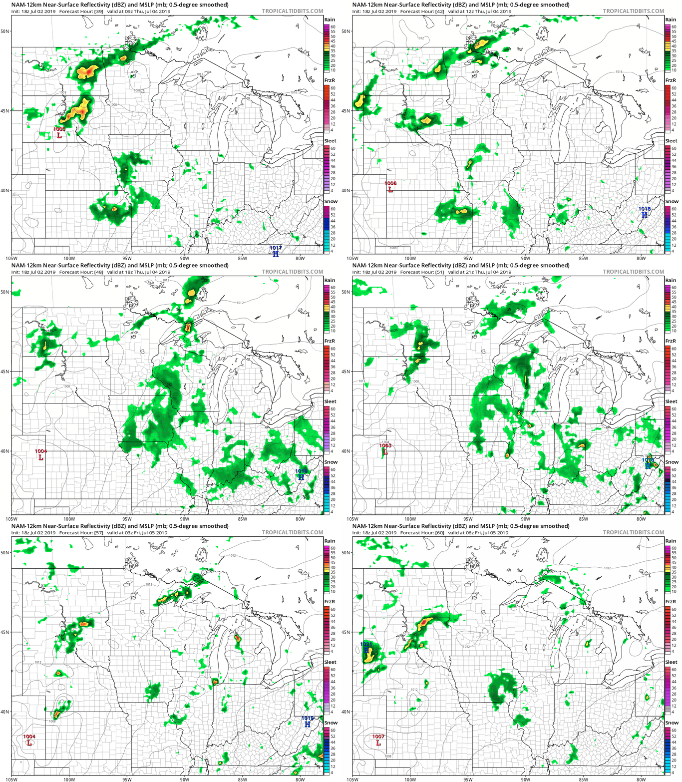
The color chart to the right of the loop refers to the strength of the signal that returns to the radar, not to the amount of rain. It will rain in some areas that look dry in the NAM loop, but the loop shows the patchy rain pattern within the model.
Temperature trends
Wednesday highs will be mainly in the 80s across Minnesota and western Wisconsin, with some 70s in parts of northwestern and north-central Minnesota. Twin Cities metro area highs could reach the upper 80s.
Fourth of July highs will be in the 80s central and south, with some 70s in the far north:
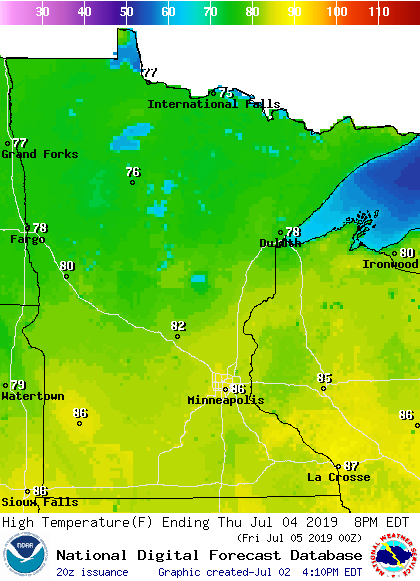
Friday highs look similar:
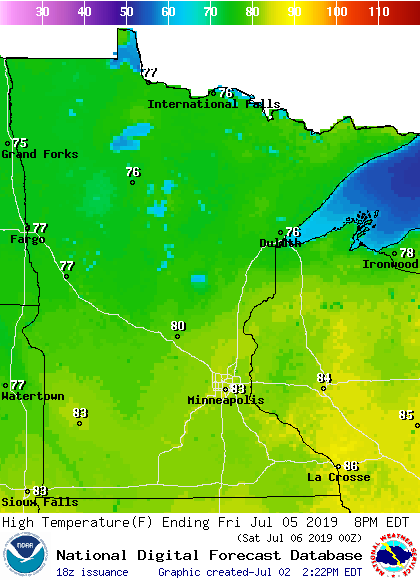
Weekend highs in the Twin Cities metro area are expected to be around 80 both days, and slightly drier air will settle over us.
I hope that you have a great time this Fourth of July holiday weekend!

