
Shower/thunderstorm chances Friday; weekend mostly quiet
Go Deeper.
Create an account or log in to save stories.
Like this?
Thanks for liking this story! We have added it to a list of your favorite stories.


This doesn't seem like a Friday. Many of us remain in holiday mode, with outdoor activities on our minds. Friday will be the most unsettled day of the next three days, but we'll have many dry hours too.
Rain and thunderstorm chances
An area of showers and thunderstorms moved into southwestern Minnesota early Friday morning, and it's expected to spread to the east-northeast through the evening. Some showers and embedded thunderstorms could arrive in the Twin Cities metro area by around mid-afternoon, and linger into early evening.
The National Oceanic and Atmospheric Administration's High-Resolution Rapid Refresh (HRRR) forecast model shows the potential rain pattern from Friday morning through Friday evening:
Turn Up Your Support
MPR News helps you turn down the noise and build shared understanding. Turn up your support for this public resource and keep trusted journalism accessible to all.
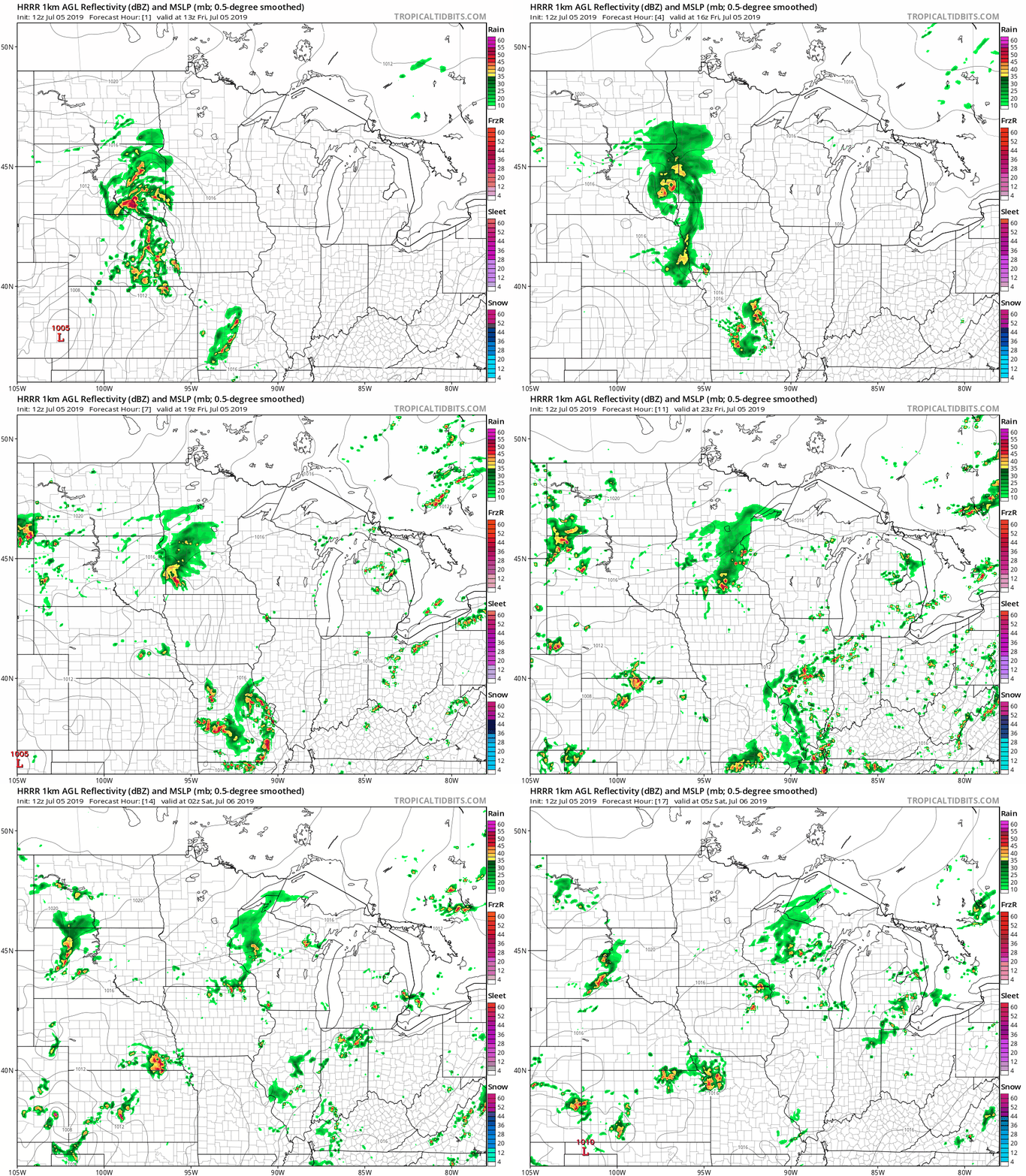
The color chart to the right of the loop refers to the strength of the signal that returns to the radar, not to the amount of rain. It'll rain in some areas that look dry in the HRRR model, but the loop shows the general rain pattern as it moves eastward. Check forecast updates.
As always, updated weather information can be heard on the Minnesota Public Radio Network, and you’ll also see updated weather info on the MPR News live weather blog.
You can see the recent local NWS radar loop here. The recent radar loop for southwestern Minnesota can be found here, and the southeastern Minnesota loop here. The northeastern Minnesota radar loop and the northwestern Minnesota radar loop are also available.
Severe weather outlook
The Storm Prediction Center of the National Weather Service shows a marginal risk of severe weather for portions of southern Minnesota and southwestern Wisconsin Friday and Friday night:
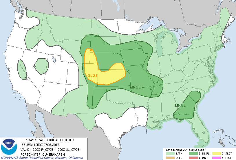
Marginal risk means that an isolated severe thunderstorm is possible.
Much of the Twin Cities metro area is included in the SPC marginal risk category. The SPC will update their severe weather outlook later this morning and also around mid-afternoon.
Temperature trends
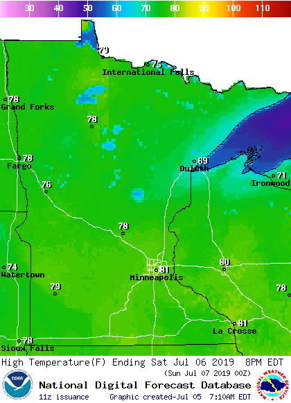
Minnesota and western Wisconsin highs will be mainly in the upper 70s to lower 80s Friday afternoon with a few mid 80s in southeastern Minnesota. Many spots in the Twin Cities metro area should reach the lower 80s.
Our average metro area high temp is 83 degrees this time of year.
Similar highs are expected on Saturday, but it'll be a bit cooler near Lake Superior:
Sunday highs will also be mainly in the upper 70s to lower 80s, with cooler temps near the big lake:
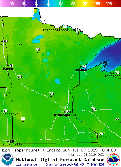
Twin Cities metro area highs are projected to be in the lower 80s Monday through Thursday of next week.
Anchorage heat
I mentioned yesterday that it was an unusually warm Fourth of July in Anchorage, Alaska.
They ended up with a high of 90, which is a new all-time high for Anchorage, based on airport data going back to 1952:
Their previous post:
In case you're wondering, the average July 4 high temp is only 65 degrees in Anchorage. They're predicting a high of about 86 degrees in Anchorage today.

