Pleasant July Sunday; unsettled at times this week
Go Deeper.
Create an account or log in to save stories.
Like this?
Thanks for liking this story! We have added it to a list of your favorite stories.


Smoky skies
Smoke from Canadian wildfires in eastern Manitoba and western Ontario spread across northern Minnesota on Saturday. In response, the Minnesota Pollution Control Agency issued an Air Quality Alert for smoky air for about the northern third of the state.
Most of the smoke is aloft as of Sunday morning. Some of it likely will mix down to the surface during the heating and atmospheric overturning of the day.
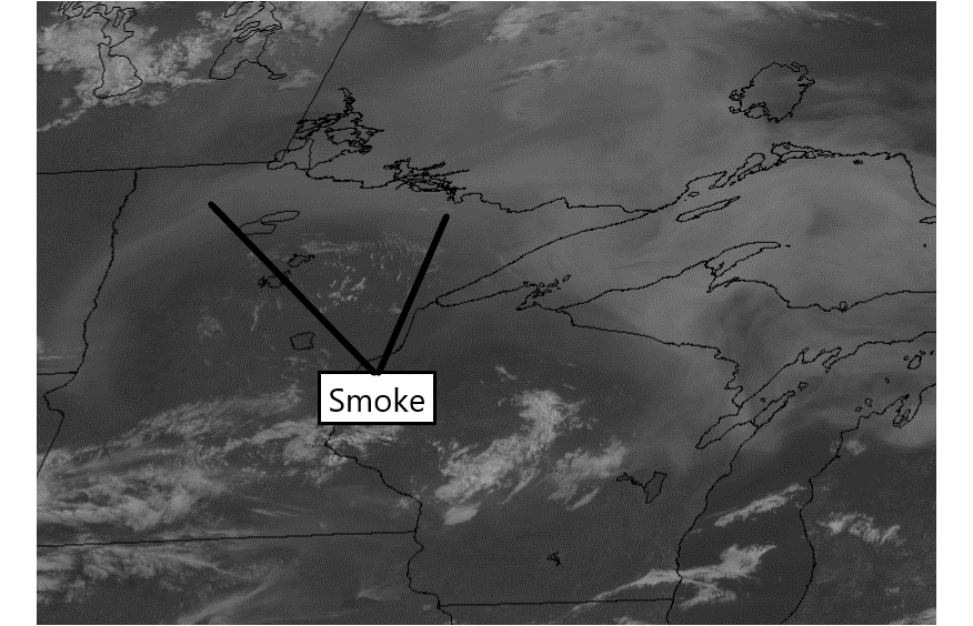
That alert is posted until noon on Sunday and has been expanded a bit farther south to include the Hinckley area.
Turn Up Your Support
MPR News helps you turn down the noise and build shared understanding. Turn up your support for this public resource and keep trusted journalism accessible to all.


Here is a quick look at the upcoming five days:

Delightful Sunday
Look for seasonable high temperatures mainly from the upper 70s to mid 80s Sunday afternoon. The Twin Cities should warm to about 83 with very light winds and comfortable humidities. The North Shore will be cooler than the rest of the state with highs around 70 thanks to a chilled flow off Lake Superior.
A few short-lived thunderstorms will likely pop up during the heating of the afternoon in the southern third of the state, possibly including the Twin Cities area.
Dry Monday for most
Monday also looks like a great July day but with an increase in humidity. Highs will be mainly in the 80s.
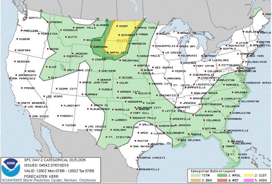
A developing low pressure system in the Dakotas will ramp up strong to severe thunderstorms in those states Monday afternoon. Some of those storms will spread into northwestern Minnesota later on Monday, probably during the evening. Some storms might be severe in that part of the state Monday evening or overnight.
Unsettled Tuesday and Wednesday
Weather systems generally move much more slowly across our part of the world in mid-summer than they did when pushed by jet streams during spring. In this case, the plodding low pressure system from the Dakotas will bring periods of showers and thunderstorms to Minnesota for Tuesday and probably Wednesday.
Later in the week
Thursday looks like a dry day.
Then scattered showers and thunderstorms Thursday night and Friday.
Hotter, muggier weather looks to be on tap for Friday and Saturday.
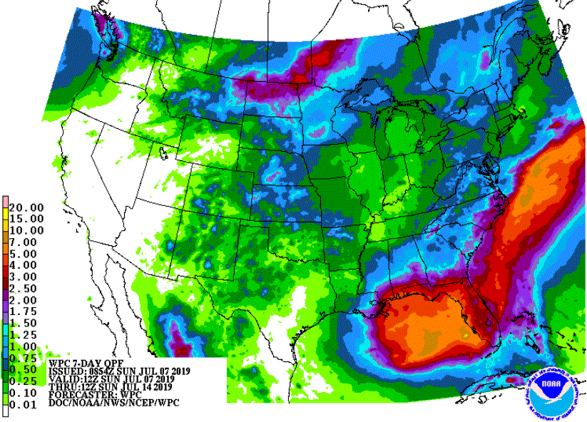
Rainfall outlook for a week
The 7-day precipitation outlook through 7 a.m. next Sunday shows significant rain for North Dakota into northwestern Minnesota. Also notice the heavy rainfalls expected along the Gulf Coast from southeastern Louisiana to Florida as a strong, moist low pressure system builds over the eastern Gulf of Mexico.