
A very nice Saturday, then periods of showers and thunderstorms on Sunday
Softball-size hail pic from Friday
Go Deeper.
Create an account or log in to save stories.
Like this?
Thanks for liking this story! We have added it to a list of your favorite stories.


Many of us didn’t see any rain or hail Friday afternoon and evening, but parts of central and northeastern Minnesota and western Wisconsin had strong to severe thunderstorms.
The softball-sized hail which fell near Clear Lake, Minn., on Friday caught the attention of the NWS Central Region Headquarters, which is located in Kansas City:
Clear Lake is in Sherburne County. There was also some very large hail in Sauk Rapids, which is in Benton County:
Here are some additional hail reports from Friday:
Turn Up Your Support
MPR News helps you turn down the noise and build shared understanding. Turn up your support for this public resource and keep trusted journalism accessible to all.
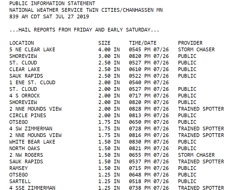
You can see that parts of the north and east metro had large hail, too, including a 3-inch diameter report from Shoreview and 2-inch diameter hail in Circle Pines.
If you ever wonder how hail sizes are described, you can consult this chart from NOAA:

Rain and thunder chances
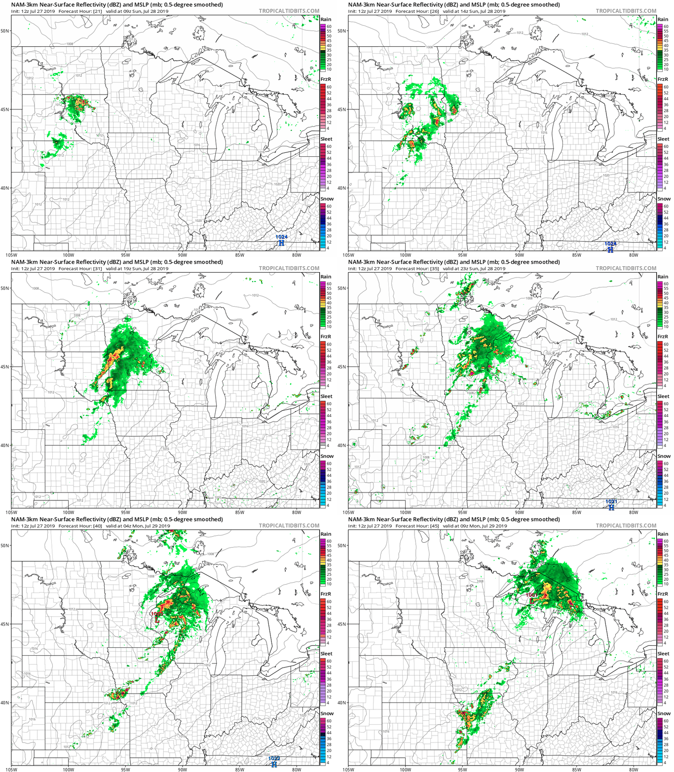
After a nice summery day on Saturday, showers and thunderstorms return to Minnesota on Sunday. The National Oceanic and Atmospheric Administration's North American Mesoscale forecast model shows the potential rain pattern from Sunday morning through Sunday night:
As always, updated weather information can be heard on the Minnesota Public Radio Network, and you’ll also see updated weather info on the MPR News live weather blog.
Some areas of heavy rain are possible Sunday and Sunday night. A severe thunderstorms will also be possible. The National Weather Service Storm Prediction Center shows a marginal risk of severe weather Sunday and Sunday night in much of central and southern Minnesota and parts of western Wisconsin:
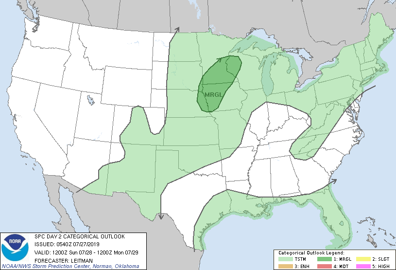
A marginal risk indicates that an isolated severe thunderstorm is possible.
Temperature trends
Most of Minnesota and western Wisconsin will have Saturday afternoon highs in the 80s. There could be a few upper 70s near the Canadian border and a few spots in far southern Minnesota could touch 90.
Sunday highs will be mainly in the upper 70s to lower 80s:

Twin Cities metro area highs are projected to be in the upper 70s Monday and Tuesday, followed by lower 80s Wednesday through Friday.
Programming note
You can hear my live weather updates on Minnesota Public Radio at 7:49 a.m. Thursdays and Fridays, and at 7:35 a.m., 9:35 a.m. and 4:35 p.m. each Saturday and Sunday.

