
Quiet Tuesday, thunderstorm chances Wednesday
Pictures of the record largest hailstone in the U.S.
Go Deeper.
Create an account or log in to save stories.
Like this?
Thanks for liking this story! We have added it to a list of your favorite stories.


This was a 4-inch diameter — softball-size — hailstone that fell early Monday afternoon near Delano, Minn:
That’s a big hunk of hail, but imagine a hailstone twice that size. This 8-inch diameter hailstone set a U.S. record when it fell in Vivian, S.D., on July 23, 2010:
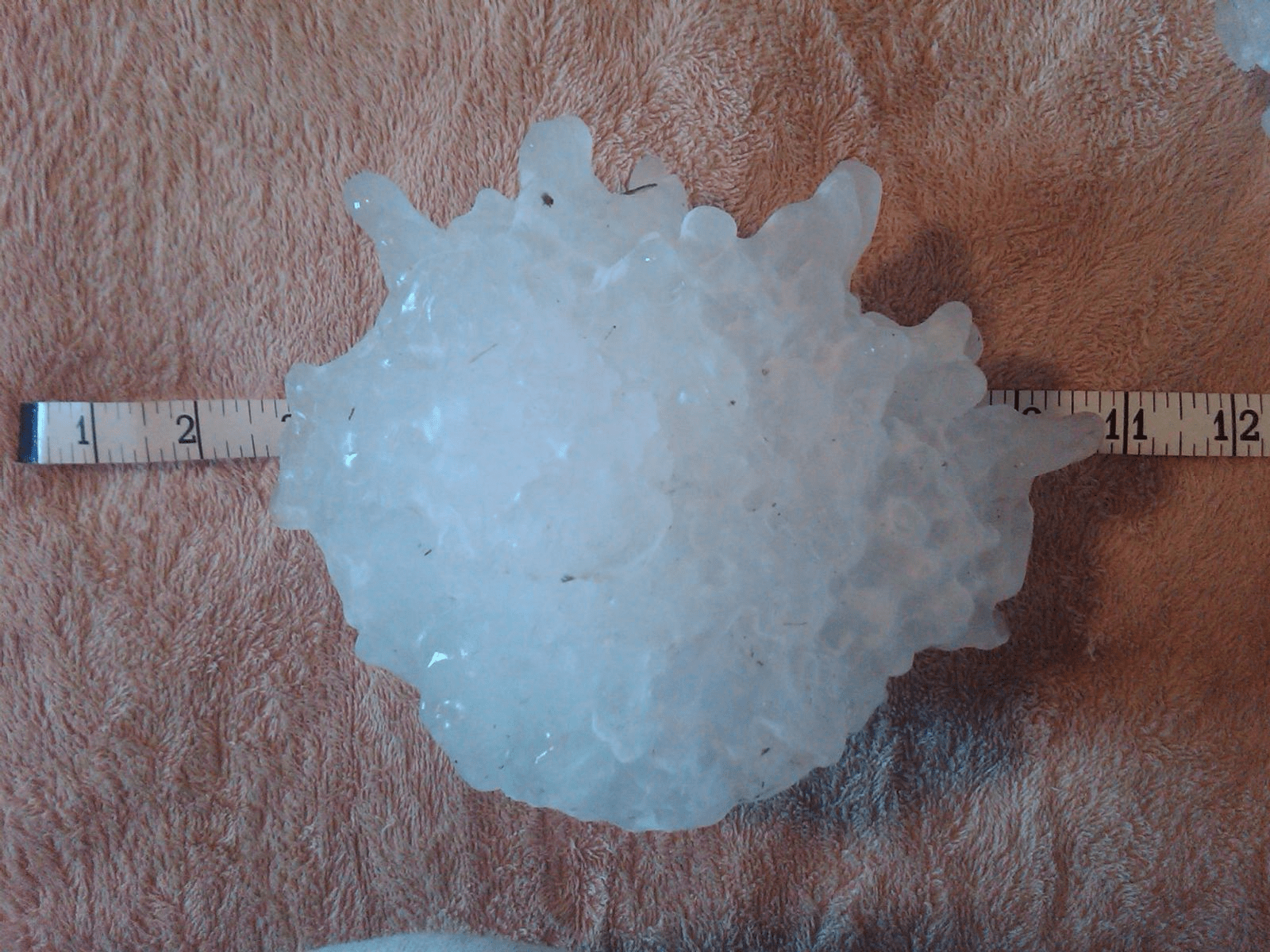
The hailstone was probably bigger than 8 inches at one time, according to the National Weather Service:
The hailstone's official record dimensions were as of the time personnel from the NWS in Aberdeen first observed and measured it.
The stone did shrink considerably (melting and sublimation) between impact and when it was first measured by NWS personnel due in part to a power outage at the residence of the individual who found the stone.
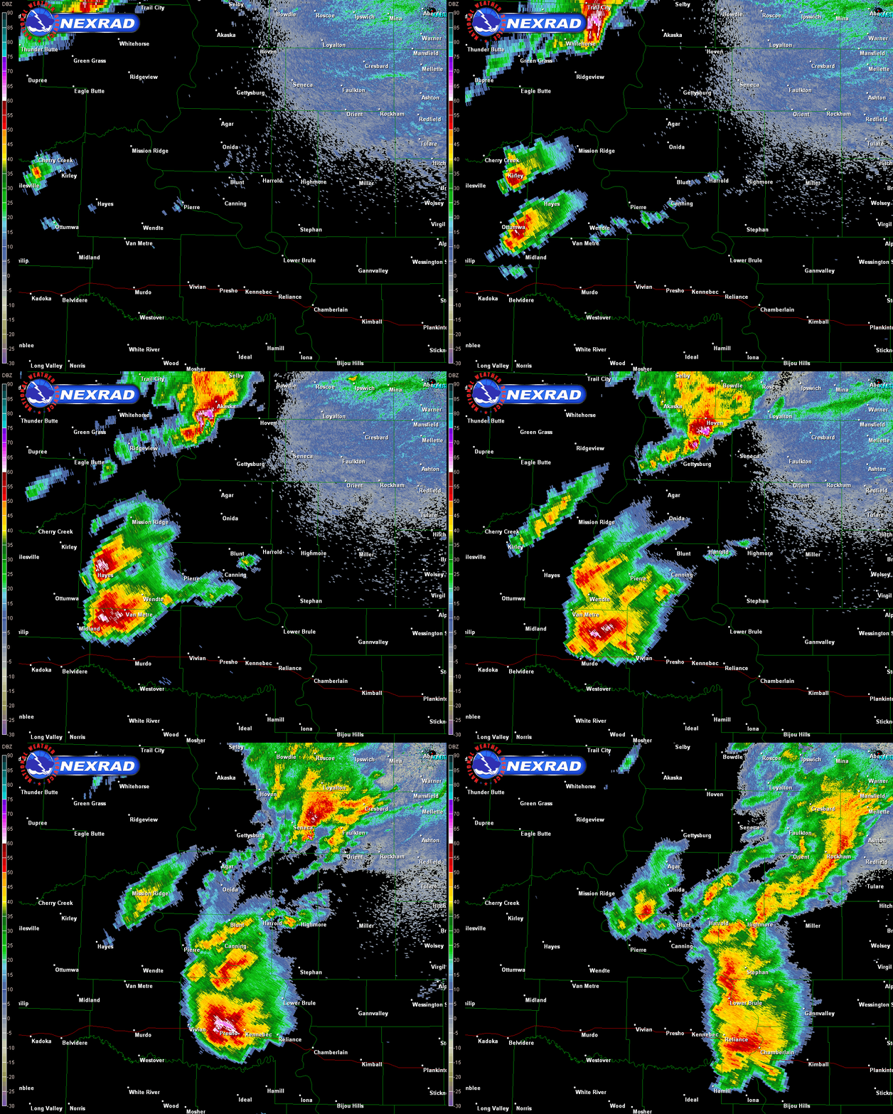
This was the radar loop for July 23, 2010, with the southern cluster of storms moving over the Vivian location:
Turn Up Your Support
MPR News helps you turn down the noise and build shared understanding. Turn up your support for this public resource and keep trusted journalism accessible to all.
Wednesday thunder chances
Scattered showers and thunderstorms could spread into far northwestern Minnesota late Tuesday afternoon and across roughly the northern third of Minnesota Tuesday evening and into central Minnesota overnight.
As always, updated weather information can be heard on the Minnesota Public Radio Network, and you’ll also see updated weather info on the MPR News live weather blog.
Scattered showers and thunderstorms are possible in Minnesota and western Wisconsin on Wednesday. The National Weather Service Storm Prediction Center shows a slight risk of severe weather for southeastern Minnesota and parts of Wisconsin Wednesday and Wednesday night:

Slight risk means that scattered severe thunderstorms are possible.
Parts of the Twin Cities metro area are in a marginal severe weather risk Wednesday and Wednesday night, meaning that an isolated severe thunderstorm is possible. SPC will update the Wednesday severe weather outlook Tuesday afternoon.
Temperature trends
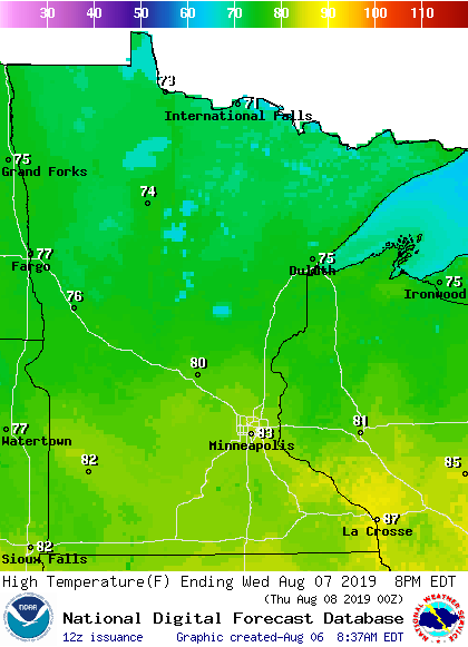
Minnesota and western Wisconsin highs will be mainly in the 80s this Tuesday, with a few 70s in northeastern Minnesota.
Wednesday will feature 70s north and 80s south:
Twin Cities metro area highs are projected to be in the upper 70s Thursday, then around 80 Friday, Saturday and Sunday.
That’ll give our air conditioners some rest!

