
A shower and thunderstorm chance in some areas on Wednesday
Next week looks a bit cooler
Go Deeper.
Create an account or log in to save stories.
Like this?
Thanks for liking this story! We have added it to a list of your favorite stories.


Tuesday was the kind of summer day that I dream about in February. Highs were in the 80s and dew point temperatures were comfortable. We had plenty of sunshine with scattered fair-weather cumulus clouds popping up with the heating of the day:

We’ll have a mixed bag of weather on Wednesday.
Rain and thunder chances
Scattered showers and thunderstorms will move across portions of northern Minnesota Tuesday evening and overnight.
Turn Up Your Support
MPR News helps you turn down the noise and build shared understanding. Turn up your support for this public resource and keep trusted journalism accessible to all.
As always, updated weather information can be heard on the Minnesota Public Radio Network, and you’ll also see updated weather info on the MPR News live weather blog.
You can see the recent local National Weather Service radar loop here. The northeastern Minnesota radar loop and the northwestern Minnesota radar loop are also available. The recent radar loop for southeastern Minnesota can be found here, and the southwestern Minnesota loop here.
Forecast models show a chance of scattered showers and thunderstorms Wednesday morning in central and southern Minnesota and parts of western Wisconsin. If the front keeps moving, most of the showers and t-storms will be confined to southeastern Minnesota and southwestern Wisconsin by Wednesday afternoon.
The National Weather Service Storm Prediction Center shows a slight risk of severe weather Wednesday and Wednesday night for southeastern Minnesota and parts of Wisconsin:
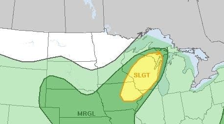
The Storm Prediction Center will update their Wednesday severe weather outlook by early Wednesday morning.
Looking ahead to the weekend, as we all do, there will be a chance of scattered showers and t-storms on Saturday.
The National Oceanic and Atmospheric Administration’s Global Forecast System model shows the potential rain pattern Friday evening through Saturday evening:
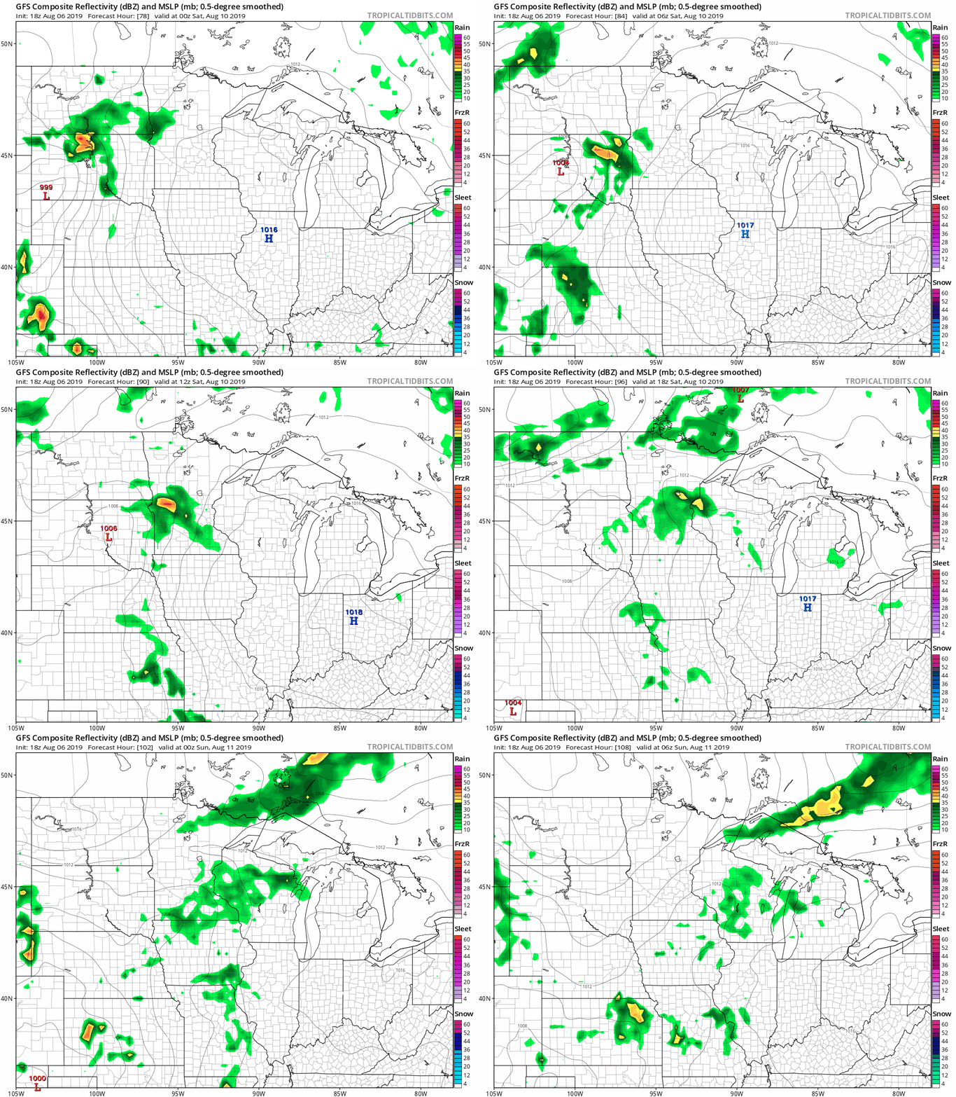
Pay more attention to the scattered nature of the rain than the exact location of the rain. We’ll have updates in the coming days.
Temperature trends
Wednesday highs are expected to reach the 70s in northern Minnesota, with 80s elsewhere:
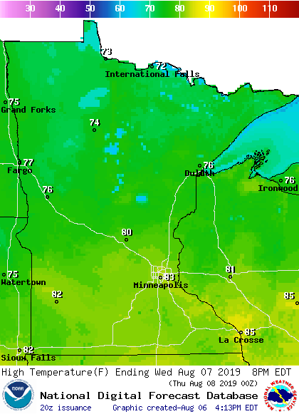
Twin Cities metro area highs are projected to be in the upper 70s Thursday, then around 80 Friday and Saturday followed by lower 80s on Sunday.
The National Weather Service Climate Prediction Center shows a tendency toward cooler than normal temperatures in Minnesota next week:
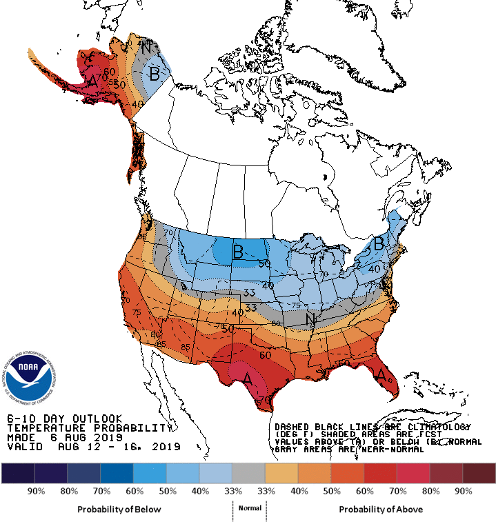
The nice thing about August is that slightly cooler than normal temperatures can still be very nice.

