
A breezy Thursday, some areas could see a morning shower/t-storm
Hurricane Dorian expected to strengthen
Go Deeper.
Create an account or log in to save stories.
Like this?
Thanks for liking this story! We have added it to a list of your favorite stories.


The best chance of showers and thunderstorms Thursday morning is in northeastern Minnesota and northwestern Wisconsin. A few scattered showers and an isolated thunderstorm could drop as far south as the Twin Cities metro area, west-central Wisconsin, and points to the southeast.
The National Oceanic and Atmospheric Administration's North American Mesoscale forecast model shows the potential rain pattern Thursday:
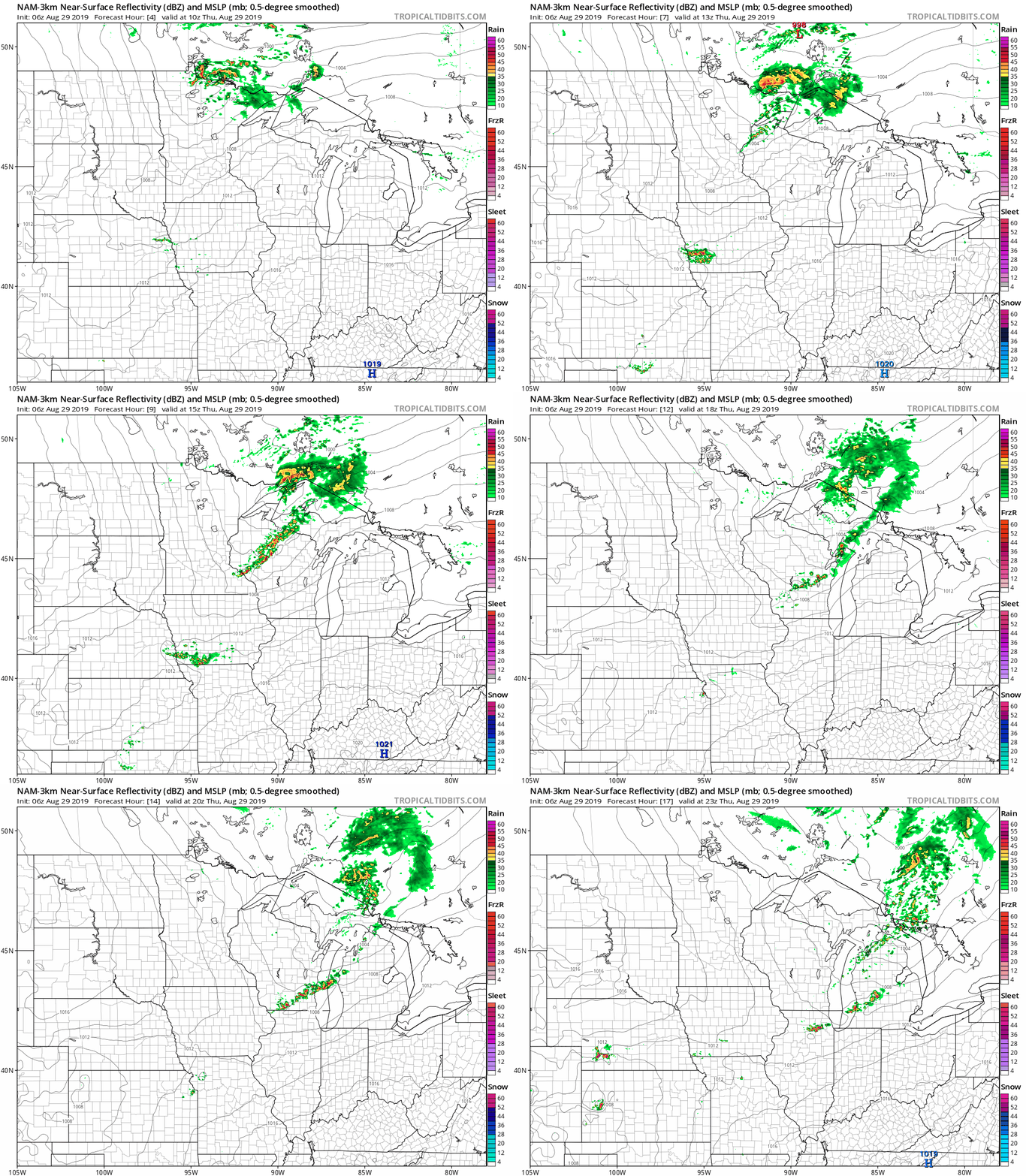
It’ll rain in some locations that look dry in the loop, but the general rain pattern within the NAM model is depicted by the loop.
As always, updated weather information can be heard on your radio or live stream, and you’ll also see updated weather info on the MPR News live weather blog.
Turn Up Your Support
MPR News helps you turn down the noise and build shared understanding. Turn up your support for this public resource and keep trusted journalism accessible to all.
You can see the recent local NWS radar loop here. The northwestern Minnesota radar loop and the northeastern Minnesota radar loop are also available. The recent radar loop for southwestern Minnesota can be found here, and the southeastern Minnesota loop here.
Temperatures
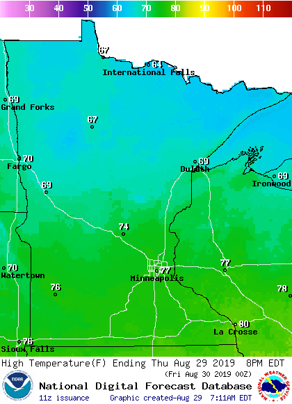
Thursday highs will be in the 60s across northern Minnesota, with 70s south:
Hurricane Dorian
The National Hurricane Center indicates that Hurricane Dorian will become a major hurricane before approaching the east coast of Florida this weekend:
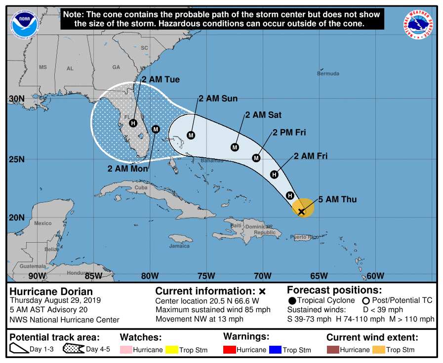
The cone in the forecast graphic depicts the “cone of uncertainty” of the path of the center of Hurricane Dorian.
The Hurricane Center will update the Hurricane Dorian forecast every few hours.
Programming note
You can hear my live weather updates on Minnesota Public Radio at 7:49 a.m. Thursdays and Fridays, and at 7:35 a.m., 9:35 a.m. and 4:35 p.m. each Saturday and Sunday.

