
Hurricane Dorian is strengthening, will be major hurricane as it approaches Florida on Monday
A beautiful Friday, mostly nice this holiday weekend
Go Deeper.
Create an account or log in to save stories.
Like this?
Thanks for liking this story! We have added it to a list of your favorite stories.


Our Friday weather will be superb, with plenty of sunshine and light winds. Highs will be in the 60s in about the northern third of Minnesota, with 70s elsewhere in Minnesota and western Wisconsin. There isn’t any steamy weather in sight.
Temperature trends
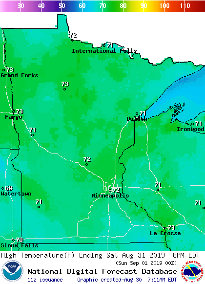
Highs in the lower 70s are expected in most areas on Saturday:
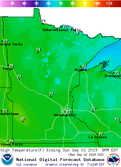
Sunday highs will be mainly in the 70s, but a few spots in southwestern Minnesota could top 80:
Monday highs could reach the lower 80s in parts of southern Minnesota, with around 80 degrees in the Twin Cities metro area:
Turn Up Your Support
MPR News helps you turn down the noise and build shared understanding. Turn up your support for this public resource and keep trusted journalism accessible to all.
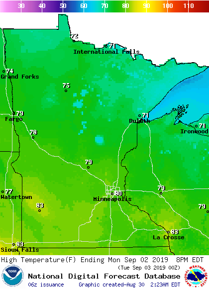
We haven’t seen 80 degrees or warmer at Minneapolis-St. Paul International Airport since Aug. 20!
Rain chances
Southern Minnesota will have a chance of scattered showers Saturday. A passing sprinkle is possible in the Twin Cities metro area on Saturday, but most of the day should be dry. Sunday is looking dry.
Northern Minnesota and northwestern Wisconsin could see scattered showers and thunderstorms at times on Labor Day. Our Twin Cities metro area shower/thunderstorm chance probably holds off until Monday evening/night.
As always, updated weather information can be heard on the Minnesota Public Radio Network, and you’ll also see updated weather info on the MPR News live weather blog.
Hurricane Dorian
Hurricane Dorian continued to strengthen Friday morning, and it’s developing a distinct eye:
Hurricane Dorian had maximum winds of 110 mph Friday morning, which is just 1 mph below Category 3 (major hurricane) strength. Dorian’s center was 255 miles east-northeast of the southeastern Bahamas, and it was moving northwest at 12 mph.
Here’s a portion of the Friday morning Hurricane Dorian public advisory, from the National Hurricane Center:


Hurricane Dorian is expected to be a major hurricane when it approaches the Florida coast on Sunday, with possible landfall late Monday or Tuesday:
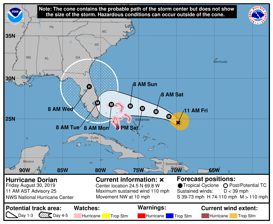
The forecast graphic depicts the “cone of uncertainty” of the path of the center of Hurricane Dorian. The National Hurricane Center will update the Hurricane Dorian forecast every few hours.
Programming note
You can hear my live weather updates on Minnesota Public Radio at 7:49 a.m. Thursdays and Fridays, and at 7:35 a.m., 9:35 a.m. and 4:35 p.m. each Saturday and Sunday.

