
Chilly temps on Sunday and beyond; Monday night snow southeast?
No warming trends in sight
Go Deeper.
Create an account or log in to save stories.
Like this?
Thanks for liking this story! We have added it to a list of your favorite stories.


At least we had one pleasant day this weekend! The abundant sunshine and relatively mild temps of Saturday will give way to chillier and cloudier weather on Sunday.
Temperature trends
Sunday highs will be mainly in the 30s across the northwestern half of Minnesota, with a lot of 40s elsewhere in Minnesota and into western Wisconsin. Parts of the Twin Cities metro area could reach highs in the mid 40s on Sunday, which is well below our average Oct. 27 high of 53 degrees.
Many locations will top out in the 30s on Monday:
Turn Up Your Support
MPR News helps you turn down the noise and build shared understanding. Turn up your support for this public resource and keep trusted journalism accessible to all.
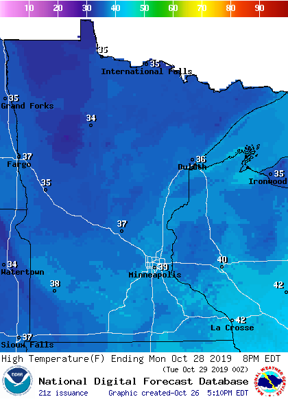
Twin Cities metro area highs are projected to be around 40 degrees on Monday and Tuesday, followed by mid-30s on Wednesday. We have a shot at 40 Thursday afternoon, then we’ll dip into the 30s by the time the trick-or-treaters head out. Highs creep into the 40s next Friday and Saturday.
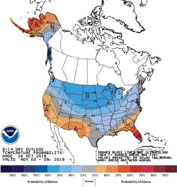
There aren’t any big warm-ups in sight. The NWS Climate Prediction Center shows a tendency for cooler than normal temperatures Nov. 3 through Nov. 9:
Rain and snow chances
Scattered rain showers and snow showers are possible in Minnesota and western Wisconsin on Sunday.
Some forecast models show southeastern Minnesota on the northern edge of accumulating snow that spreads from Iowa into parts of Wisconsin from late Monday into early Tuesday. The National Oceanic and Atmospheric Administration's Global Forecast System (GFS) model shows the potential precipitation pattern from Monday afternoon through Tuesday morning:
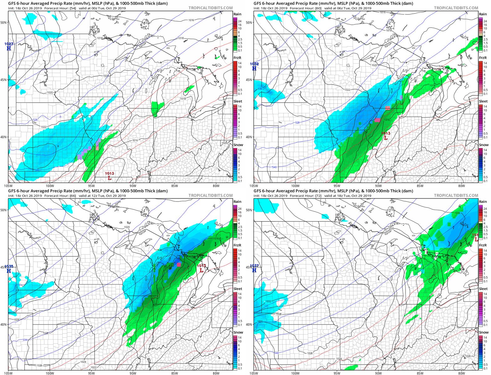
The Twin Cities metro area would have a chance of snow showers Monday night with the GFS forecast track, but a northward shift in the forecast track is possible…stay tuned.
Listen for updated weather information on the MPR network, and you’ll also see updated weather info on the MPR News live weather blog.
Another low pressure system could bring accumulating snow to southeastern Minnesota on Thursday.
Fall colors from space
NOAA’s weather satellites are used to detect clouds, but they can also detect changes in our tree canopy:
Programming note
You can hear my live weather updates on Minnesota Public Radio at 7:49 a.m. Thursdays and Fridays and at 7:35 a.m., 9:35 a.m. and 4:35 p.m. each Saturday and Sunday.

