
A chilly week; snow tracks to our south on Halloween
California wildfire smoke plume
Go Deeper.
Create an account or log in to save stories.
Like this?
Thanks for liking this story! We have added it to a list of your favorite stories.


We topped out at 45 degrees in the Twin Cities on Sunday, which was 8 degrees cooler than our average Oct. 27 high temp. If you’re waiting for warmer temps before you finish outdoor projects like painting or raking leaves, you’ll have to be patient.
Temperature trends
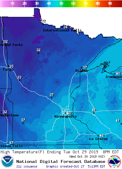
Monday highs will be mainly in the 30s, but a few spots in the Twin Cities metro area, southeastern Minnesota and western Wisconsin could touch 40.
A similar high temperature pattern is on tap for Tuesday:
Turn Up Your Support
MPR News helps you turn down the noise and build shared understanding. Turn up your support for this public resource and keep trusted journalism accessible to all.
Twin Cities metro area highs are projected to be in the upper 30s Wednesday and Thursday. Temperatures will drop a few degrees Halloween evening as the trick or treaters scurry from house to house. At this point it looks like highs on Friday and next weekend will only reach the lower 40s.
Snow chances
The best chance of accumulating snow from late Monday into early Tuesday will be to the southeast. The National Oceanic and Atmospheric Administration's North American Mesoscale forecast model shows the primary snow area from eastern Iowa into southern Wisconsin Monday evening into early Tuesday:
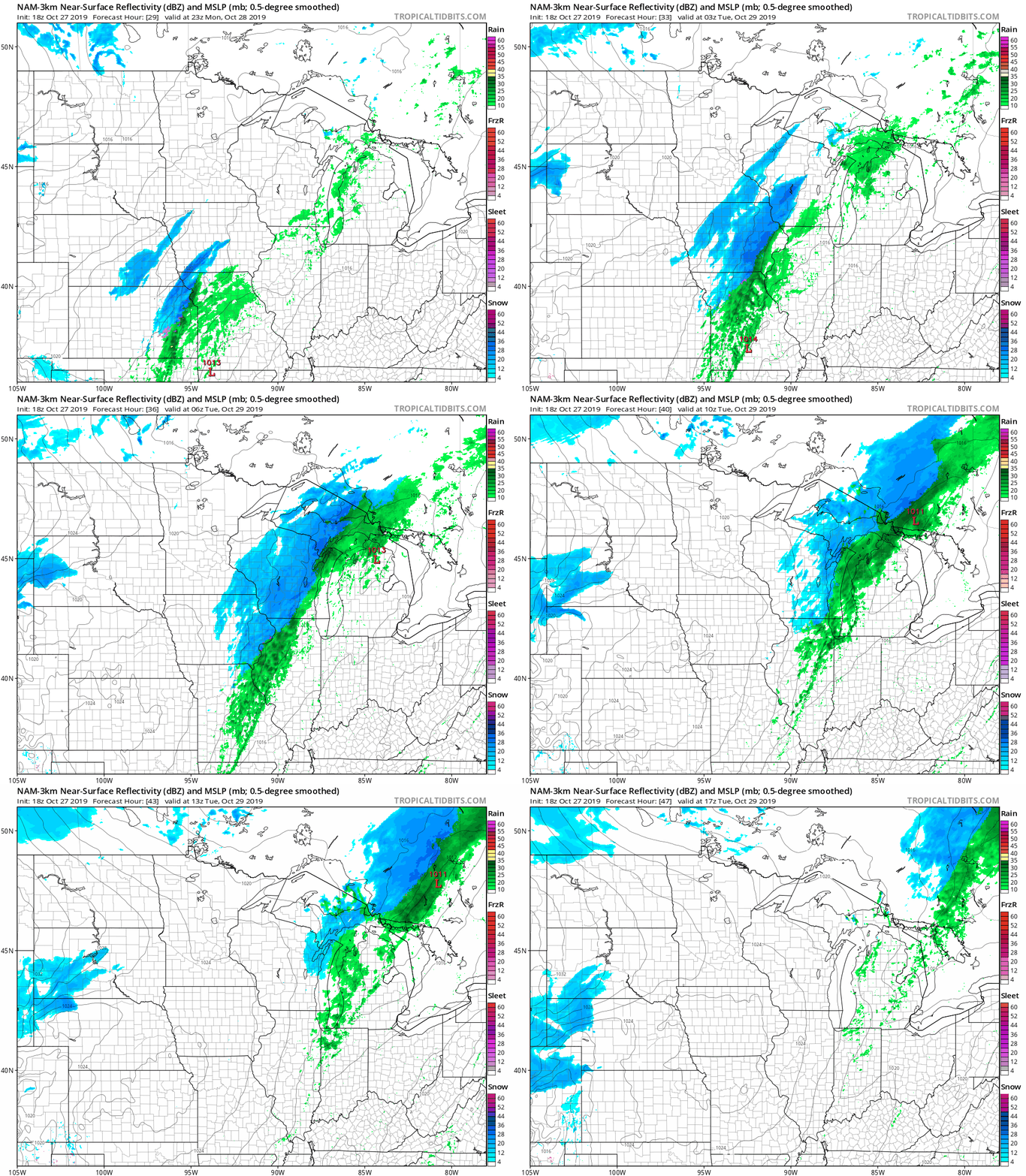
Some minor snow accumulations will be possible in southeastern Minnesota and parts of west-central Wisconsin. The Twin Cities metro area could see a few snow showers Monday evening into Monday night.
Listen for updated weather information on the MPR network, and you’ll also see updated weather info on the MPR News live weather blog.
Computer models show a more significant swath of snow from eastern Iowa into southern Wisconsin on Halloween. This storm track could change, but here’s the Thursday and Thursday night precipitation pattern shown by NOAA’s Global Forecast System (GFS) model:
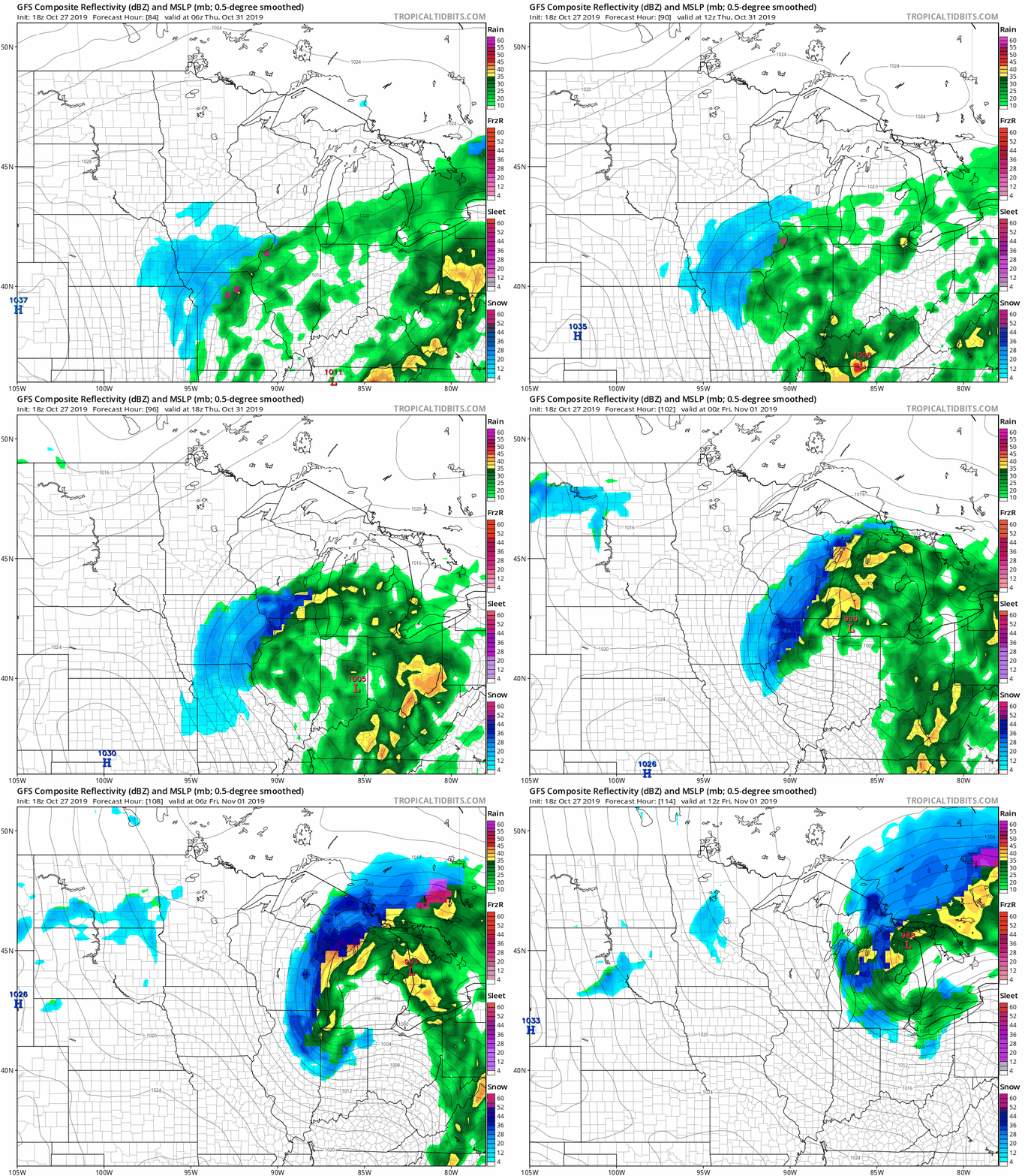
Check forecast updates if you have Halloween travel plans in eastern Iowa or southern Wisconsin.
Halloween weather notes
As you might imagine, we can have a wide range of weather conditions on Halloween. The Minnesota State Climatology Office has compiled some interesting Twin Cities Halloween weather information.
Impress your friends with these Twin Cities Halloween weather tidbits from the Climatology Office:
It is more common for the daily high on Halloween to be in the 60s than in the 30s. 70s tend to be rare, with only eight Halloween high temperatures being 70 degrees or above or about one in eighteen years. The warmest Halloween on record was 83 degrees in 1950, with one of the coldest one year later with a high of 30 in 1951. The coldest Halloween maximum temperature was a bone-chilling 26 degrees back in 1873. The last twenty years have had some balmy Halloween afternoons, like the 71-degree F high in 2000. We've had some chilly ones as well, like in 2017, when the temperature never rose above 35 F at MSP.
If you’re wondering about rain or snow frequency on Halloween:
Measurable precipitation has occurred on Halloween only 26% of the time in the Twin Cities, or 38 times out of 145 years. The most rain recorded was in 1979 with .78 inches. In 1991 .85 inches of precipitation fell, which was snow. In spite of the 1991 Halloween Blizzard, measurable snow on Halloween is about as rare as getting a full-sized candy bar in your trick or treat bag. Since 1872 there's been enough snow to measure only six times: .6 in 1884, .2 in 1885, 1.4 in 1932, .4 in 1954, .5 in 1995 and of course 8.2 inches with the Halloween Blizzard of 1991. Thus there has been measurable snow on only 4% of the days.
The 8.2 inches of Halloween snow in 1991 was just the beginning of a blizzard that lasted into early November. MSP airport recorded an additional 18.5 inches of snow on Nov. 1, 1991, plus 1.1 inch on Nov. 2 and .6 of an inch on Nov. 3, for a snowstorm total of 28.4 inches!
California wildfires
A state of emergency was declared in California on Sunday as firefighters battled massive wildfires in several locations.
NOAA’s weather satellite captured this time lapse of the smoke plume from the Kincaid fire:
Let’s hope that the winds drop off a bit on Monday, as forecast.

