
It's Novem-brrr; Saturday the chilliest day this weekend
October weather summary
Go Deeper.
Create an account or log in to save stories.
Like this?
Thanks for liking this story! We have added it to a list of your favorite stories.


Light on-and-off snow showers are falling Friday morning, and some roads have slick spots. Be careful out there.
Madison, Wis., had 4 inches of snow on Thursday, which is the most snow that they’ve ever recorded on Halloween. Their snow total for the final few days of October was 8.1 inches, and this polar bear was quite happy:
4.6 inches of snow were tallied at Chicago’s O’Hare airport from Wednesday into Thursday.
Temperature trends
Yes, it’s November now. Maybe I should call this Novem-brrr!
Turn Up Your Support
MPR News helps you turn down the noise and build shared understanding. Turn up your support for this public resource and keep trusted journalism accessible to all.
We’ll have highs in the 30s across much of Minnesota and western Wisconsin Friday, with some lower 40s in far southern Minnesota. Some spots in the Twin Cities metro area could hit 40 degrees. That’s chilly; our average high temperature is 50 degrees this time of year in the Twin Cities.
Saturday highs will be mainly in the 30s, with lower 40s southwest:
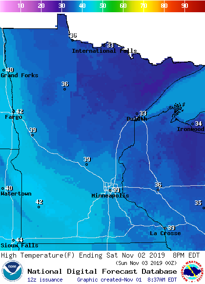
Some spots in the metro area could touch 40 on Saturday.
Sunday highs reach the 40s in roughly the southern half of Minnesota, with mainly 30s north:
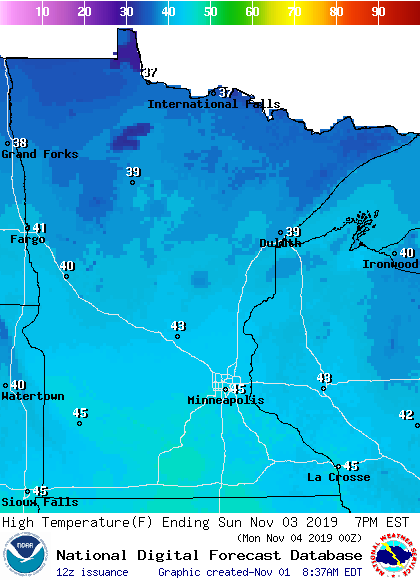
Twin Cities metro area highs are projected to reach about 40 degrees on Monday, followed by highs in the lower 30s Tuesday and Wednesday.
Snow and rain chances
Off and on snow showers are expected in much of northern Minnesota this Friday, with a few sprinkles also possible. Central and southern Minnesota, along with west-central and southwestern Wisconsin, will have a continued chance of occasional sprinkles and light snow showers Friday.
Listen for updated weather information on the MPR network, and you’ll also see updated weather info on the MPR News live weather blog.
On Saturday, the best chance of light snow showers will tend to be during the morning hours. The National Oceanic and Atmospheric Administration's North American Mesoscale (NAM) forecast model shows the potential precipitation pattern on Saturday:
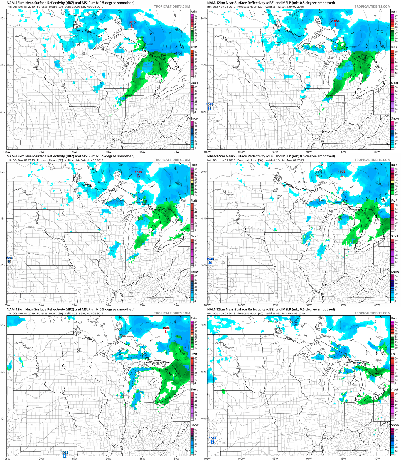
The best chance of snow showers on Sunday looks to be in northern Minnesota, but the south could see some rain-snow showers late in the day.
October recap
The average temperature during October 2019 at Minneapolis-St. Paul International Airport was 2.8 degrees lower than normal. Our monthly precipitation total of 4.05 inches was 1.62 inches higher than normal:

There was a trace of snow at MSP airport, but some locations in the north metro saw enough snow to cover the grass on Oct. 13.
Programming note
You can hear my live weather updates on Minnesota Public Radio at 7:49 a.m. Thursdays and Fridays and at 7:35 a.m., 9:35 a.m. and 4:35 p.m. each Saturday and Sunday.

