
Temps recover a bit on Sunday; when will mild temps return?
Rain/snow shower chances in parts of Minnesota Sunday and Sunday night
Go Deeper.
Create an account or log in to save stories.
Like this?
Thanks for liking this story! We have added it to a list of your favorite stories.


Southwestern Minnesota saw plenty of sunshine Saturday afternoon, and highs in the 40s. Clouds and highs in the 30s were common elsewhere in Minnesota and western Wisconsin, as pesky clouds refused to leave.
Our average Twin Cities high temperature is 49 degrees this time of year. We won’t hit that mark Sunday afternoon, but we do have a good shot at reaching the mid 40s.
Temperature trends
Sunday highs are forecast to reach the 40s across much of central and southern Minnesota, plus western Wisconsin, with some 30s in far northern Minnesota.
Turn Up Your Support
MPR News helps you turn down the noise and build shared understanding. Turn up your support for this public resource and keep trusted journalism accessible to all.
Many locations top out in the 30s on Monday, with around 40 in the metro area:
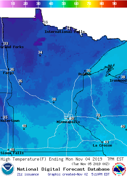
Twin Cities metro area highs are projected to be in the lower 30s Tuesday and Wednesday. We might only reach the upper 20s on Thursday, with highs in the lower 30s returning on Friday.
Looking for something warmer? The European Centre for Medium-Range Weather Forecasts model shows a temperature of 10 degrees Celsius next Sunday afternoon (Nov. 10), which equals 50 degrees Fahrenheit:

The ECMWF uses the day/month/year format, so 10/11/2019 is Nov. 10th.
That may be a one-day blip in a cool stretch of days. The National Weather Service Climate Prediction Center shows a strong tendency for cooler than normal temps over the Nov. 8 through Nov. 12 time frame:
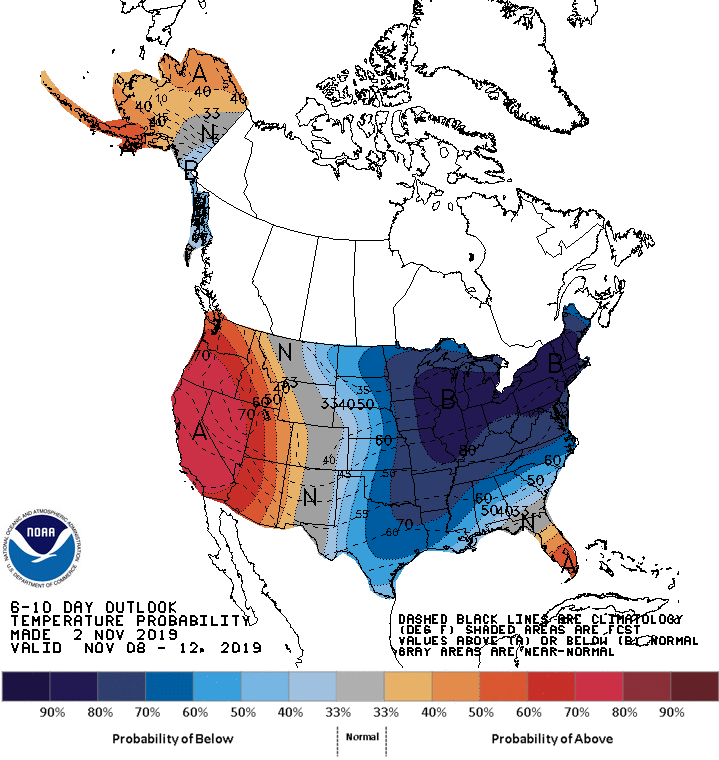
You can have one mild day in a 7-day period and still end up with a cooler than normal average temp for that week.
Rain and snow chances
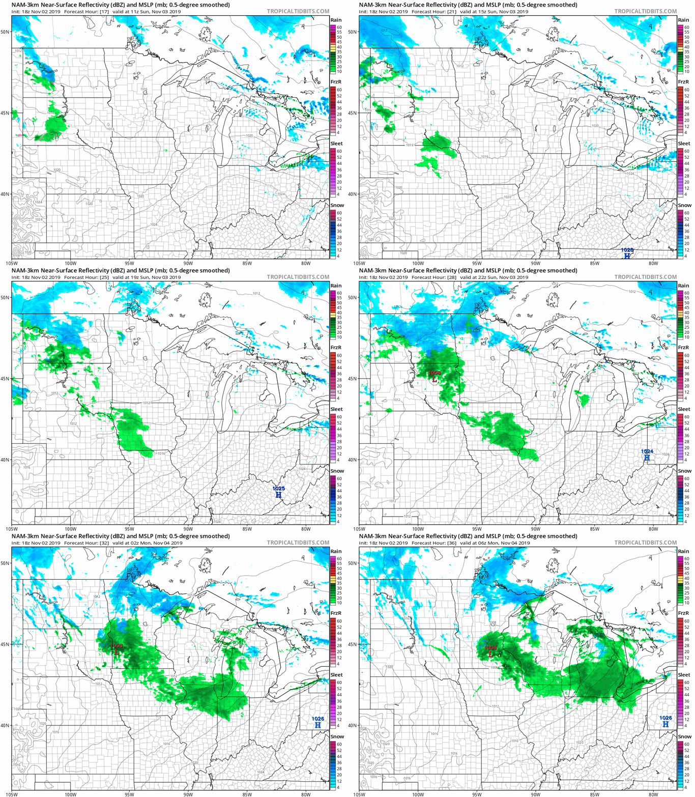
Northern Minnesota and northwestern Wisconsin could see scattered rain/snow showers at times on Sunday, and those same areas will have a chance of snow showers Sunday night. Southwestern Minnesota could see some rain showers Sunday afternoon, and that chance of rain showers spreads eastward into the Twin Cities metro area and west-central Wisconsin Sunday evening, with a chance of a rain/snow mix overnight Sunday night.
The National Oceanic and Atmospheric Administration's North American Mesoscale (NAM) forecast model shows the potential precipitation pattern Sunday and Sunday evening:
Listen for updated weather information on the MPR network, and you’ll also see updated weather info on the MPR News live weather blog.
Time change reminder
Daylight Saving Time ends at 2 a.m. this Sunday. Turn back your clocks before you go to sleep Saturday night:

It’s a good thing that most computers and cell phones do this time adjustment automatically, or many of us would be arriving at our Sunday destinations one hour early!
This is a good time to check or change your smoke detector/carbon monoxide detector batteries. You can use the old batteries for something less critical.
Programming note
You can hear my live weather updates on Minnesota Public Radio at 7:49 a.m. Thursdays and Fridays and at 7:35 a.m., 9:35 a.m. and 4:35 p.m. each Saturday and Sunday.

