
A chilly week; Tuesday night snow chance in the Twin Cities
This is winter weather awareness week
Go Deeper.
Create an account or log in to save stories.
Like this?
Thanks for liking this story! We have added it to a list of your favorite stories.


This Sunday was our second consecutive Sunday with a high temp of 45 degrees in the Twin Cities. The afternoon sunshine felt great, and winds were light. Chillier temps are on tap this week.
Temperature trends
Monday highs retreat to the 30s in most areas, but we could reach 40 degrees in the Twin Cities and parts of southeastern Minnesota.
There’ll be a lot of highs in the 30s on Tuesday, with 20s in far northern Minnesota:
Turn Up Your Support
MPR News helps you turn down the noise and build shared understanding. Turn up your support for this public resource and keep trusted journalism accessible to all.
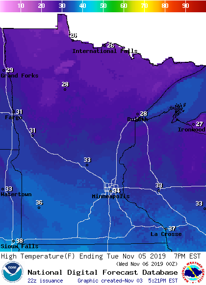
Twin Cities metro area highs are projected to reach the mid 30s on Tuesday and the lower 30s on Wednesday. We might only see highs in the upper 20s this Thursday, followed by lower 30s Friday.
There aren’t any extended warm-ups in sight. The National Weather Service Climate Prediction Center shows a strong tendency for cooler than normal temps over the Nov. 9 through Nov. 13 time frame:
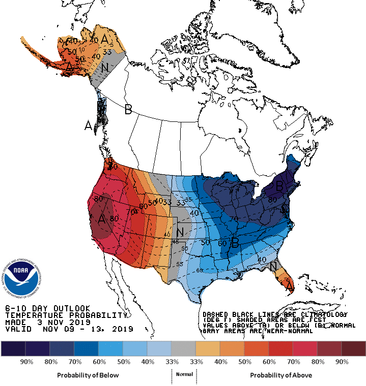
Maybe we’ll sneak one mild day in there.
Rain and snow chances
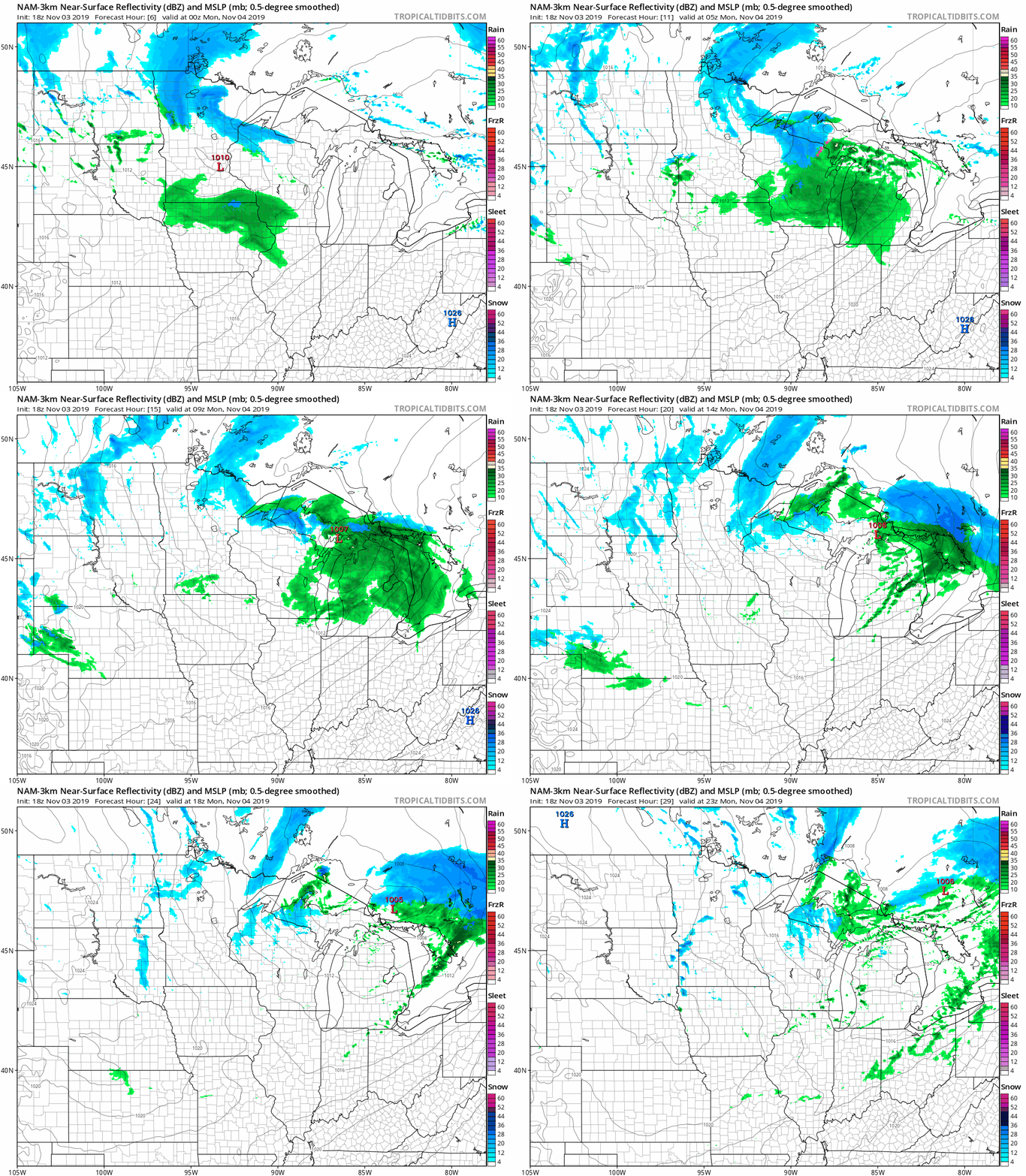
Periods of snow are expected to move across the northern third of Minnesota, plus northwestern Wisconsin, from Sunday evening into Monday morning. Far southern Minnesota will see some rain showers at times Sunday evening and overnight Sunday night, possibly mixed with some snowflakes early Monday. The Twin Cities metro area could see a passing Sunday night sprinkle, and a sprinkle or flurry early on Monday.
The National Oceanic and Atmospheric Administration's North American Mesoscale (NAM) forecast model shows the potential precipitation pattern Sunday evening through Monday:
Listen for updated weather information on the MPR network, and you’ll also see updated weather info on the MPR News live weather blog.
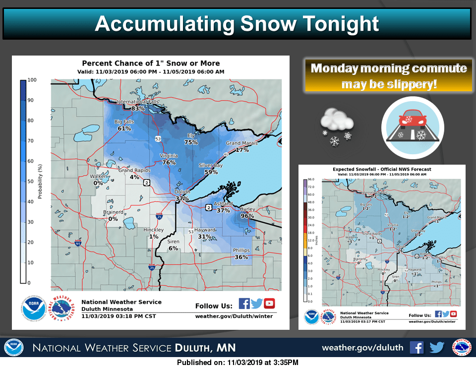
Roads may become slippery in parts of northeastern Minnesota and northwestern Wisconsin Sunday night into Monday morning. “Tonight” in this graphic refers to the overnight hours of Sunday night:
Tuesday night snow?
The NAM forecast model shows some accumulating snow from central Minnesota through the Twin Cities and into western Wisconsin Tuesday evening and overnight Tuesday night. Check forecast updates, but some one to two inch snow amounts seem possible on grassy areas.
Winter weather awareness week
This week is winter weather awareness week in Minnesota and Wisconsin. The NWS will cover winter weather-related topics each day this week.
Monday’s topic is winter storms, and includes info on the terminology that’s used by the NWS this time of year:

It doesn’t have to snow a lot to cause slick roads. Minnesota road condition updates can be found here.

