
Milder weather today; accumulating snow Sunday evening into Monday up north
Chilly week ahead, Tuesday night snow potential in the metro area
Go Deeper.
Create an account or log in to save stories.
Like this?
Thanks for liking this story! We have added it to a list of your favorite stories.


Now that we’re off of Daylight Saving Time, brace yourself for the early sunset. The sun will set at 4:59 p.m. today in the Twin Cities metro area. It’s good to get out during your lunch hour this time of year, since it’s dark outside by the end of the work day for many people.
Temperature trends
Sunday highs are forecast to reach the 40s across much of central and southern Minnesota, plus western Wisconsin, with some 30s in far northern Minnesota. We’ll probably reach the mid to upper 40s in the Twin Cities metro area.
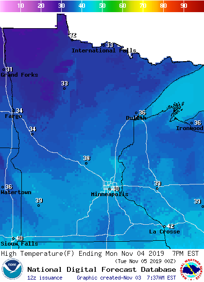
Monday highs retreat to the 30s in most areas, with around 40 degrees in the Twin Cities and areas to the southeast:
Turn Up Your Support
MPR News helps you turn down the noise and build shared understanding. Turn up your support for this public resource and keep trusted journalism accessible to all.
Twin Cities metro area highs are projected to reach the mid 30s Tuesday, followed by lower 30s Wednesday. We might only reach the upper 20s on Thursday, with highs in the lower 30s on Friday.
Rain and snow chances
An area of snow is expected to move into northwestern and north-central Minnesota Sunday afternoon, and expand eastward Sunday evening. Snow continues up north overnight and into Monday. Rain moves into parts of southwestern Minnesota Sunday afternoon, then spreads eastward Sunday evening and overnight, possibly mixed with snow in some areas Sunday night.
The National Oceanic and Atmospheric Administration's North American Mesoscale (NAM) forecast model shows the potential precipitation pattern Sunday afternoon through Monday morning:
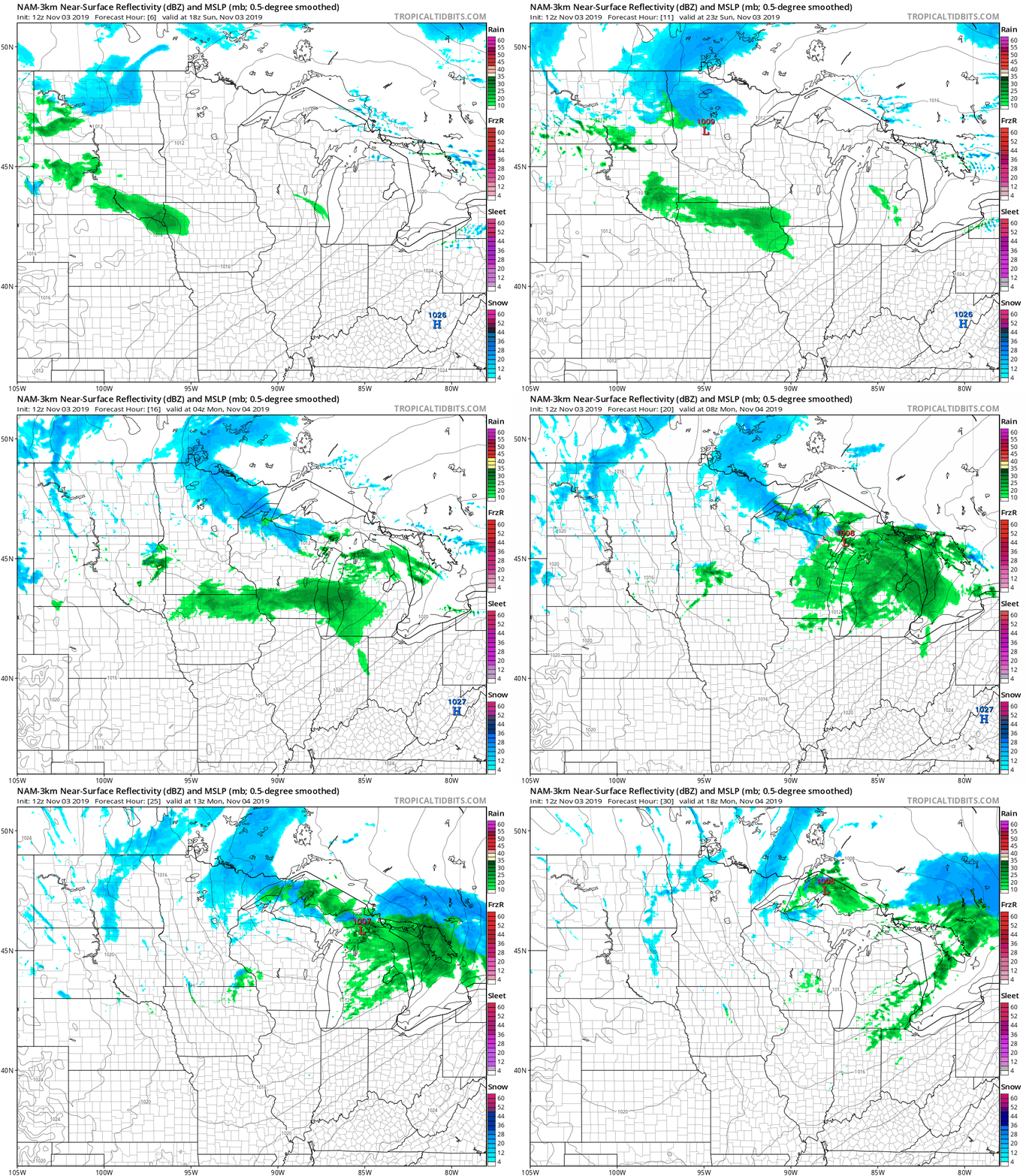
The rain that moves across southern Minnesota late Sunday and Sunday night is expected to be steadiest to the far south. The Twin Cities metro area could see a shower Sunday evening, with additional shower chances overnight Sunday night, possibly mixed with a few flakes late Sunday night.
Listen for updated weather information on the MPR network, and you’ll also see updated weather info on the MPR News live weather blog.
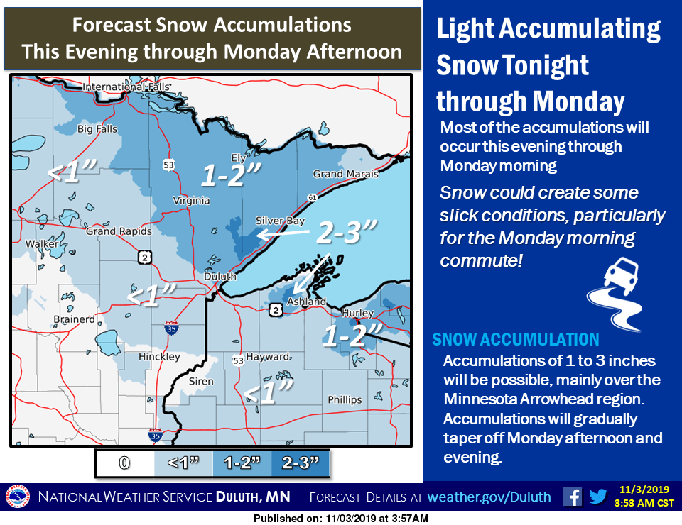
Here’s the NWS snow forecast for northern Minnesota from Sunday evening through Monday:
The Twin Cities metro area could see some accumulating snow Tuesday evening into the overnight hours of Tuesday night. At this point, it appears that an inch or two of snow is possible. Check for updated forecasts on that Tuesday night snow potential.
On this date
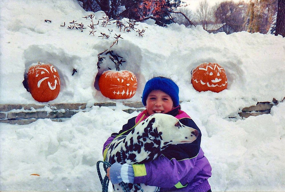
The storm system that gave us the 1991 Halloween Blizzard was still dropping some light snow on the Twin Cities on Nov. 3, 1991, as it moved away.
Here are the snow totals from that 1991 storm:
October 31: 8.2 inches
November 1: 18.5 inches
November 2: 1.1 inch
November 3: 0.6 inch
The storm total came to 28.4 inches, which is still the highest snowstorm total in Twin Cities weather records.
Programming note
You can hear my live weather updates on Minnesota Public Radio at 7:49 a.m. Thursdays and Fridays and at 7:35 a.m., 9:35 a.m. and 4:35 p.m. each Saturday and Sunday.

