
Rain/snow mix ends Thursday afternoon; update on snow potential next week
Twin Cities getting close to our wettest year on record
Go Deeper.
Create an account or log in to save stories.
Like this?
Thanks for liking this story! We have added it to a list of your favorite stories.


Our rain/snow mix in the Twin Cities is expected to move out by early Thursday afternoon. Up north, they’re shoveling and plowing several inches of snow.
Here are some northern Minnesota snow amounts from overnight and early Thursday morning:
Orr: 9.2 inches
Ely: 8.5 inches
Babbitt: 7.5 inches
Bigfork: 7.3 inches
Cook: 6.8 inches
The National Weather Service snowfall report map looked like this at 9 a.m.:

You can go to the link and hover over any snowfall report to get details on snow measurements and time of observation.
Turn Up Your Support
MPR News helps you turn down the noise and build shared understanding. Turn up your support for this public resource and keep trusted journalism accessible to all.
Warnings and advisories
The snow will move out of northeastern Minnesota Thursday afternoon, but winter storm warnings continue until noon in Cook and Lake counties and a small section of St. Louis County, while winter weather advisories continue until noon this Thursday for areas near Duluth and into Carlton County:

Here are links to updates on the winter storm warnings and winter weather advisories.
Temperature trends
Our Thursday high of 44 degrees happened before 1 a.m., and we are falling through the 30s and into the upper 20s later Thursday afternoon. Falling temps and gusty winds are expected statewide.
Friday highs reach the 30s in most areas:

We’ll see highs in the 40s in far southern Minnesota on Saturday, with 30s elsewhere:
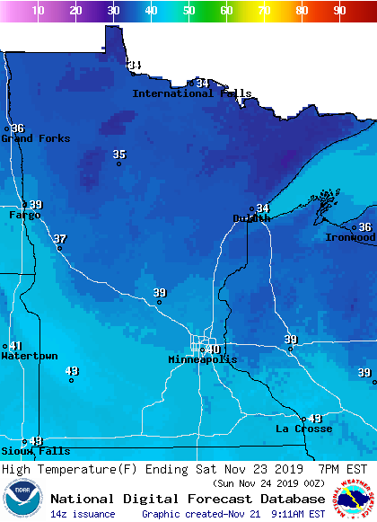
Southern and central Minnesota, plus western Wisconsin, will reach the 40s Sunday afternoon:
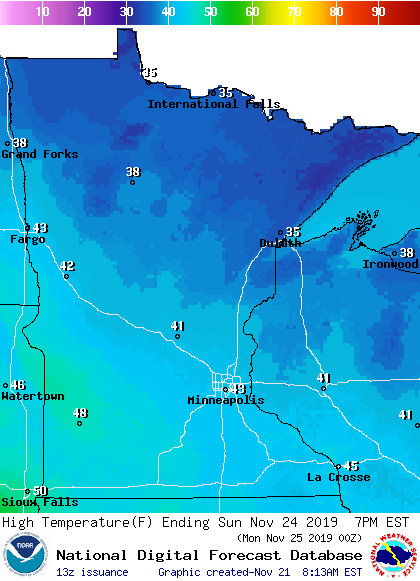
Twin Cities metro area highs are projected to reach the lower 40s next Monday and Tuesday.
Rain and snow chances up north
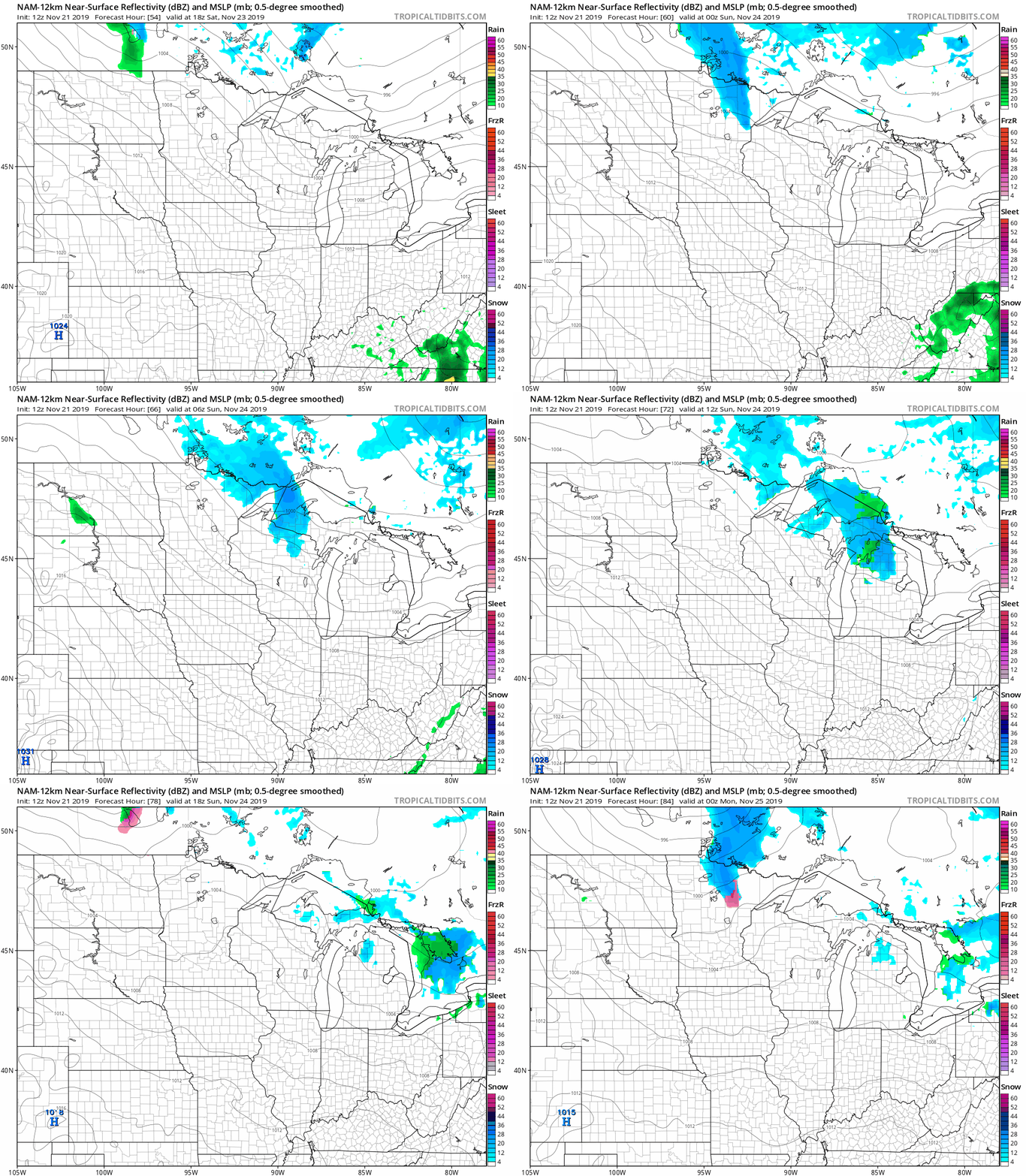
Far northern Minnesota could see some periods of snow showers or a rain/snow mix Saturday afternoon and Saturday night, as well as Sunday night. The National Oceanic and Atmospheric Administration's North American Mesoscale (NAM) forecast model shows this potential precipitation pattern Saturday afternoon through Sunday:
Listen for updated weather information on the MPR network, and you’ll also see updated weather info on the MPR News live weather blog.
Thanksgiving week
NOAA’s Global Forecast System (GFS) model shows this potential precipitation pattern from next Tuesday through Thanksgiving Day:
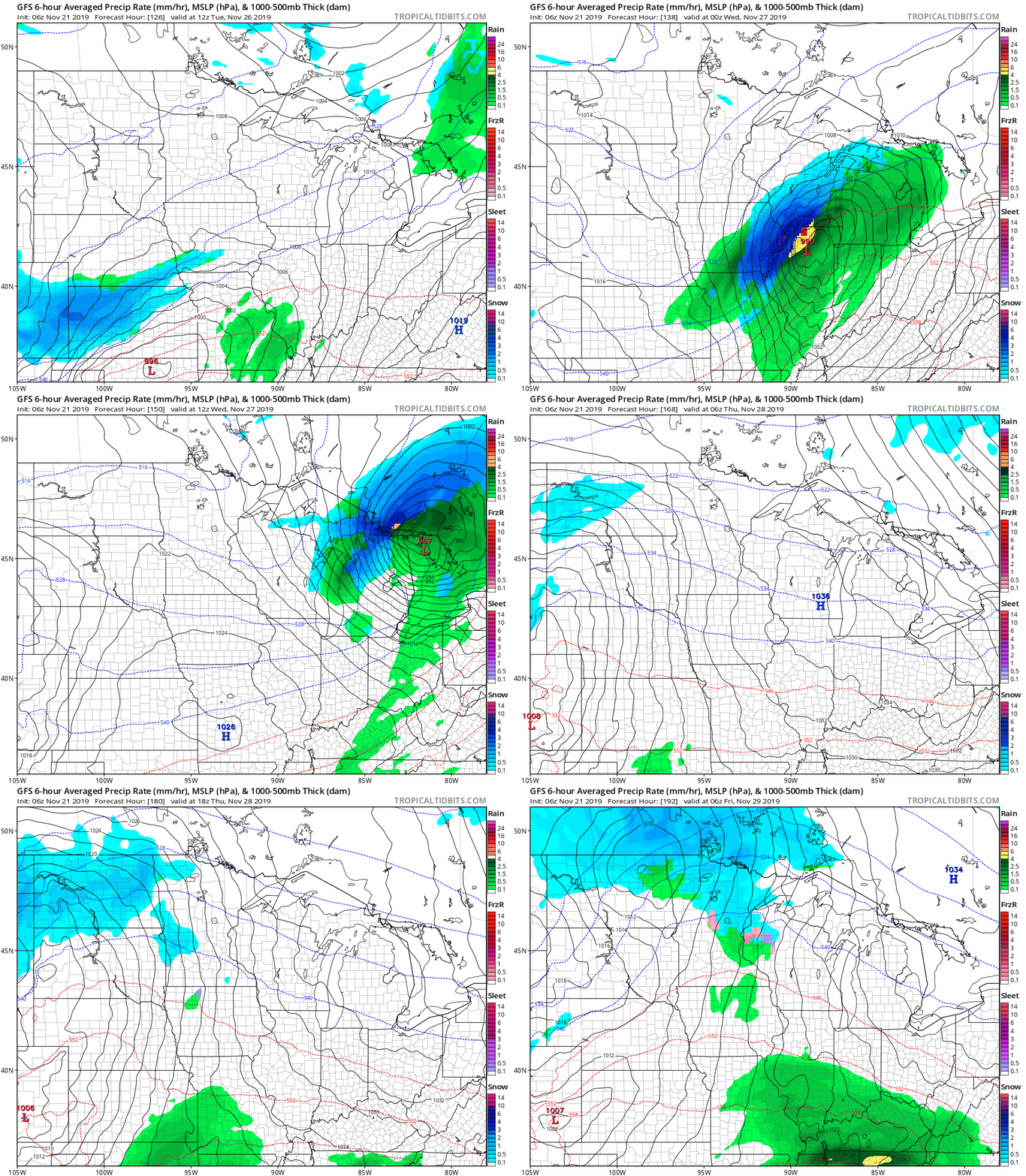
In this scenario, eastern Iowa and southern/eastern Wisconsin would see some accumulating snow Tuesday and Wednesday.
Minnesota would see a mix of rain and snow on Thanksgiving. That’s still a week away, and the models will probably change as we get closer to Thanksgiving. Stay tuned.
Precipitation record is in sight
Through 9 a.m. this Thursday, our 2019 Twin Cities precipitation total (rain plus the water content of snow) is at 40.01 inches.
We are only 15/100ths of an inch from surpassing the wettest year on record in the Twin Cities, which was 40.15 inches in 1911:

____________________________________________________________________________________________________
Updated record precipitation: The chart above did not include the 40.32 inches of precipitation tallied at MSP airport in 2016. The Minnesota State Climatology Office has confirmed that 40.32 is the official annual precipitation record for the Twin Cities.
____________________________________________________________________________________________________
We still have the rest of November and all of December to break that record!
Programming note
You can hear my live weather updates on Minnesota Public Radio at 7:49 a.m. Thursdays and Fridays and at 7:35 a.m., 9:35 a.m. and 4:35 p.m. each Saturday and Sunday.

