
Light snow/freezing drizzle possible Friday; heavy snow in some areas this weekend
Go Deeper.
Create an account or log in to save stories.
Like this?
Thanks for liking this story! We have added it to a list of your favorite stories.


At least we had good travel weather this Thanksgiving. Our travel conditions will deteriorate in some areas this weekend.
Thursday night into Friday morning
Minnesota and western Wisconsin will see some areas of freezing drizzle and light snow showers Thursday night and Friday morning, followed by patchy drizzle and a few flurries Friday afternoon.
The National Weather Service has issued a Winter Weather Advisory from 10 p.m. Thursday to noon Friday in southwestern and west-central Minnesota:
Turn Up Your Support
MPR News helps you turn down the noise and build shared understanding. Turn up your support for this public resource and keep trusted journalism accessible to all.
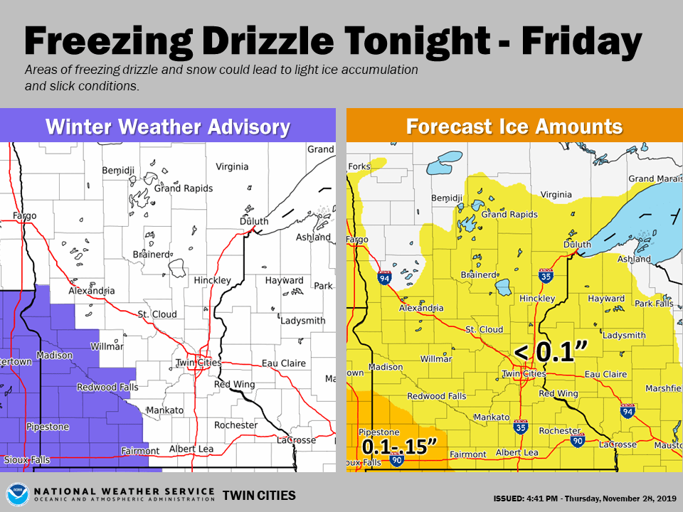
“Tonight” in the image refers to Thursday night. The freezing drizzle is expected to be more spotty elsewhere. Updated weather information on the MPR network, and you’ll also see updated weather info on the MPR News live weather blog.
The main event this weekend
As we go through the weekend a strong low pressure system will move from Nebraska through Iowa and into southern Wisconsin. It’ll spin plenty of moisture over Minnesota and Wisconsin. The National Oceanic and Atmospheric Administration's North American Mesoscale (NAM) forecast model shows the potential precipitation pattern from Friday afternoon through Saturday evening:
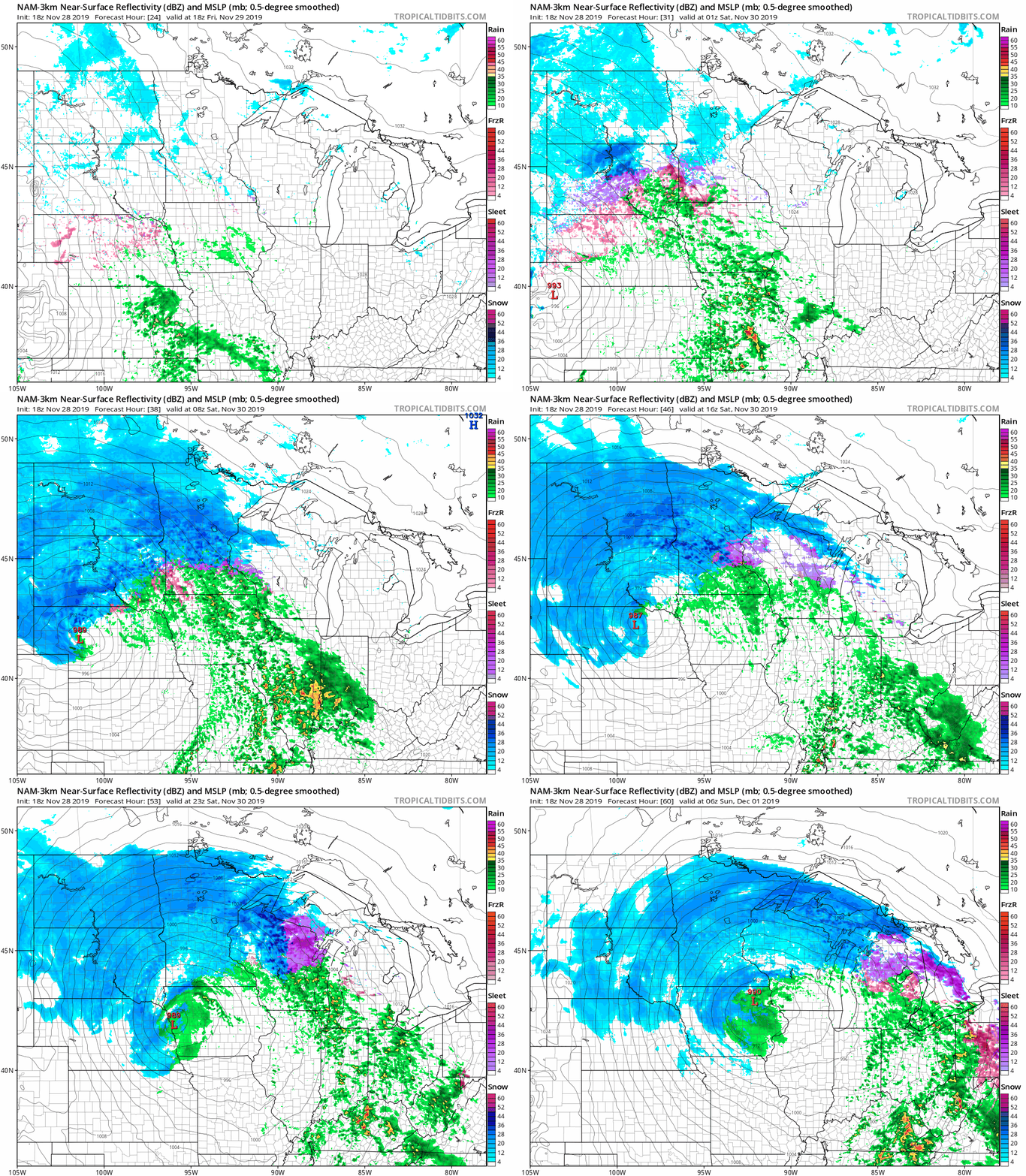
The heaviest snow band this weekend may be in central and northern Minnesota and parts of northern Wisconsin. It looks like we’ll see snow or a wintry mix in the Twin Cities Friday evening, then a transition to mostly snow overnight into early Saturday, followed by a mix or rain Saturday afternoon. We would tend to go back to snow Saturday night into early Sunday.
Winter storm watches begin at 6 p.m. Friday and run through noon Saturday from central Minnesota through the Twin Cities metro area and into west-central Wisconsin, and they run from Friday evening into Sunday from northern Minnesota into northwestern Wisconsin:
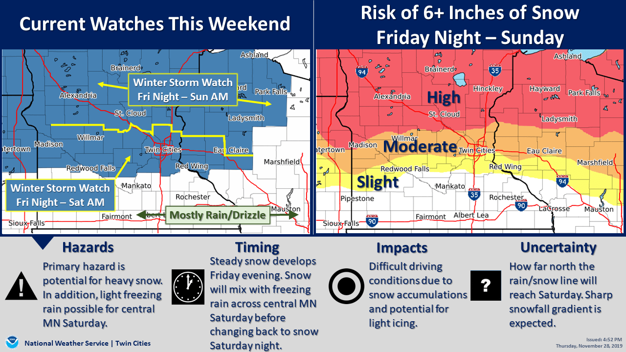
Check forecast updates Friday morning to see if advisories and warnings have been issued for this storm.
The Duluth office of the NWS posted these thoughts on the heavy snow potential:
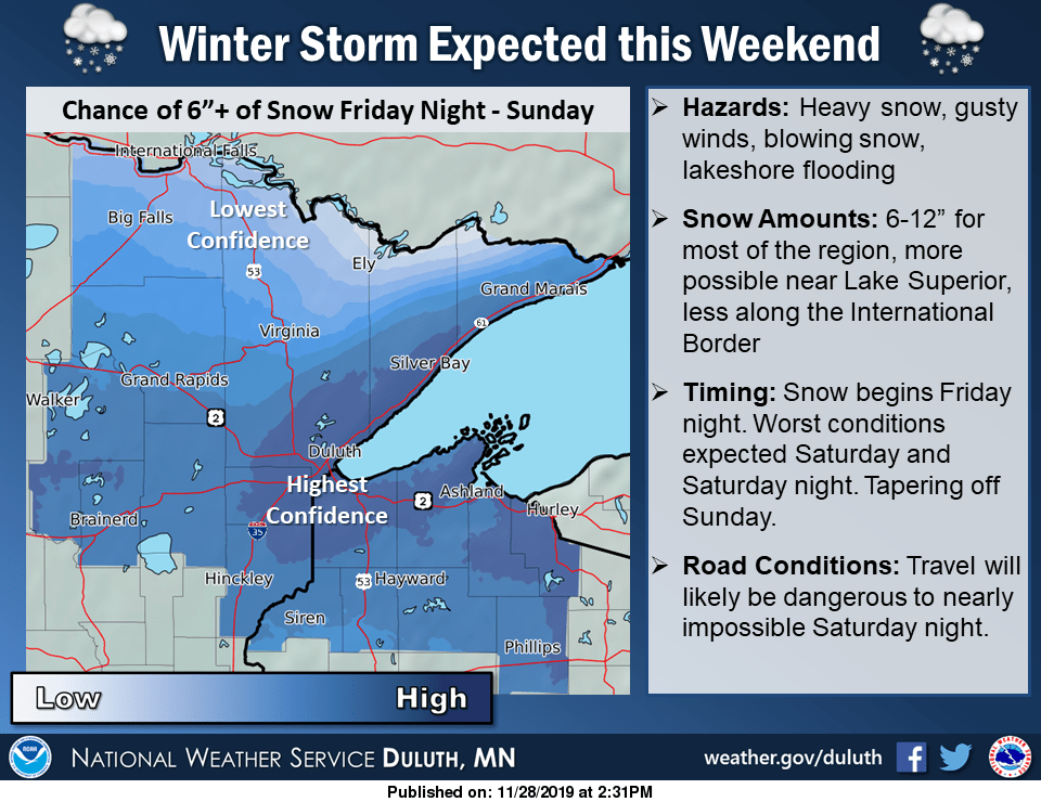
The counties for which the Duluth NWS office issues forecasts are shaded. Fierce winds may cause whiteout conditions at times this weekend in northern Minnesota. Some locations in northwestern Minnesota could see double-digit weekend snow totals:
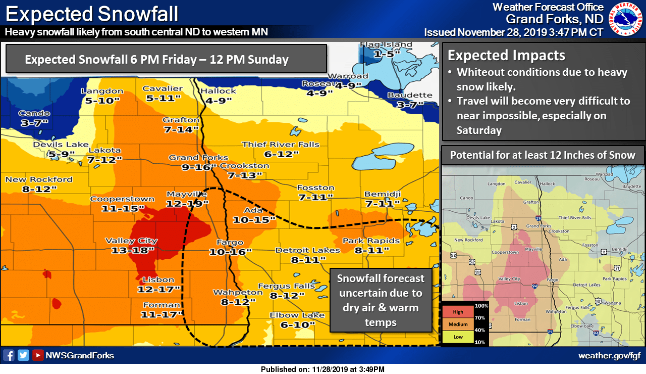
If you have travel plans this weekend, you can check Minnesota road conditions and Wisconsin road conditions.
Temperature trends
Minnesota and western Wisconsin will have highs in the 30s this Friday.
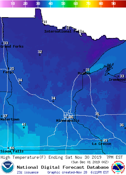
Saturday highs reach the 30s in most areas, with a few lower 40s possible in the southwest:
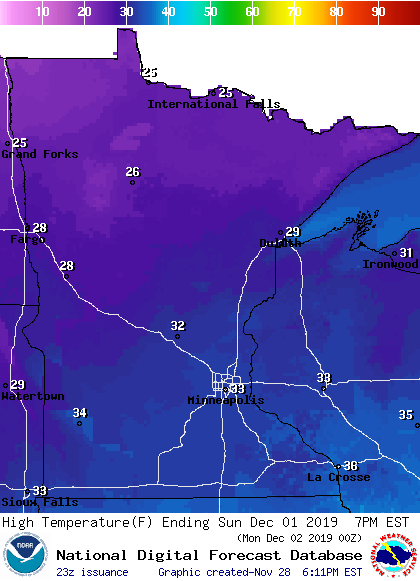
Sunday highs reach the 30s in the south, with 20s north:
Twin Cities metro area highs are projected to reach the upper 20s on Monday, followed by lower 30s Tuesday and Wednesday. Our average high temp is 33 degrees this time of year.

