
Outdoor plans this weekend? We have the updated forecast
Snow depths are impressive
Go Deeper.
Create an account or log in to save stories.
Like this?
Thanks for liking this story! We have added it to a list of your favorite stories.


While some of us were shoveling snow last weekend, others were out playing in the fresh snow:

The latest snow depth map from the National Oceanic and Atmospheric Administration shows substantial snow cover over most of Minnesota and the northern half of Wisconsin:

Snow depths are now in the 10- to 20-inch range across much of northeastern Minnesota and far northern Wisconsin. Some locations near Lake Superior are in the range of 20 to 39 inches.
Elsewhere in Minnesota and west-central Wisconsin, there are many locations with 5- to 10-inch snow depths.
Turn Up Your Support
MPR News helps you turn down the noise and build shared understanding. Turn up your support for this public resource and keep trusted journalism accessible to all.
I’ll bet that there’ll be quite a few cross-country skiers out this weekend, as well as sledders and snowmobilers.
Weekend temperatures
Saturday high temps reach the upper 20s in far northern Minnesota, with mostly 30s elsewhere:
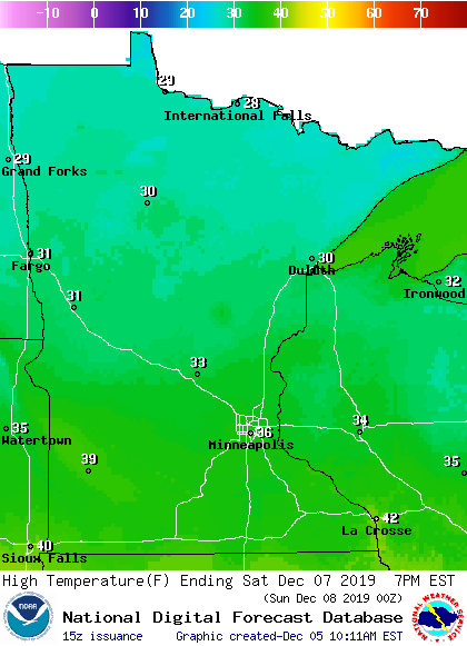
A few spots could touch 40 degrees in far southern Minnesota.
Sunday highs reach the 30s in the southeastern half of Minnesota, with 20s and teens to the northwest:
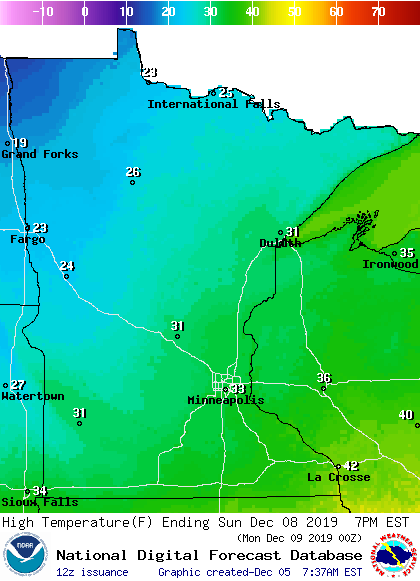
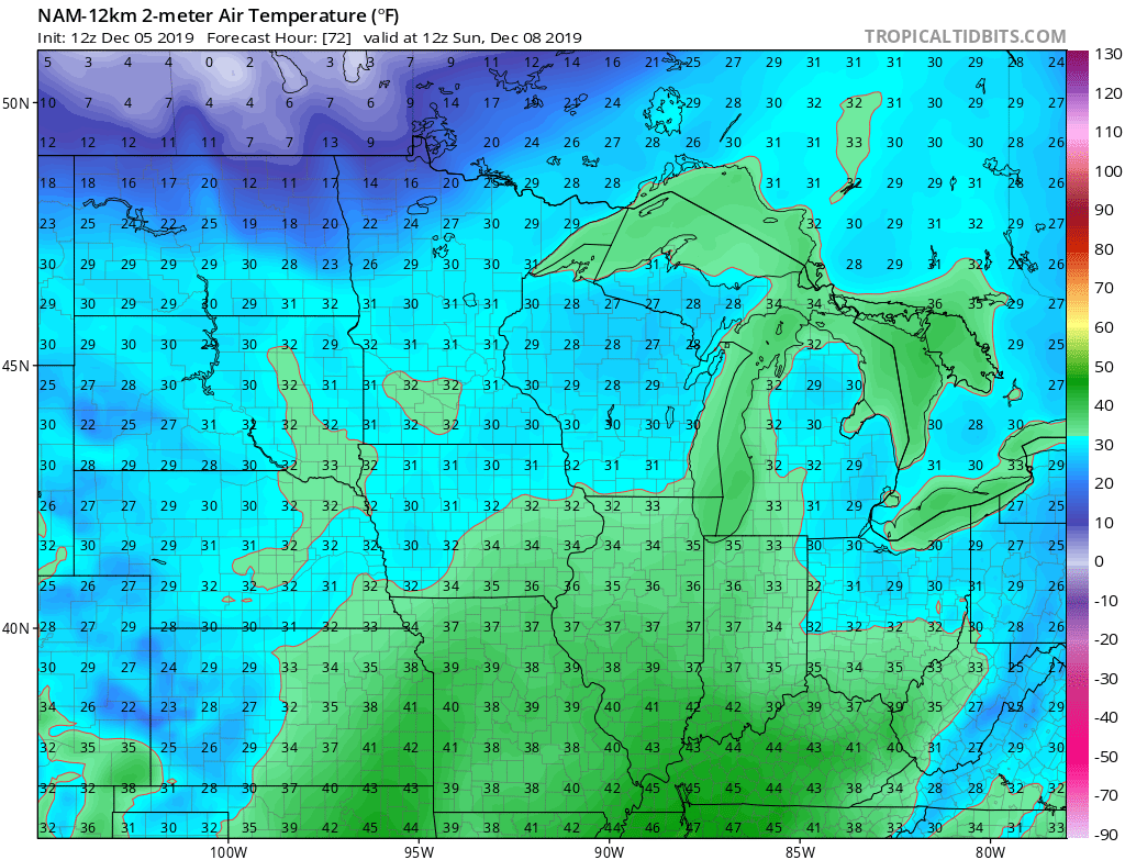
If your outdoor recreation will take place in northwestern Minnesota, be aware that the Sunday high will occur early in the day, followed by falling temps as a cold front advances. Here are the 6 a.m. temperatures from NOAA’s North American Mesoscale (NAM) forecast model:
By 6 p.m. on Sunday, temperatures dip into the single digits and lower teens in the far northwest:
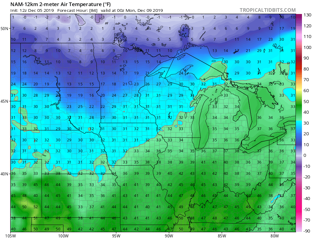
Temperatures also drop a bit Sunday afternoon in north-central and northeastern Minnesota.
Here are the forecast wind chill temperatures for 1 p.m. on Sunday:
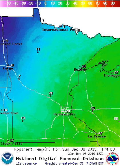
That’s right, below-zero wind chill temps will have arrived by Sunday afternoon in parts of northwestern Minnesota. Bring warm clothes if you’re headed in that direction for the weekend!
Weekend rain and snow chances?
NOAA’s North American Mesoscale forecast model shows the potential precipitation pattern from Friday evening through Sunday afternoon:
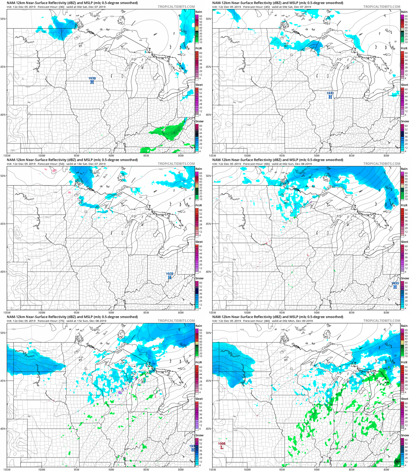
Minnesota and western Wisconsin won’t have to deal with any big storms this weekend, but a batch of light snow could move across the far north Friday evening and overnight Friday night. A scattered wintry mix is possible in the north on Saturday. Minnesota and Wisconsin will have a snow shower chance on Sunday.
You can hear updated weather information on the MPR network, and you’ll see updated weather info on the MPR News live weather blog.

