
Snow slows morning commute; deep freeze to follow
2-4 inches of new snow expected in the Twin Cities; 6-10 in Duluth
Go Deeper.
Create an account or log in to save stories.
Like this?
Thanks for liking this story! We have added it to a list of your favorite stories.


A wintry storm system is hitting much of the state before a deep freeze settles into the region.
Snow timing
Snow has already moved out of northwest Minnesota, but not before dumping 4 to 6 inches-plus in north-central portions of the state.
As of 7 a.m., the highest snow report is from Nimrod at 6.5 inches.
Meanwhile, the heaviest snow is in a line from about Worthington, just moving into the Twin Cities, and up toward. Duluth.
Turn Up Your Support
MPR News helps you turn down the noise and build shared understanding. Turn up your support for this public resource and keep trusted journalism accessible to all.
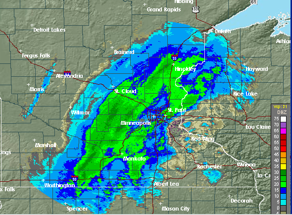
Snow will continue to clear out quickly across the state, with all except eastern Minnesota out of it by noon. The North Shore will be the last to clear out. For the Twin Cities, any heavier snow should be over by noon, with 2 to 4 inches total, and it will wind down quickly in the early afternoon.
Here is what is expected by 1 p.m.:
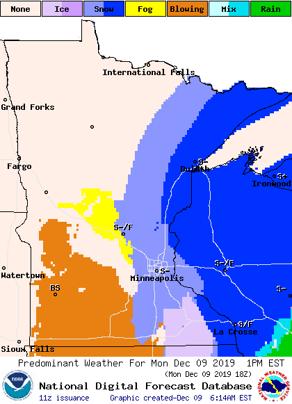
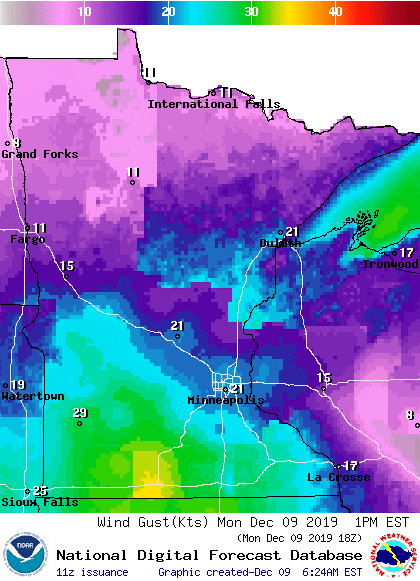
It’ll be windy, especially for southern Minnesota, which could contribute to blowing snow after the snow ends.
Here comes the cold
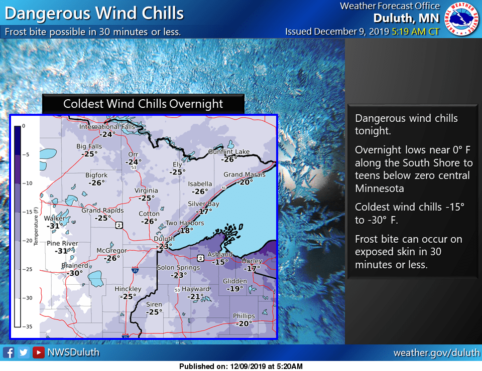
As the storm moves though, temperatures will continue to plummet. Portions of northwest Minnesota are already seeing subzero temperatures, and the entire state will be below zero by Tuesday morning. Watch for dangerous wind chills Monday night, with much of the state feeling like minus 10 to minus 30 with the wind.
Programming note
You can hear my live weather updates on Minnesota Public Radio at 7:48 a.m. Mondays through Fridays.

