
More snow and another blast of cold air on the way
Temperatures to fall Saturday for most of the state
Go Deeper.
Create an account or log in to save stories.
Like this?
Thanks for liking this story! We have added it to a list of your favorite stories.


Thursday’s snow moves out for most of Minnesota by noon, but more accumulating snow returns Friday with a system that brings in another blast of cold air for the weekend.
Thursday snow and temperatures
The light snow that impacted Minnesota overnight and into Thursday morning is already clearing out in a line from west to east. Most of the snow will have moved out by noon.
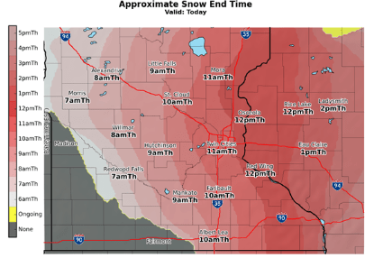
For the Twin Cities expected snow totals will likely be 1 to 2 inches with a few isolated parts of Minnesota that could see a final total of 2 to 4 inches.
Temperatures recover some from the cold snap on Tuesday and Wednesday, although they will still be below average.
Turn Up Your Support
MPR News helps you turn down the noise and build shared understanding. Turn up your support for this public resource and keep trusted journalism accessible to all.
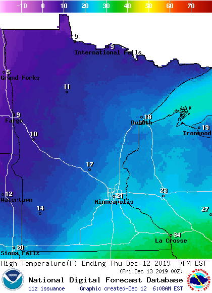
There will also be a large temperature contrast across the state, with parts of northwestern Minnesota stuck in the single digits, while southeastern Minnesota could see a couple 30-degree readings. The Twin Cities will likely see highs near 20.
Friday snow
Another round of snow begins moving across Minnesota overnight Thursday, and will bring snow to almost all of Minnesota on Friday, before moving out early Saturday. It currently looks like most of the state will see 1 to 3 inches of snow, with slightly higher amounts possible for northern Minnesota.
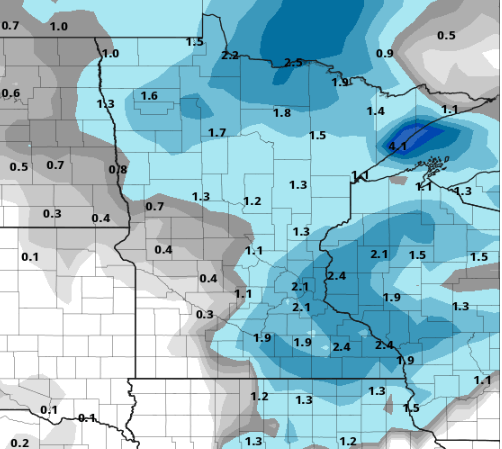
For the central through southern parts of western Minnesota, snow could be even lighter, but there is a slight chance in those areas for light freezing rain on Friday, so watch for slick spots.
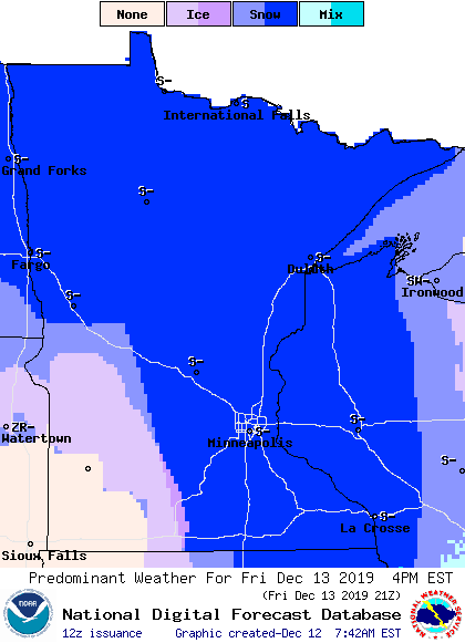
In terms of the commute around the Twin Cities, the morning commute could see the start of light snow, but the evening commute looks likely to have more impacts.
More cold
Behind that next round of snow, colder temperatures return. For Saturday, temperatures will be falling for most of the state, so many locations will set their Saturday highs right at 12:01 a.m., with lower temperatures by the afternoon. That sets us up for another very cold morning on Sunday, with many places starting well below zero.
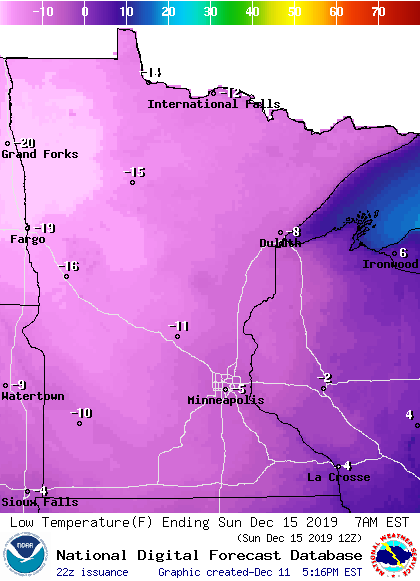
Sunday highs will likely on reach into the single digits.
Next week
After our cold weather Sunday, temperatures rebound some by Monday, but overall we remain on the cool side, with temperatures running easily 5 to 15 degrees below average.
The temperature graph below shows forecast highs and lows for the Twin Cities, with model temperature uncertainty shaded in red for the highs and blue for the lows:
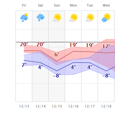
It does look like a quieter week for precipitation though, with what currently looks like only limited chances for lighter snow.
Programming note
You can hear my live weather updates on Minnesota Public Radio at 7:48 a.m. Monday through Friday morning.

