
Light snow and more cold, followed by an extended warmup
A potential Christmas Day storm is brewing
Go Deeper.
Create an account or log in to save stories.
Like this?
Thanks for liking this story! We have added it to a list of your favorite stories.


Light snow moves across Minnesota Tuesday, with another round of dangerous cold by Wednesday morning.
Tuesday’s forecast
A cold front has been moving through northern Minnesota and will be passing through the Twin Cities area early Tuesday afternoon.
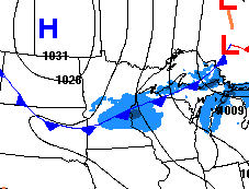
In northern Minnesota, where the front has already passed through, some towns are already below zero and temperatures will not rise much Tuesday. In fact, a few places will see temperatures fall by afternoon. For example, Ely will go from temperatures in the teens Tuesday morning to subzero temperatures by afternoon.
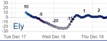
For the rest of the state, cold air comes in a little later, so Wednesday will be the noticeably colder day.
Turn Up Your Support
MPR News helps you turn down the noise and build shared understanding. Turn up your support for this public resource and keep trusted journalism accessible to all.
The front is predominantly dry, so any snow will remain light. Many places will see no snow at all, or just a flurry, and any measurable snow stays under an inch.
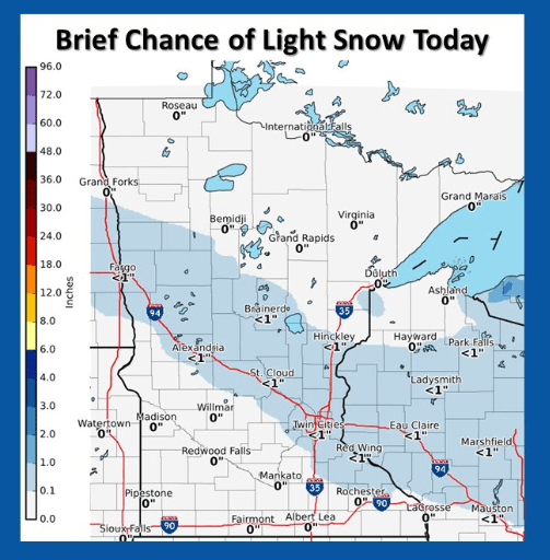
For the Twin Cities, highs will be in the low 20s, and the most likely time to see a few flakes is right around lunchtime. It will be no more than a dusting.
Wednesday’s cold, then a rebound
Behind Tuesday’s cold front, much colder air returns across the state for Wednesday, with the entire state starting off below zero.
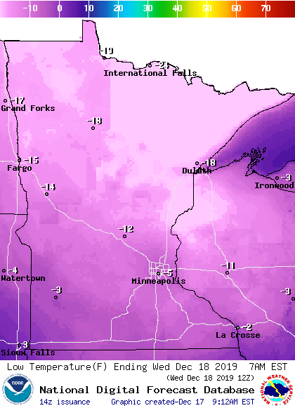
Much of the state will see wind chills of at least minus 10 to minus 20 overnight Tuesday into Wednesday morning, with parts of northern Minnesota having dangerously cold minus 30 to minus 40 degree wind chills.
Wednesday’s highs only make it into the single digits for northern Minnesota, and teens for the southern part of the state.
Already Thursday, we start to warm and the state returns to highs predominantly in the 20s. By the weekend, most of the Minnesota will be in the 30s, putting temperatures 5 to 10 degrees above average.
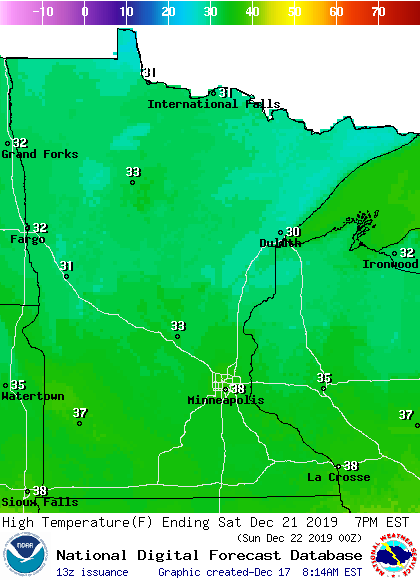
The warmer weather will likely stick around through most of next week too. Here is the extended outlook from Sunday through Dec. 26, showing a high probability of above average temperatures:
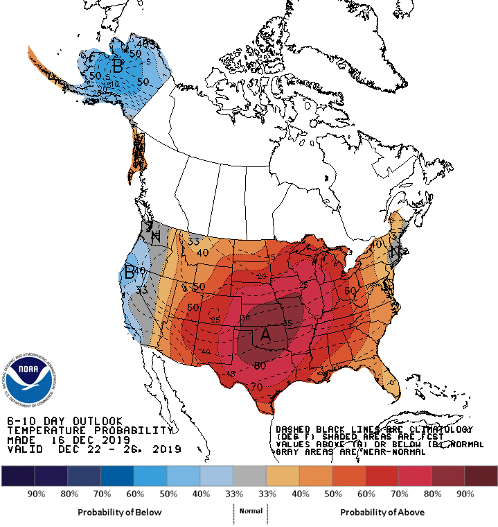
Upcoming snow and next week’s potential
Snow prospects this week remain very slim. After Tuesday’s light snow, there is another round of light snow that will clip northern Minnesota Wednesday, mostly in the afternoon.
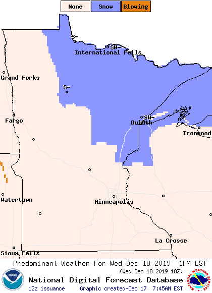
Snow totals should remain under an inch for most of the area.
The next big chance for precipitation doesn’t come until next week. Timing is still somewhat uncertain, but right now it looks like Dec. 25-26 are the best chances for active weather. Because temperatures may still be above average, there is a potential for rain, snow or even a little ice.
Here is one model, showing possible storm placement and precipitation for late Christmas Day:
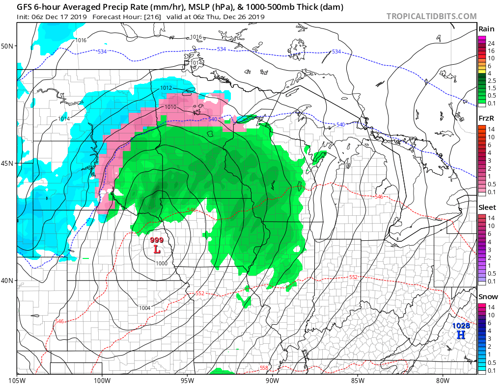
We will continue to update you on this potential storm as we get closer to the holiday. Just be prepared that travel may be messy.
Programming note
You can hear my live weather updates on Minnesota Public Radio at 7:48 a.m. Monday through Friday morning

