
Mild Thursday; no subzero lows for metro the next 5 days
Friday may bring patchy freezing drizzle
Go Deeper.
Create an account or log in to save stories.
Like this?
Thanks for liking this story! We have added it to a list of your favorite stories.


This December has been much colder than last December.
The official Twin Cities low temp has dipped below zero on five days this December. Last December, the Minneapolis-St. Paul International Airport didn’t have any temps below zero, and we saw our first subzero temp of 2019 on Jan. 19.
I’m happy to report that we won’t see any subzero temps in the Twin Cities over the next five days. Some spots in northern and central Minnesota are starting their Thursday with below-zero temps, but this should be their last dip below zero for several days.
Temperature trends
Thursday highs range from the teens in far northern Minnesota to the 30s in the far south:
Turn Up Your Support
MPR News helps you turn down the noise and build shared understanding. Turn up your support for this public resource and keep trusted journalism accessible to all.
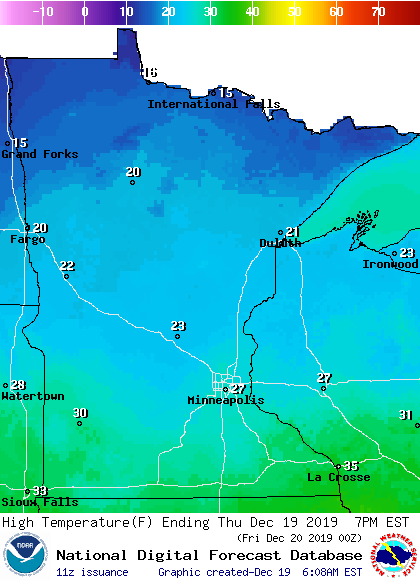
Twin Cities metro area highs will reach the upper 20s, but an isolated 30 is possible.
Friday highs will be in the 20s west and north, with 30s southeast:
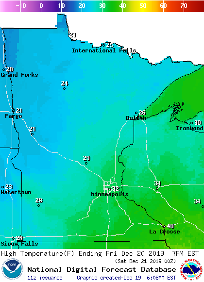
High reach the lower 30s Friday afternoon in the Twin Cities metro area.
Friday drizzle/flurry?
Minnesota and western Wisconsin could see some patchy drizzle/freezing drizzle and flurries on Friday.
The National Oceanic and Atmospheric Administration’s North American Mesoscale forecast model shows the potential precipitation pattern Friday and Friday evening:
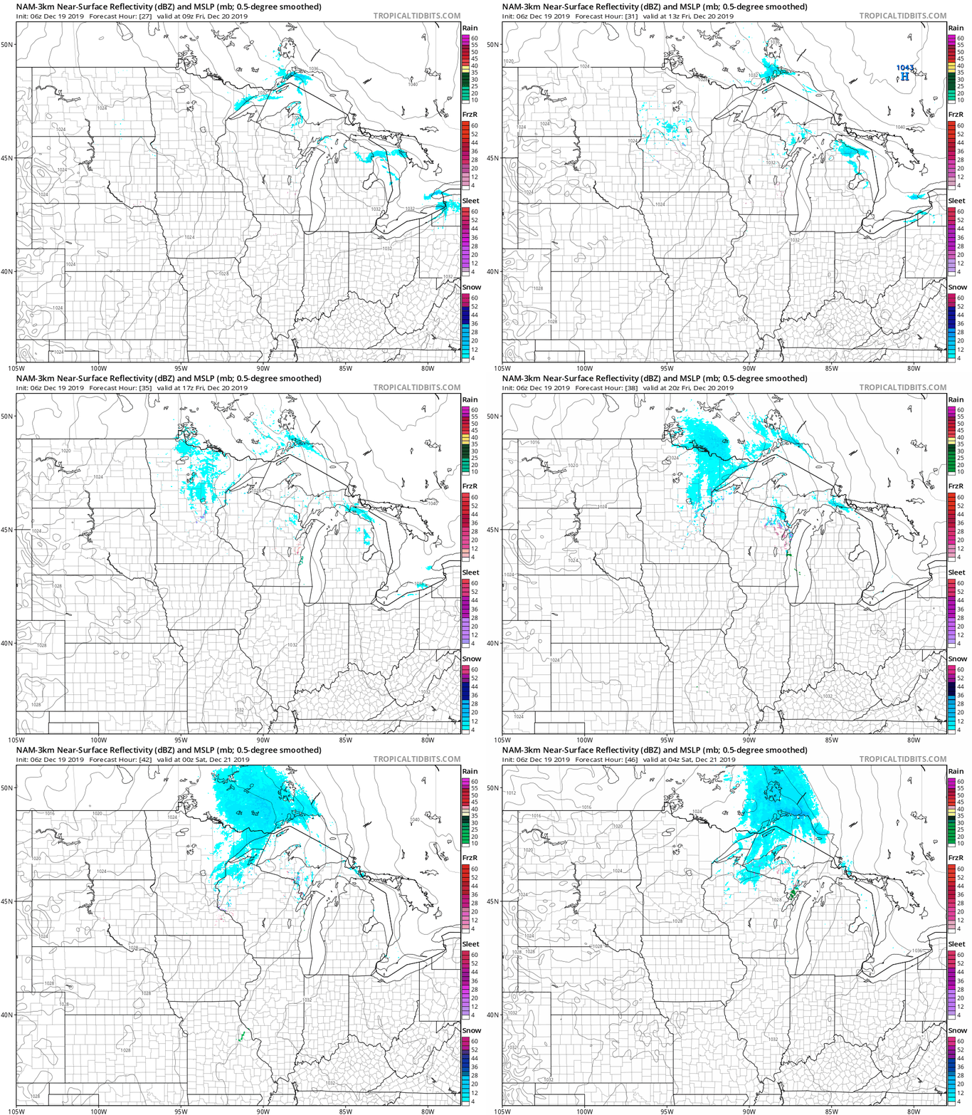
Drizzle/freezing drizzle and flurries are often too light to be detected by radar.
You can hear updated weather information on the MPR network, and you’ll see updated weather info on the MPR News live weather blog.
Looking to the weekend? I’ll post your weekend outlook around midmorning.

