
The deep chill is gone; mild temps this weekend
Freezing drizzle chance on Friday
Go Deeper.
Create an account or log in to save stories.
Like this?
Thanks for liking this story! We have added it to a list of your favorite stories.


We started with mild temperatures the first nine days of December, but the past nine days have been either chilly or very cold.
Our average temperature for December 2019 is running 2.9 degrees cooler than normal in the Twin Cities. We’ll put a dent in that stat with mild temperatures over the next few days.
Last December was 6.1 degrees warmer than normal in the Twin Cities, and our official temp didn’t dip below zero at all last December. Our first subzero temp of 2019 was on Jan. 19. According to the Minnesota State Climatology Office, that set a record:
On Jan. 19, 2019, the mercury finally dipped below zero in the Twin Cities (as measured at the Minneapolis-St. Paul International Airport), with a minimum temperature of minus 1 degree recorded just after sunrise.
This was the latest into the winter the Twin Cities had gone without a below-zero reading, setting the record by one calendar day. The previous record had been a three-way tie between 2012, 2002 and 1889.
We’ve already dipped below zero on five days this December in the Twin Cities, but I don’t see another trip below zero in the next week.
Turn Up Your Support
MPR News helps you turn down the noise and build shared understanding. Turn up your support for this public resource and keep trusted journalism accessible to all.
Temperature trends
Our temperature recovery starts this Thursday afternoon, with highs in the 20s across much of Minnesota and a few spots in the south reaching the lower 30s. The metro area will top out in the upper 20s to around 30. Our average Twin Cities high temp is 26 degrees this time of year.
Friday highs will reach the 30s in the metro area and points to the south and east:
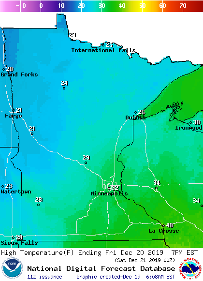
On to the weekend…
There’ll be a lot of highs in the 30s on Saturday:
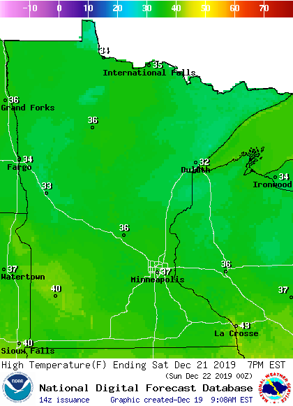
A few spots in far southern Minnesota top 40 degrees.
Sunday will be warmer than normal as well:
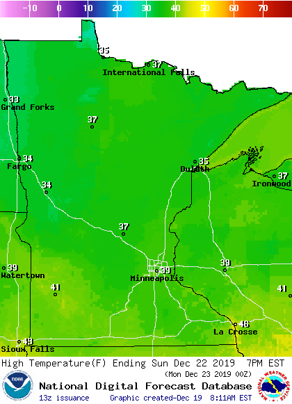
I wouldn’t be surprised if we hit 40 Sunday afternoon in the Twin Cities.
Rain and snow chances
Computer models aren’t showing any rain or snow for Minnesota or western Wisconsin on Saturday or Sunday.
If you’re traveling to your weekend destination on Friday, there will be a chance of patchy drizzle/freezing drizzle and flurries.
The National Oceanic and Atmospheric Administration’s North American Mesoscale forecast model shows the potential precipitation pattern Friday and Friday evening:
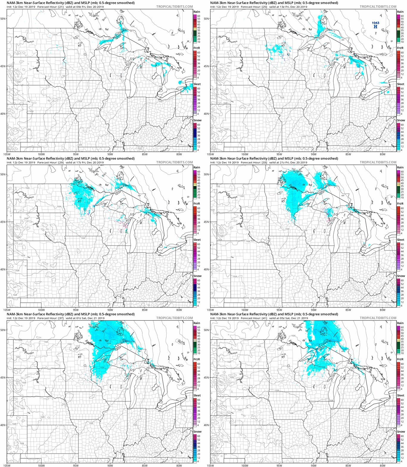
Drizzle/freezing drizzle and flurries are often too light to be detected by radar.
You can hear updated weather information on the MPR network, and you’ll see updated weather info on the MPR News live weather blog.
Snow depths
Mild temperatures this weekend will shrink our snow depths a bit, but there’s plenty of snow on the ground in most areas. Here’s the latest snow depth analysis from the National Oceanic and Atmospheric Administration:

There are between 10 and 20 inches of snow on the ground across much of northeastern Minnesota and northern Wisconsin, with more than 20 inches in many areas near Lake Superior.
Most spots in northwestern Minnesota, plus central and southern Minnesota and west-central Wisconsin, are in the 4-to-10-inch snow depth range.
As you can see, most areas have ample snow for cross-country skiers, sledders and snowboarders. There’s even enough snow cover for snowmobiling in parts of Minnesota and northern Wisconsin.
Have some fun in the snow!

