
Sunday felt like March, and we'll see mild temps this week; how about rain and snow chances?
The Minnesota River peeked through a veil of clouds Sunday afternoon
Go Deeper.
Create an account or log in to save stories.
Like this?
Thanks for liking this story! We have added it to a list of your favorite stories.


Our official high temp was 42 degrees Sunday afternoon at Minneapolis-St. Paul International Airport. That was 17 degrees warmer than our average Dec. 22 Twin Cities high temp, and it equaled our average high for the middle of March. I didn’t see anyone wearing flip-flops, but I did see a lot of people out enjoying the warmth and sunshine.
Here’s the Sunday afternoon loop from the National Oceanic and Atmospheric Administration’s GOES-16 satellite:
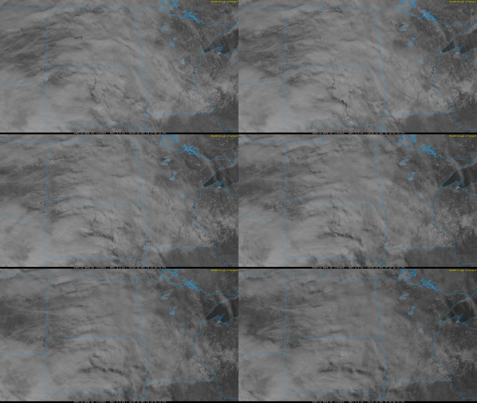
You can see how the sun was filtered by bands of mostly high-level clouds from time to time. You can also see how the snow cover only extends into far northern Iowa. The roads and buildings in the Twin Cities metro area reflect less sunlight than the more unbroken snow-covered areas beyond the metro area, and you can see the Minnesota River as well:

You can also see the snow cover on Mille Lacs Lake, Leech Lake and Upper and Lower Red Lake through the thin veil of clouds on the satellite loop. By the way, there’s plenty of snow cover in northeastern Minnesota and northwestern Wisconsin. Those areas have a lot of trees, which don’t reflect as much sunlight as the less-forested areas to the south.
Turn Up Your Support
MPR News helps you turn down the noise and build shared understanding. Turn up your support for this public resource and keep trusted journalism accessible to all.
Temperature trends
Highs will be in the 30s on Monday across most of Minnesota and western Wisconsin, with a few 20s in northwestern and north-central Minnesota.
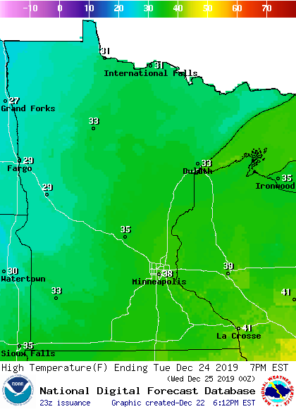
Tuesday highs will also be mainly in the 30s, with 20s in west-central and northwestern Minnesota:
Similar highs are expected on Christmas day:
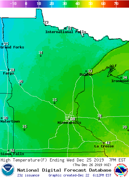
Twin Cities metro area highs are projected to reach the mid 30s on Thursday and lower 30s on Friday. That’s still a bit warmer than our average highs this time of year.
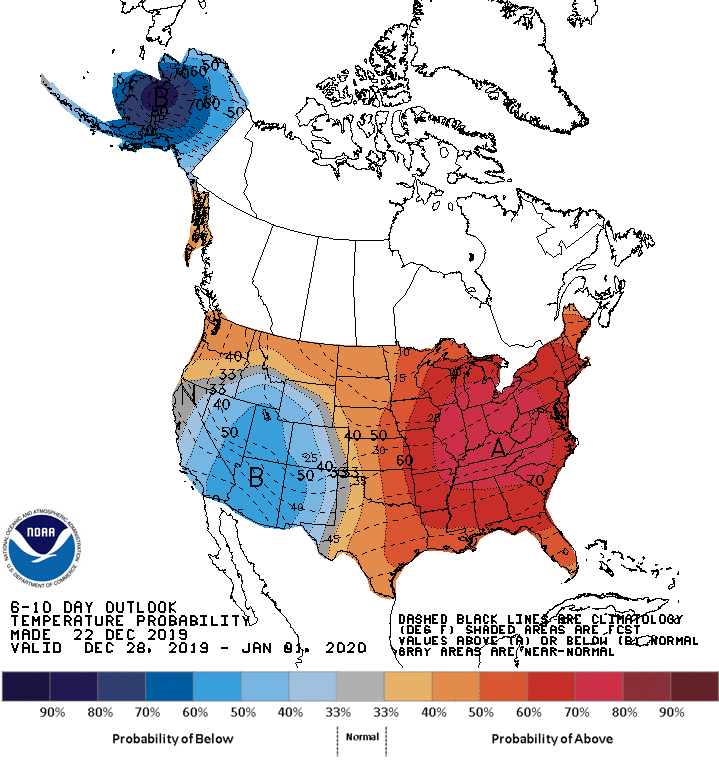
Warmer than normal temps could linger right through the end of December and into New Year’s Day. The Climate Prediction Center of the National Weather Service shows a strong tendency toward warmer than normal temperatures across Minnesota and Wisconsin for the period from Dec. 28 through Jan. 1:
Rain and snow chances
I’ll start by mentioning that some areas of fog and freezing fog are possible in Minnesota and western Wisconsin late Sunday night and early Monday morning.
The weather should be quiet in most areas on Tuesday, but there will be a chance of light snow showers and patchy drizzle and freezing drizzle in northern Minnesota. Some forecast models show a chance of rain showers and snow showers in Minnesota and western Wisconsin on Christmas Day and also on Thursday. There could even be some accumulating snow in northern Minnesota Wednesday night into Thursday…check forecast updates.
You can hear updated weather information on the MPR network, and you’ll see updated weather info on the MPR News live weather blog.
I hope that you have a great week!

