
Rain showers at times for the metro, heavy snow parts of western and northern Minnesota today
Metro snow Monday and Monday night
Go Deeper.
Create an account or log in to save stories.
Like this?
Thanks for liking this story! We have added it to a list of your favorite stories.


Here’s a quick morning update…
The National Oceanic and Atmospheric Administration's North American Mesoscale (NAM) forecast model shows the potential precipitation pattern from this morning through Monday evening:
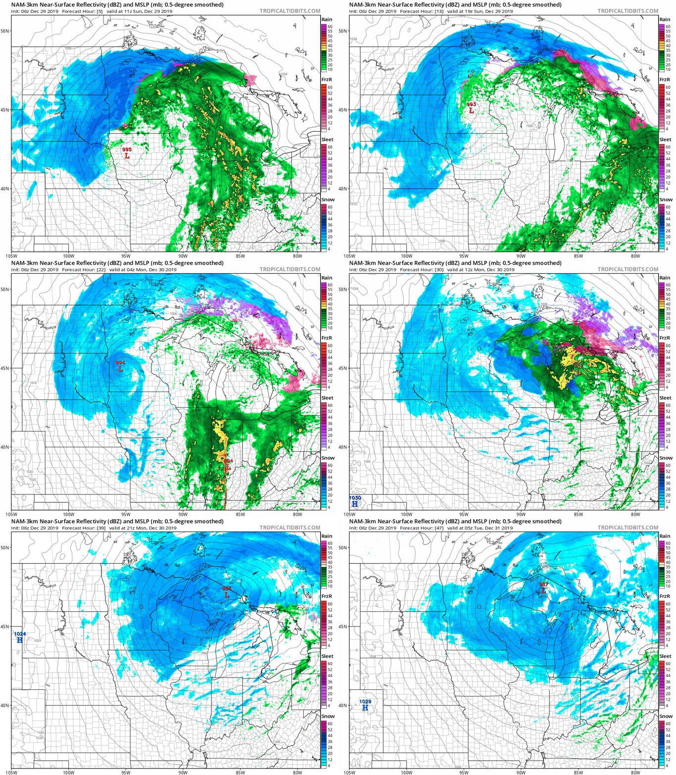
The Twin Cities metro area and points to the south and east will see scattered rain showers today. Snow continues today in much of northern Minnesota and western Minnesota.
Here are potential snow totals today and tonight:
Turn Up Your Support
MPR News helps you turn down the noise and build shared understanding. Turn up your support for this public resource and keep trusted journalism accessible to all.
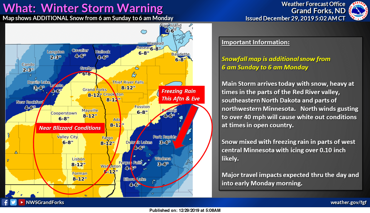
Winter storm warnings continue in the heavy snow area today. There may be a wintry mix around the southeastern fringe of the heavy snow.
Northeastern Minnesota could see snow totals like this today and tonight:

Northeastern Minnesota and northwestern Wisconsin could see snow totals like this Monday into early Tuesday:

The Twin Cities metro area has the potential for 3 to 5 inches of snow Monday into Monday night, and a winter weather advisory starts in the metro area at midnight tonight and runs until 6 a.m. Tuesday.
Updates on the winter storm will be posted by the NWS offices in the Twin Cities, Duluth, Grand Forks, La Crosse and Sioux Falls.
The Minnesota Department of Transportation will have updated road conditions. Wisconsin road conditions can be found here.
You can hear updated weather information on the MPR network, and you’ll see updated weather info on the MPR News live weather blog.
Temperature trends
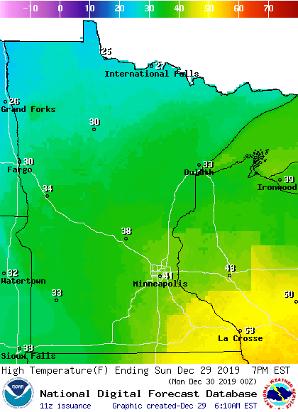
Sunday highs range from 20s northwest to 40s southeast:
Programming note
You can hear my live weather updates on MPR News at 7:35 a.m., 9:35 a.m. and 4:35 p.m. each Saturday and Sunday.

