
The winter storm that caused havoc over the weekend brings statewide snow Monday
High winds will cause blowing snow and reduced visibility
Go Deeper.
Create an account or log in to save stories.
Like this?
Thanks for liking this story! We have added it to a list of your favorite stories.


The winter storm that impacted Minnesota all weekend brings statewide snow Monday before finally clearing out. Because of the new snow and blowing snow on Monday, almost all of Minnesota is under a winter weather advisory, with the North Shore under a winter storm warning due possible heavier snow from lake-effect enhancement.
Temperatures
Colder air moves across the state Monday, with most temperature either holding steady or falling this morning, and falling for almost the entire state by Monday afternoon.
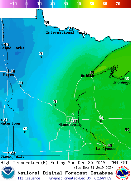
That puts highs in the 20s and low 30s, with the colder air causing the precipitation across the state to switch to snow.
Precipitation
Because of the colder air, almost the entire state is seeing any precipitation as snow.
Turn Up Your Support
MPR News helps you turn down the noise and build shared understanding. Turn up your support for this public resource and keep trusted journalism accessible to all.
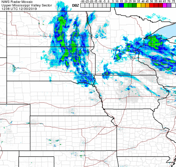
However, there is occasionally some light freezing rain mixing in and that is possible through Monday morning. Plus, some wet areas have refrozen. So watch for slick areas.
All precipitation will likely be snow from Monday afternoon through the departure of the storm.
The highest new snow totals for Monday are set up over eastern Minnesota, including the Twin Cities, which could see 3 to 5 inches by Monday night.

The snow winds down overnight Monday into early Tuesday.
Winds
Winds have already picked up across western Minnesota as of Monday morning, and will increase for the rest of the state through the morning.
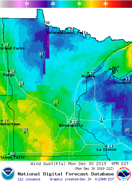
As winds gust in excess of 30 mph at times, blowing snow reducing could reduce visibility anytime through Tuesday morning.
An updated forecast with an extended look at the week ahead will be posted around 9 a.m.

