
Cool sunshine for Tuesday, then milder air and light snow chances return
New Year's Eve will be seasonably cold
Go Deeper.
Create an account or log in to save stories.
Like this?
Thanks for liking this story! We have added it to a list of your favorite stories.


Tuesday’s forecast brings the return of sunshine and seasonable cold for New Year’s Eve. Minnesota will see a quieter pattern for the remainder of the week.
Tuesday’s weather
Clouds are clearing out and the state will be under partly to mostly sunny skies by afternoon.
Tuesday morning is still somewhat breezy, but winds are also diminishing and will be lighter by the afternoon.
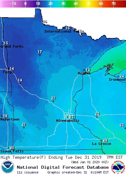
Temperatures will not be as mild as they have been, but it’s a return to closer to average temperatures for this time of year. Highs will range in the teens and 20s.
New Year’s Eve
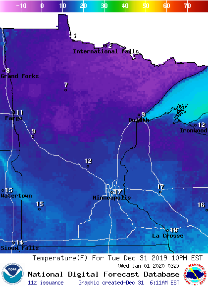
If you’re headed out for New Year’s Eve, it will be dry and seasonable. Temperatures as we ring in the new year will be in the single digits in northern Minnesota and teens for southern Minnesota. For the Twin Cities, temperatures at midnight will be near 15 degrees.
Turn Up Your Support
MPR News helps you turn down the noise and build shared understanding. Turn up your support for this public resource and keep trusted journalism accessible to all.
Quieter through the weekend
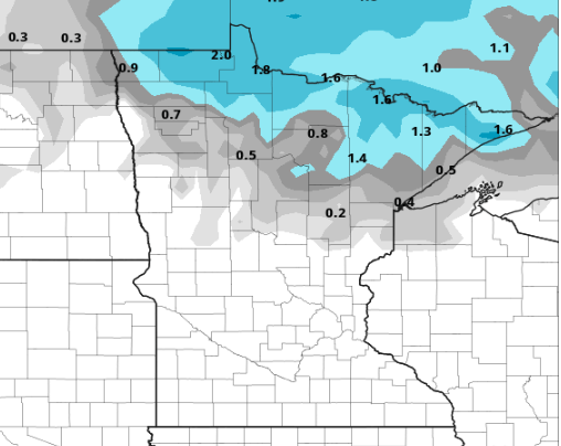
We will see a couple minor disturbances move through the state in the coming days, but there are no major storms on the horizon. A weak front that will move across Minnesota Thursday could bring light snow, possibly up to 2 inches, to northern Minnesota from Wednesday evening through Thursday afternoon.
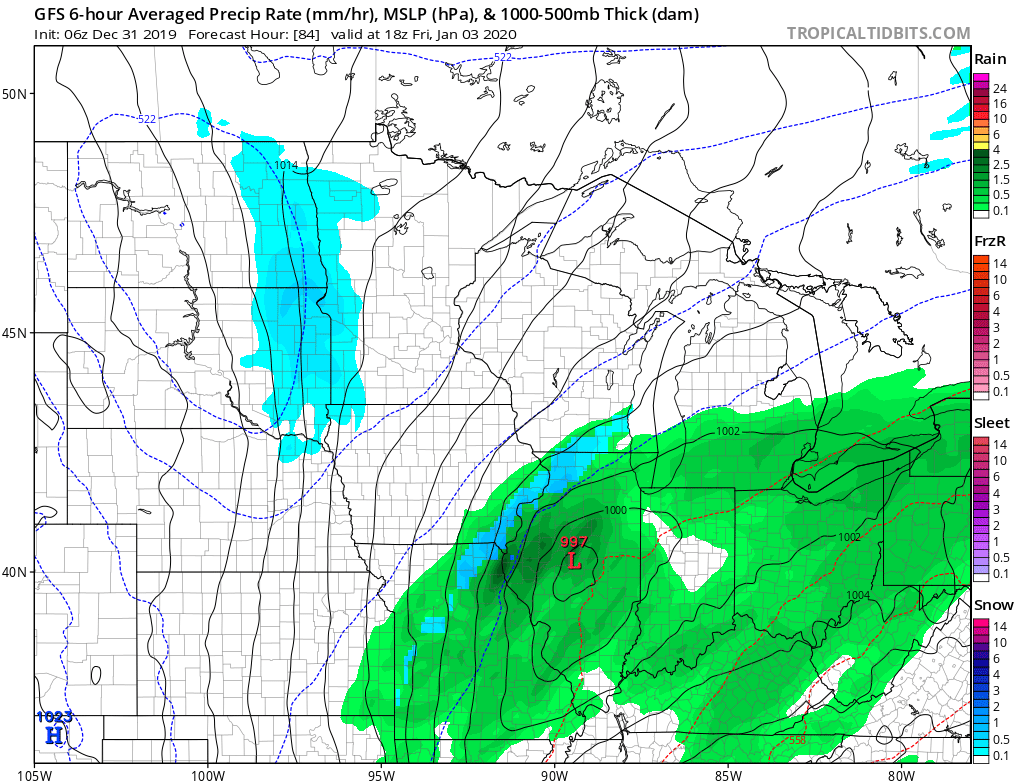
A more widespread chance for snow moves across the state on Friday, with western Minnesota most likely seeing some light accumulation. A system to the south that could have clipped southeastern Minnesota with some heavier snow currently looks like it will stay too far to the south to cause problems.
Another potential system moves through Sunday that could also bring some lighter snow.
Temperatures rebound back above average and highs will likely stay in the 20s and 30s through the end of the week.
Colder next week
Temperatures across Minnesota have been predominantly above average the past two weeks, but next week could break that trend with temperatures that will likely dip below average midweek.
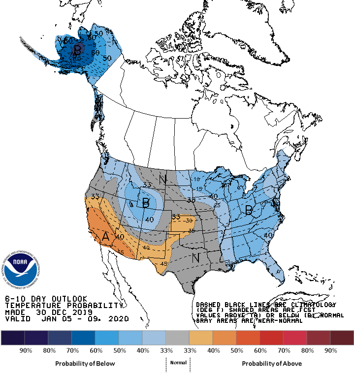
Right now, it looks like the state could be about 10 degrees below average, but that temperature forecast will become more refined as we get closer to next week.
Have a safe and happy new year!
Programming note
You can hear my live weather updates on Minnesota Public Radio at 7:48 a.m. Monday through Friday morning.

