
A mild Thursday, then cooler with snow by Friday
Snow exits the Arrowhead Thursday morning
Go Deeper.
Create an account or log in to save stories.
Like this?
Thanks for liking this story! We have added it to a list of your favorite stories.


Thursday is another mild day across Minnesota, with above-average temperatures for the entire state. The only precipitation is an area of snow and ice departing the Arrowhead Thursday morning.
Thursday’s weather
A weak cold front is moving across Minnesota Thursday morning which has brought light areas of snow and ice across northern Minnesota since Wednesday.
As of 9 a.m. the snow and occasional light freezing rain is mostly in the Arrowhead of Minnesota and should be entirely cleared out by late morning.
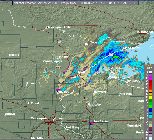
The snow is very light, so totals will be under 1 inch.
Turn Up Your Support
MPR News helps you turn down the noise and build shared understanding. Turn up your support for this public resource and keep trusted journalism accessible to all.
The entire state will stay mostly cloudy Thursday. Temperatures are very mild Thursday morning, with most of the state in the 20s and 30s, putting the state 10-20 degrees above average for morning lows.
Because of the cold front moving across, temperatures will not rise much by afternoon.
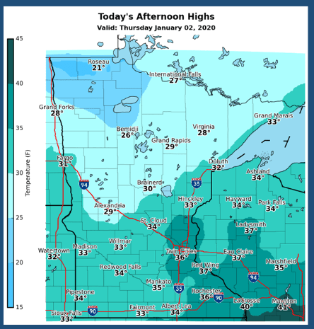
Some places, such as the Twin Cities could see temperatures fall slightly by Thursday afternoon.
Snow chances
There are no major storms on the horizon for Minnesota in the week ahead, so it will be a fairly dry break. A couple disturbances do move across the state bringing occasional light snow.
The next chance for snow comes Friday, for all except the northeast corner of the state. The area mostly likely to see accumulation is southern Minnesota, with 1-2 inches possible.
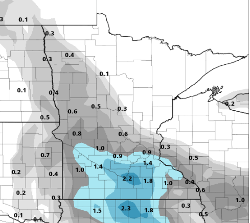
This also means mostly cloudy skies Friday except for those in northeastern Minnesota.
Another round of snow moves through on Sunday.
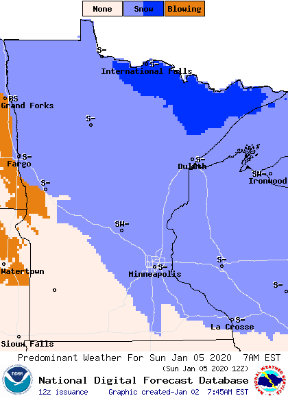
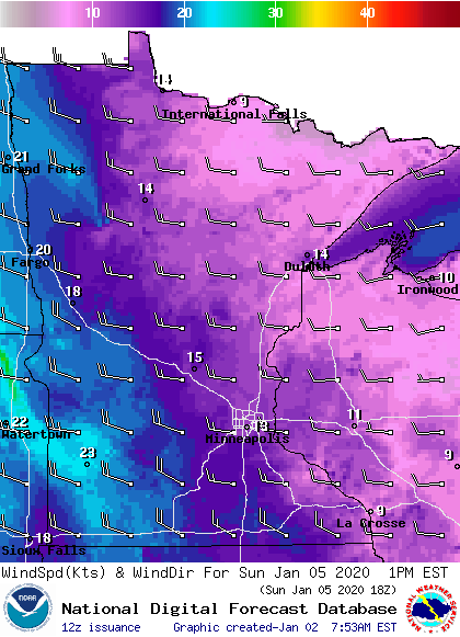
The best chance for accumulation with that is for northern Minnesota to get 1-2 inches. It will be windy, though, on Sunday, especially for western Minnesota, so any snow could include blowing snow areas.
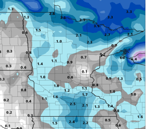
As an idea of how minimal the snow will be, here is the snow projection for the entire next week. Even adding up all the minor snow chances, the state likely only gets 0-3 inches for the entire period.
Temperatures
Behind Thursday’s weak cold front, temperatures cool just a couple degrees for Friday and Saturday, putting highs in the 20s.
As the system bringing Sunday’s snow approaches, warm air funnels back in. In fact, most temperatures will stay steady or even rise slightly Saturday night and most of the Minnesota returns to the 30s by Sunday afternoon.
Colder air moves back in behind that system, so next Monday and Tuesday temperatures cool back closer to average for January, in the teens for northern Minnesota and 20s for southern Minnesota.
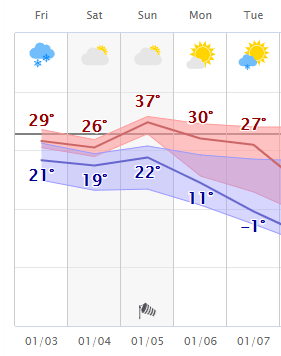
Here is the expected temperature trend for the Twin Cities. The shaded areas show the amount of uncertainty, so especially into next week, it is somewhat uncertain exactly how much cold air moves back in.
Programming note
You can hear my live weather updates on Minnesota Public Radio at 7:48 a.m. Monday through Friday morning.

