
A quick round of snow bursts across Minnesota Friday
Temperatures fall by afternoon for southern parts of the state
Go Deeper.
Create an account or log in to save stories.
Like this?
Thanks for liking this story! We have added it to a list of your favorite stories.


Temperatures drop a few degrees Friday as an area of mostly light snow moves across the state.
Snow
A weak area of low pressure skirts across the southwest corner of Minnesota Friday, bringing predominantly light snow to most of the state. The northeast corner of the state may escape any snow this time around.
Light snow is already pushing into western Minnesota as of Friday morning. Snow totals for most places, including the Twin Cities will be less than an inch.
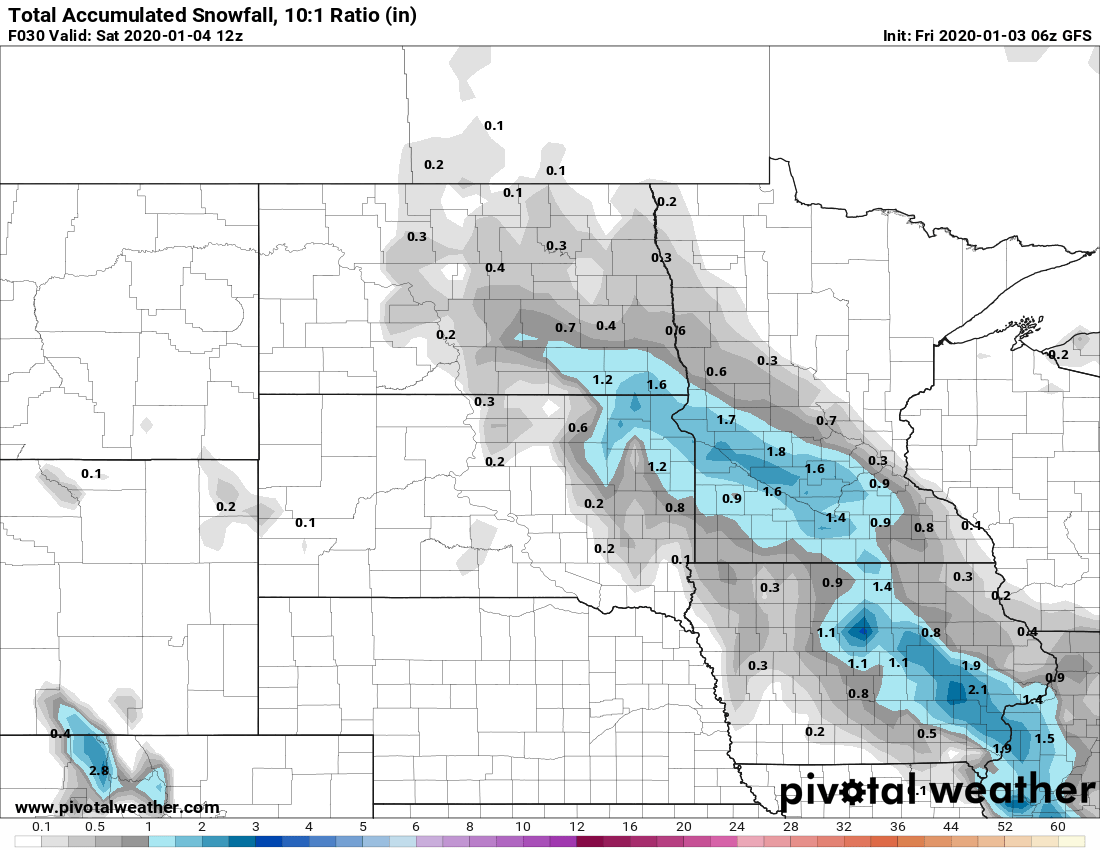
However, southwestern Minnesota could see more totals up to 2 inches, and a corridor along the Upper Minnesota River Valley, especially just south of Redwood Falls to Mankato, could see some isolated reports up to 4 inches.
Turn Up Your Support
MPR News helps you turn down the noise and build shared understanding. Turn up your support for this public resource and keep trusted journalism accessible to all.
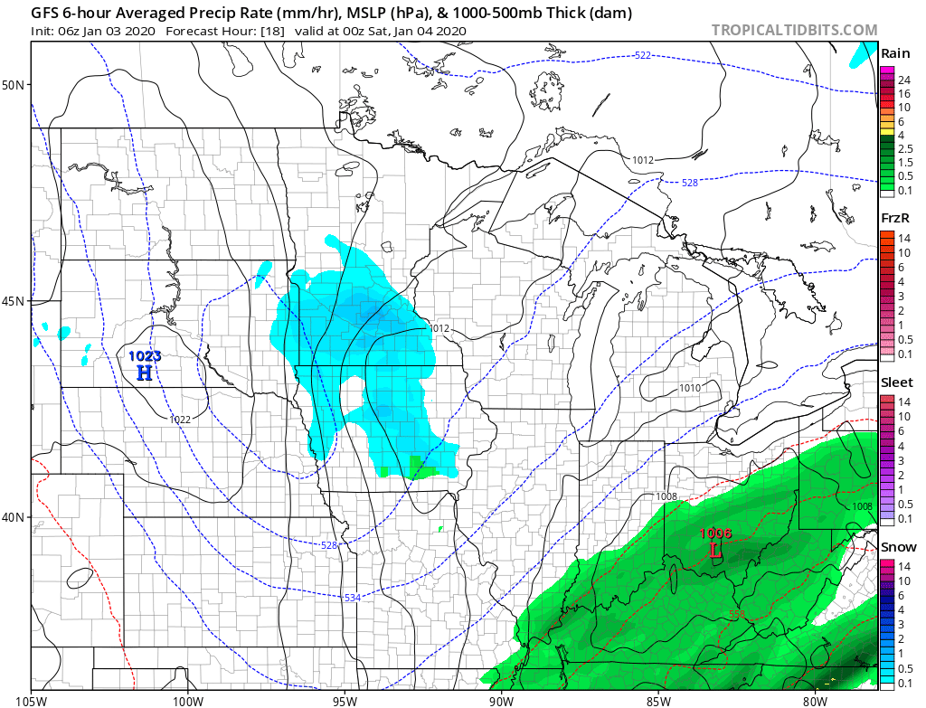
For the area seeing the higher snow totals, snow could come through quickly in the afternoon reducing visibility, so be prepared for slower travel.
Temperatures
Highs Friday will range in the 20s and 30s, but some locations will set those highs in the morning.
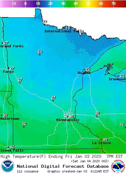
Temperatures Friday morning range from teens in northern Minnesota to mild 30s in southern Minnesota.
Most of southern Minnesota will see temperatures that remain steady through the morning or even fall slightly by afternoon. For example, the Twin Cities will likely go from the low 30s Friday morning to the upper 20s by afternoon.
Another round of snow is possible for Minnesota on Sunday. That extended forecast will be updated around 9 a.m.
Programming note
You can hear my live weather updates on Minnesota Public Radio at 7:48 a.m. Monday through Friday morning.

