
Temperatures boomerang in the week ahead; snow chances remain light
Monday stays mostly sunny and comfortable
Go Deeper.
Create an account or log in to save stories.
Like this?
Thanks for liking this story! We have added it to a list of your favorite stories.


The week ahead brings a couple of major temperatures swings accompanied by chances for light snow.
Monday’s forecast
After a cool start Monday morning, temperatures are headed at least 10 degrees above average by Monday afternoon, for highs ranging from the upper 20s to mid-30s.
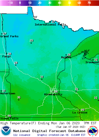
The mild temperatures will be aided by plentiful sunshine with the exception of southern Minnesota, which sees a few more clouds due to a weather disturbance south of the state.
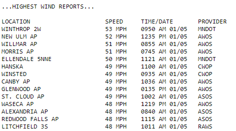
Winds have died down significantly since Sunday, when wind gusts topped 50 mph at times.
Turn Up Your Support
MPR News helps you turn down the noise and build shared understanding. Turn up your support for this public resource and keep trusted journalism accessible to all.
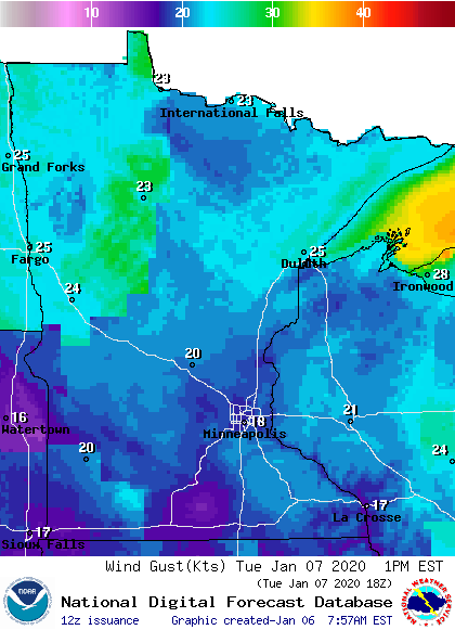
However, they could become breezier again by late Monday, and it will remain windy through most of Tuesday.
Tuesday’s cold front
Ahead of a cold front that moves across Minnesota Tuesday, not only will winds pick up, but clouds increase in the late evening hours, and a slight chance for snow returns.
For most of the state, including the Twin Cities, the snow would be nothing more than a few flakes passing by late Monday night.
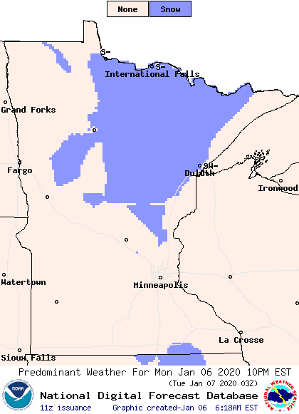
Northern Minnesota may see a light dusting of snow under 1 inch that lingers through mid-Tuesday, with the Arrowhead possibly seeing snow linger through the afternoon.
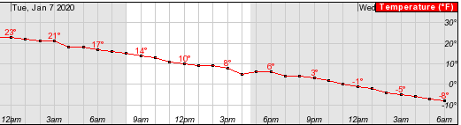
The front will also bring colder air back. In fact, the majority of Minnesota will see Tuesday highs set just after midnight, as temperatures fall through the day, dropping below zero for most by Wednesday morning. Here is an example of that downward trend for Duluth on Tuesday:
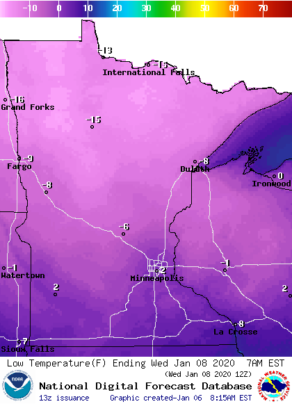
Wednesday morning temperatures will range from the negative teens in northern Minnesota to southern Minnesota clinging to the low single digits.
The next storm swings temperatures back
Already by Wednesday another system starts to move in to Minnesota, bringing warm air ahead of it.
Much like temperatures fall all of Tuesday, temperatures are expected to rise all Wednesday and keep rising through the overnight. This sets up a milder Thursday, with the return of highs in the 20s and 30s.
That system also brings back snow. Flurries or very light snow is possible Wednesday. Then, the best chance for accumulation comes for northern Minnesota Wednesday night into Thursday afternoon at 1-2 inches of snow.
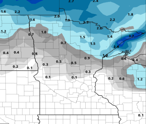
For southern Minnesota, no accumulation is expected. A little rain could mix in the with snow due to the mild temperatures Thursday afternoon.
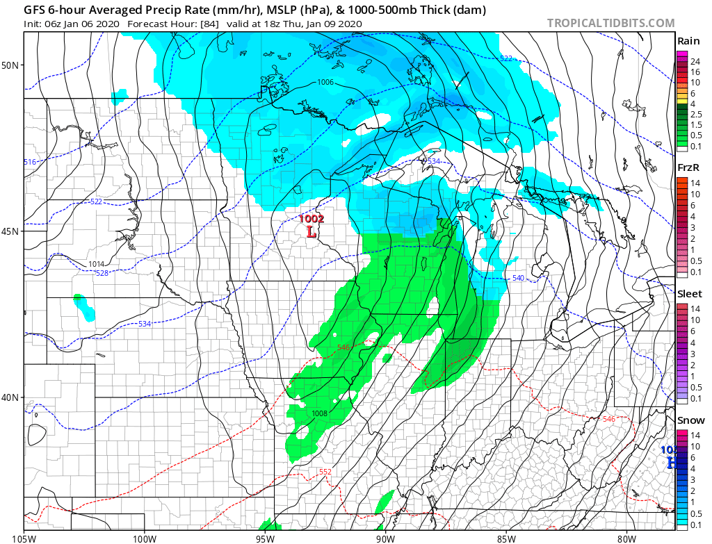
Colder air moves back in behind that system, sending temperatures below average Friday and Saturday.
Programming note
You can hear my live weather updates on Minnesota Public Radio at 7:48 a.m. Monday through Friday morning.

