
Minnesota warms through Thursday, but more rounds of dangerous cold are ahead
Ice may cause travel problems Thursday
Go Deeper.
Create an account or log in to save stories.
Like this?
Thanks for liking this story! We have added it to a list of your favorite stories.


After a cold start Wednesday morning, temperatures climb non-stop through Thursday afternoon. But, the same storm causing the warm-up will also bring snow and ice across most of Minnesota.
Wednesday’s forecast
After a bitterly cold start, with almost the entire state below zero and some places close to 30 below, temperatures will slowly warm all day and keep warming through the overnight Wednesday. Because of that, highs will be set at the end of the day. Afternoon temperatures will still be below average, with northern and central Minnesota in the single-digits, and southern Minnesota barely in the teens.

Here is how that temperature climb looks for the Twin Cities through Thursday morning:

Winds also start picking up again, and by Wednesday evening, much of the state will be seeing wind gusts 20-30 mph or higher.
Turn Up Your Support
MPR News helps you turn down the noise and build shared understanding. Turn up your support for this public resource and keep trusted journalism accessible to all.

That will add a wind chill to the already cold air. The same storm bringing the milder air also starts to move snow across northern Minnesota by late Wednesday afternoon. There is also a slight chance for freezing precipitation to mix in, but the higher chance for that comes on Thursday.
Incoming storm
The warm-up we see through Wednesday and into Thursday courtesy of a warm-front ahead of low pressure that moves across Minnesota on Thursday. By Thursday afternoon, most of the state is at least slightly above average, with highs predominantly in the 20s and 30s. However, the warm air moving in over a colder surface will likely cause periods of light freezing rain in addition to the snow northern Minnesota will see.
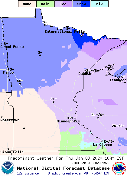
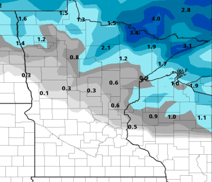
For the Twin Cities, the best chance to see ice is Thursday morning, because by the afternoon temperatures are mild enough to switch the precipitation to all rain. For central Minnesota northward, especially the northeastern corner of the state, periods of freezing rain could linger through late Thursday afternoon. Watch for slick spots on the roads. Most of the snow with this system stays light, with northern parts of Minnesota getting 1”-3”.
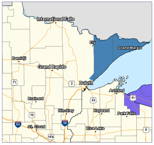
The very northern part of Lake Superior could see lake enhancement to the snow along with ice, so Cook and Lake counties are under a Winter Storm Watch from 6 p.m. Wednesday through 4 p.m. Thursday.
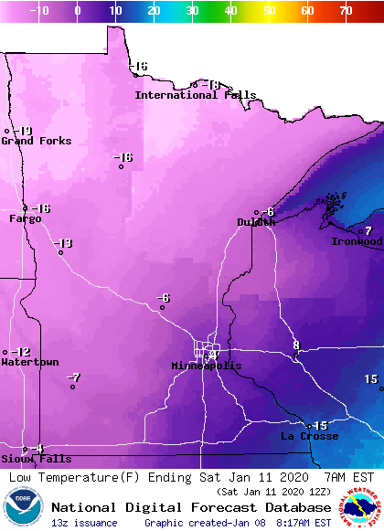
Most of the precipitation clears out by later Thursday afternoon, but then we get on the cold side of the storm and temperatures begin to dive again. Almost all of Minnesota will set high temperatures for Friday right at the start of the day, then most places will see falling temperatures through Saturday morning. We bottom-out with widespread lows below zero again as we start Saturday.
The start of next week
Another disturbance moves through Minnesota on Sunday, bringing light snow that looks like it will only total 0-1” across the state.
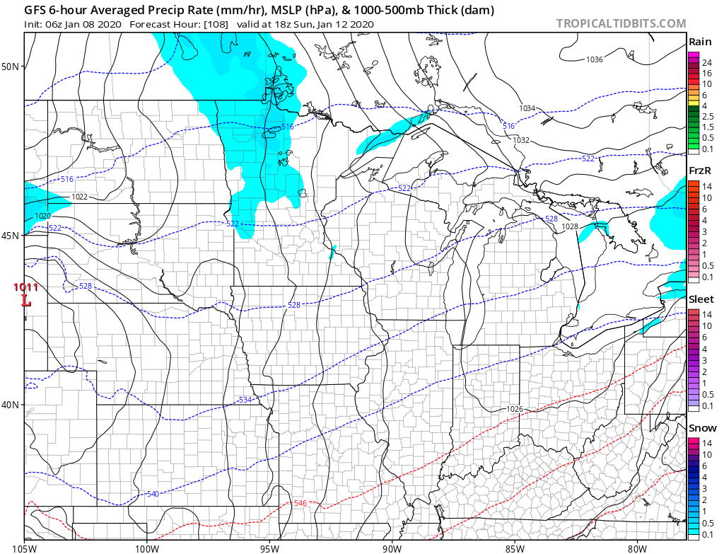
A more impressive storm will likely impact the state by Tuesday. Currently it looks like that will bring more widespread snow accumulation, but exactly totals are still uncertain.
There is also colder air that comes in behind that system, so we could be in for a significant cold snap by the middle of next week. It’s still unclear how cold it will get, but it is very likely overnight lows will be back below zero, and it is possible some daytime highs stay sub-zero as well. It’s not out of the question we could see our coldest air so far this winter next week. We’ll keep you posted!
Programming note
You can hear my live weather updates on Minnesota Public Radio at 7:48 a.m. Monday through Friday morning.

