
Cold temps linger, with snow chances in some areas; recap of our 1994 arctic cold
Midweek thaw still on track
Go Deeper.
Create an account or log in to save stories.
Like this?
Thanks for liking this story! We have added it to a list of your favorite stories.


It’s plenty cold this Sunday, with highs only reaching the single-digits in western Minnesota and the lower teens to the east, including the Twin Cities metro area. Our average high this time of year is 24 degrees in the Twin Cities.
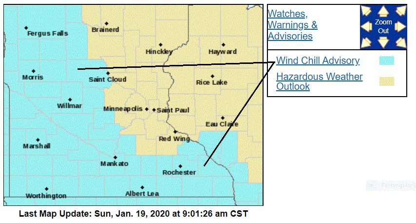
Wind chills will be in the 20s below zero this morning in much of western Minnesota, plus parts of central and southern Minnesota and southwestern Wisconsin, where wind chill advisories continue until noon:
Temperature trends
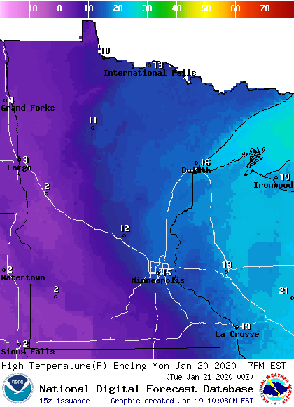
Monday is Martin Luther King Jr. Day, and temperatures will still be cold. Highs reach the single digits in the west, with teens to the east:
Turn Up Your Support
MPR News helps you turn down the noise and build shared understanding. Turn up your support for this public resource and keep trusted journalism accessible to all.
Temps start to recover on Tuesday and our January thaw arrives on Wednesday.
Twin Cities metro area highs are projected to be around 20 on Tuesday, followed by upper 30s Wednesday and Thursday and lower 30s on Friday.
Snow chances
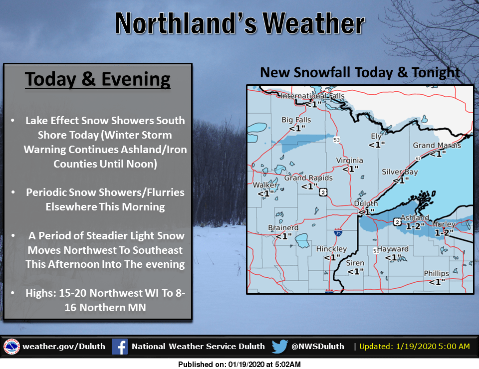
Lake-enhanced snow continues today in parts of far northern Wisconsin:
The rest of western Wisconsin, plus much of Minnesota, could see some passing flurries at times this Sunday. We’re also expecting a more organized area of snow to spread into northern Minnesota this Sunday afternoon, then move southward this evening and overnight.
The National Oceanic and Atmospheric Administration’s North American Mesoscale forecast model shows the potential precipitation pattern this Sunday afternoon through Monday morning:
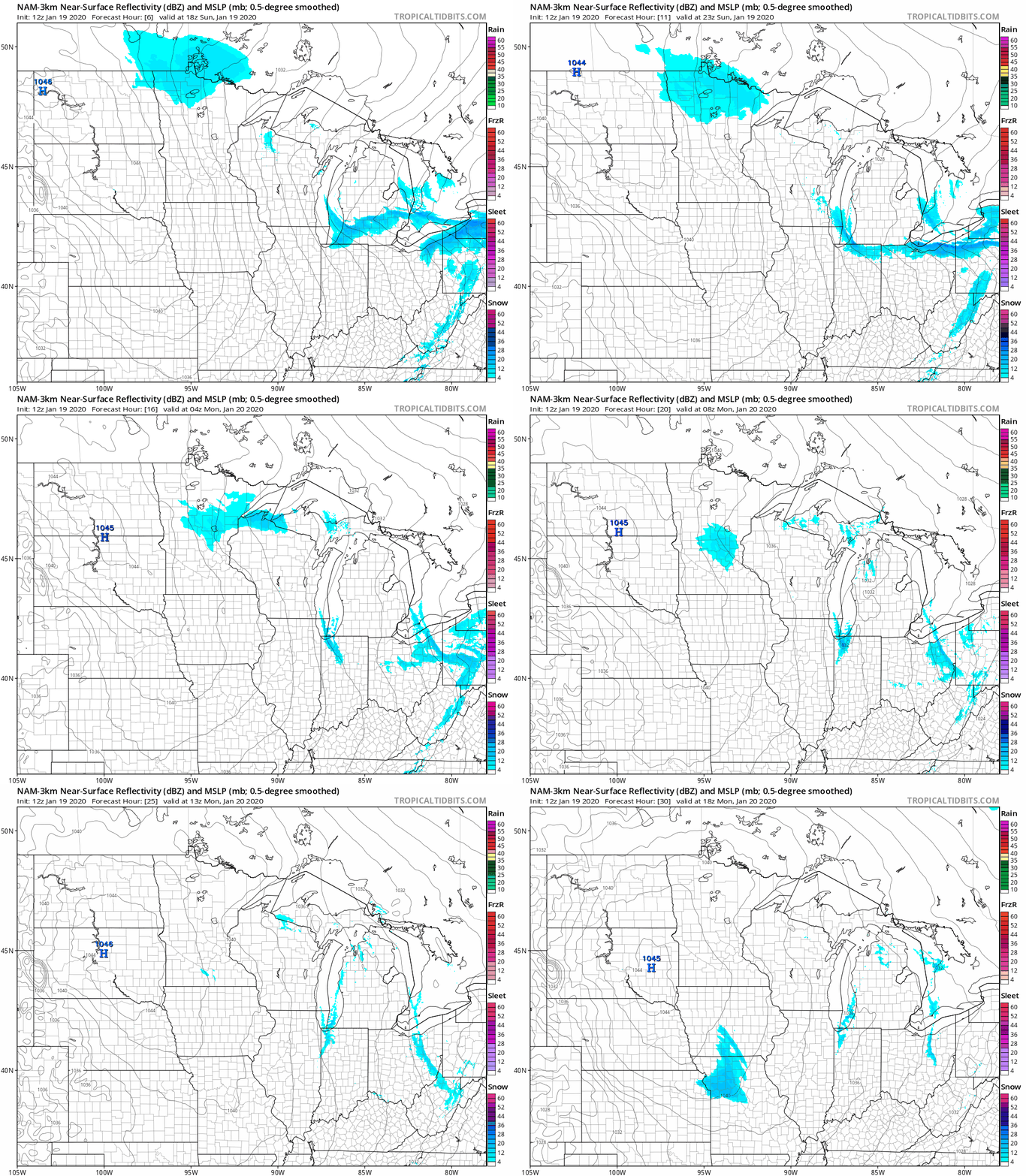
The Twin Cities metro area could see a few snow showers overnight and very early on Monday.
You can hear updated weather information on the MPR network, and you’ll see updated weather info on the MPR News live weather blog.
Some roads are still slick due to our recent snow plus the very cold temps. The Minnesota Department of Transportation will have reports on road conditions. Wisconsin road conditions can be found here.
1994 arctic chill
According to the National Weather Service, the low on Jan. 19,1994 was 47 degrees below zero in Brainerd. We hit 27 degrees below zero at MSP airport in the Twin Cities that same day.
We had an incredibly long stretch of arctic chill in the Twin Cities in January of 1994:

The second column lists the low temps, which were in the 20s below zero on 4 of 5 days from Jan. 15 through Jan. 19 of 1994. Our high temp was 16 degrees below zero on Jan. 18!
By the way, the far right column lists snowfall amounts for each day.
Programming note
You can hear my live weather updates on MPR News at 7:35 a.m., 9:35 a.m. and 4:35 p.m. each Saturday and Sunday.

