
Tuesday starting off cooler, with widespread flurries
Cloudy skies prevail again
Go Deeper.
Create an account or log in to save stories.
Like this?
Thanks for liking this story! We have added it to a list of your favorite stories.


Minnesota is starting off again with a very low layer of clouds that is producing scattered flurries across the state Tuesday morning. While the flurries should end by late morning, the clouds stick around all day.
Tuesday’s forecast
Some slightly cooler air has moved into Minnesota, making us 5 to 15 degrees cooler across the state for Tuesday. This returns us back to more average January temperatures, and highs Tuesday will be in the teens and 20s.

High pressure is still dominating our weather and combined with low-level moisture and light winds, we have been seeing very low stratus clouds, especially in the mornings.
The previous couple mornings the low clouds have produced fog and drizzle, but for Tuesday — thanks to the cooler morning temperatures — it is producing flurries so light it’s not even being picked up on radar.
Turn Up Your Support
MPR News helps you turn down the noise and build shared understanding. Turn up your support for this public resource and keep trusted journalism accessible to all.
Here are the areas most likely to see flurries or light snow Tuesday morning, but there have been a few snowflakes throughout the state:
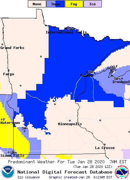
The low clouds will lift through later in the morning, which should end most of the flurries, but all of Tuesday will remain cloudy.
A weak disturbance moves into western Minnesota Tuesday night that could bring light snow near the upper Minnesota River Valley overnight into Wednesday morning.
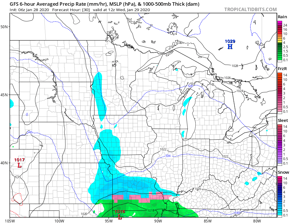
Less than one-half inch of accumulation is expected.
Very mild air returns again by the weekend. That extended forecast will be updated around 9 a.m.
Programming note
You can hear my live weather updates on Minnesota Public Radio at 7:48 a.m. Monday through Friday morning.

