
Snow and freezing drizzle create slick spots Thursday
Temperatures stay above average
Go Deeper.
Create an account or log in to save stories.
Like this?
Thanks for liking this story! We have added it to a list of your favorite stories.


An area of light snow and freezing rain will spread across northern Minnesota Thursday morning, and through the rest of the state by late afternoon.
Thursday’s weather
An area of low pressure will be moving across Minnesota through Friday, bringing in some warmer air aloft, and light precipitation. It is spreading into northwestern Minnesota already Thursday morning, putting the area in a winter weather advisory until noon Thursday due to potential freezing drizzle.
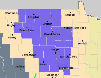
It is because of the mild air aloft that some of the precipitation could come as freezing rain, or more likely even lighter as freezing drizzle, along with light snow. Little to no ice is expected to accumulate, and snow will remain under an inch for most of the state, but slick spots could develop on the roads. The mixed precipitation spreads across Minnesota by Thursday evening.
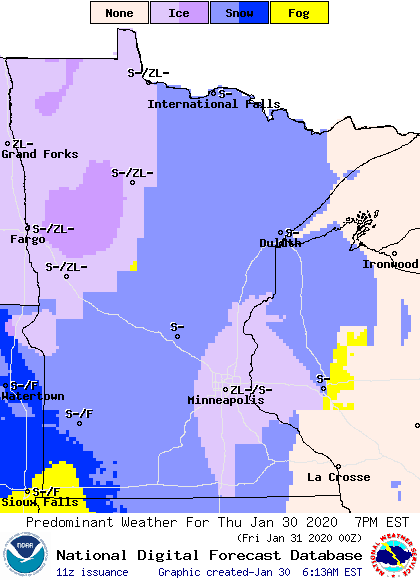
It will move out for most of the state by Friday morning.
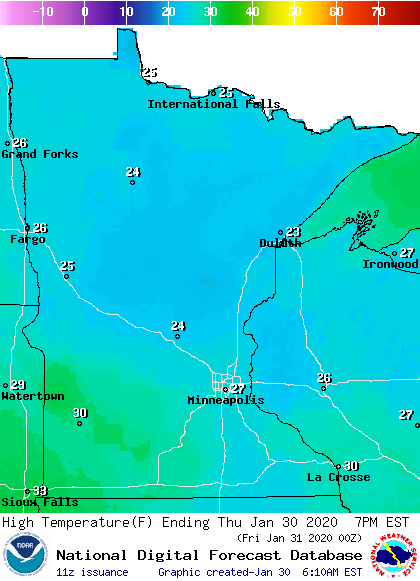
Skies will remain cloudy again on Thursday, with high temperatures slightly above average, in the 20s and low 30s.
Programming note
You can hear my live weather updates on Minnesota Public Radio at 7:48 a.m. Monday through Friday morning.
Turn Up Your Support
MPR News helps you turn down the noise and build shared understanding. Turn up your support for this public resource and keep trusted journalism accessible to all.

