
Freezing drizzle, light snow possible Thursday afternoon; temps ramp up this weekend
Some weekend sun?
Go Deeper.
Create an account or log in to save stories.
Like this?
Thanks for liking this story! We have added it to a list of your favorite stories.


I want to let you know about our weekend weather, but I should first mention some possible weather impacts Thursday afternoon into Friday.
Northwestern and west-central Minnesota saw areas of freezing drizzle and light snow Thursday morning, and that mix may linger into afternoon. There will be some slick spots in those areas.
A batch of freezing drizzle and light snow is also expected to spread across parts of southern and central Minnesota plus western Wisconsin later Thursday afternoon and evening, then continue overnight and into early Friday. Slick spots will probably develop on some roads.
The National Oceanic and Atmospheric Administration’s North American Mesoscale forecast model shows the potential precipitation pattern Thursday afternoon through Friday afternoon:
Turn Up Your Support
MPR News helps you turn down the noise and build shared understanding. Turn up your support for this public resource and keep trusted journalism accessible to all.
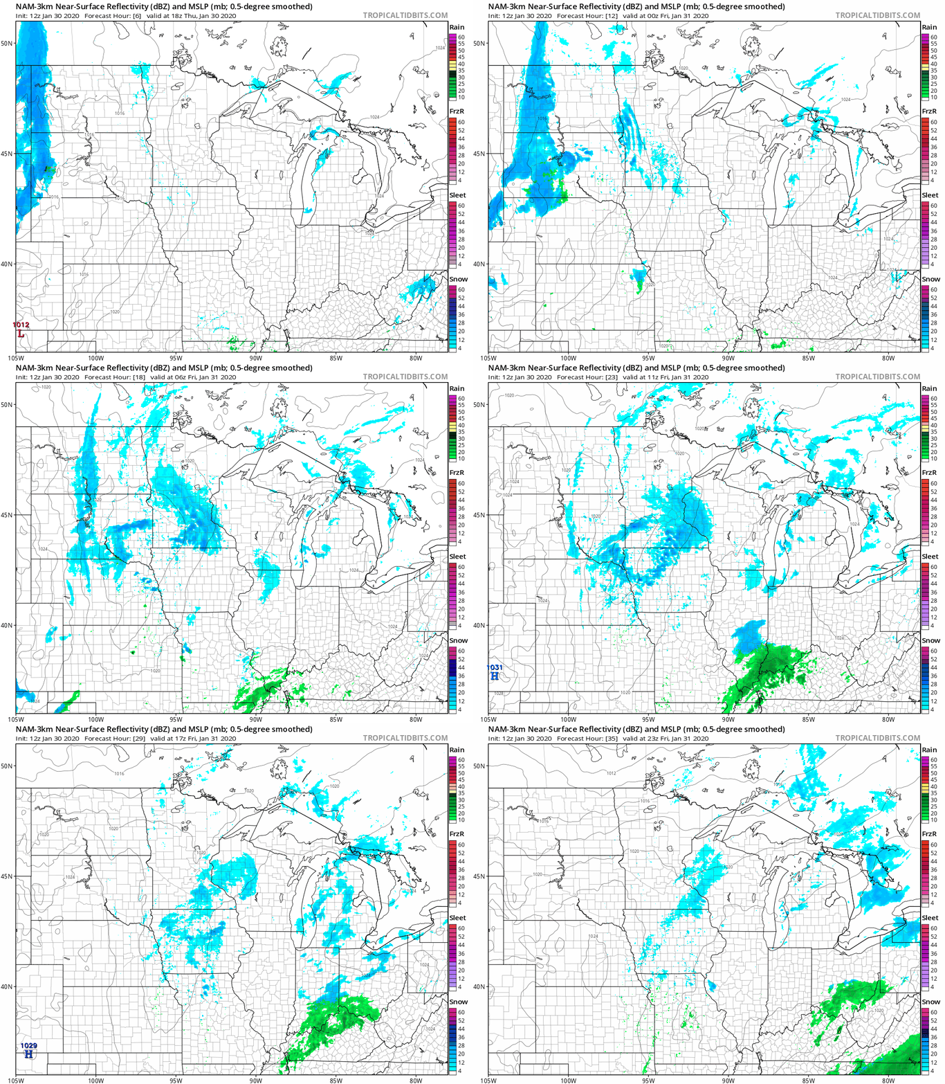
At this point, it looks like the Twin Cities metro area will see 1 inch or less of snow overnight into early Friday. Some spots in southwestern Minnesota may see between 1 and 2 inches of snow.
You can hear updated weather information on the MPR network, and you’ll see updated weather info on the MPR News live weather blog.
The weekend
Many of us will have a mix of clouds and sun this weekend, as temperatures ramp upward. Minnesota and western Wisconsin highs will reach the 30s this Saturday:
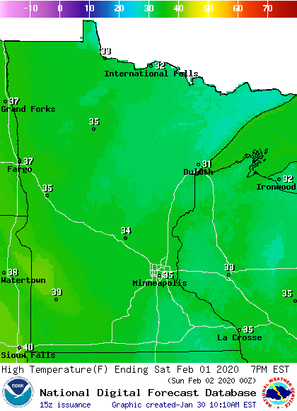
I wouldn’t be surprised to see a stray 40-degree temp in southwestern Minnesota.
Sunday highs reach the 40s across about the southern half of Minnesota, plus western Wisconsin, with many upper 30s in northern Minnesota:
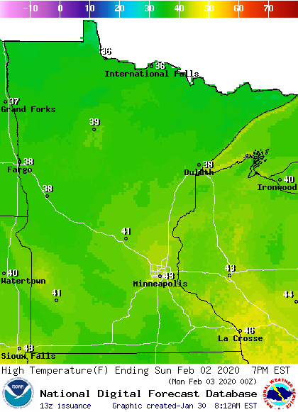
Our average Twin Cities high temp is only 25 degrees at the beginning of February, so this will be a very mild start to the month!
Snow depths
If you have outdoor plans this weekend, you’ll be happy to know that there’s plenty of snow on the ground across most of Minnesota and Wisconsin.
Here’s Thursday’s snow depth analysis from the National Oceanic and Atmospheric Administration:

Most locations in northern Minnesota and northwestern Wisconsin have between 16 and 30 inches of snow cover, and parts of northeastern Minnesota have more than 30 inches of snow on the ground, with a few 40-inch reports.
The official snow depth in the Twin Cities was 7 inches Thursday morning. St. Cloud, Minn., reported a snow depth of 10 inches, while Duluth reported 26 inches.
There’s plenty of snow on the ground in most areas for cross-country skiers, sledders, snowboarders and snowmobilers.

