
The return of sunshine could mean a shadow for Groundhog Day
Record warm temperatures are possible Sunday morning
Go Deeper.
Create an account or log in to save stories.
Like this?
Thanks for liking this story! We have added it to a list of your favorite stories.


Warm air is going to dominate Minnesota’s weather over the weekend, along with a little more sunshine into the week ahead.
Friday evening and overnight
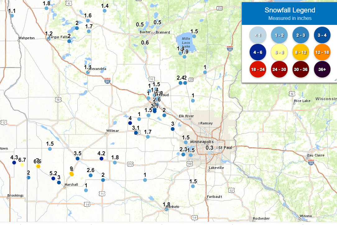
The snow that moved through Minnesota during part of Thursday and Friday has cleared out. While most of the state saw amounts ranging from no snow to light amounts, southwestern Minnesota saw a few reports over 6 inches of snow.
The northeastern part of the state could still see a very slight chance for light snow or freezing drizzle overnight.
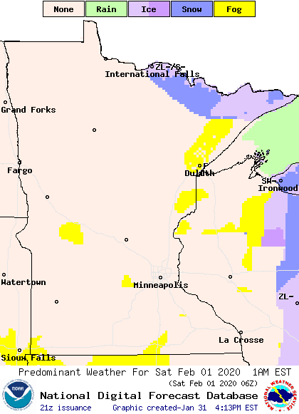
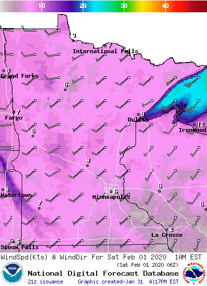
The widespread fog that many parts of Minnesota saw through the day on Friday should be less prevalent Friday night thanks to just a bit more wind, particularly in western Minnesota.
Turn Up Your Support
MPR News helps you turn down the noise and build shared understanding. Turn up your support for this public resource and keep trusted journalism accessible to all.
Otherwise it will remain mostly cloudy and mild, with overnight temperatures in the teens and 20s.
A warm weekend ahead
February is going to start off on a very warm note, with the entire state likely to see high temperatures above freezing on Saturday, and many locations in the upper 30s and low 40s for highs Sunday.
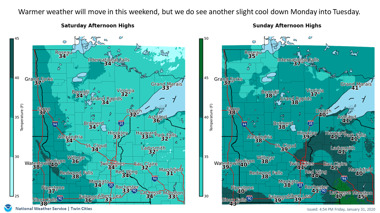
Sunday morning is when we will see the mildest temperatures compared to averages. The morning lows in the 30s on Sunday will be 20-30 degrees above our average lows, so this is when we are mostly likely to set records.

Although it will stay mostly cloudy for much of the weekend, we will finally see a few more breaks of sunshine. Currently, it looks like the most sun over the weekend could come Sunday morning.
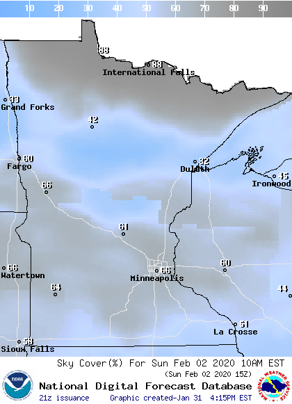
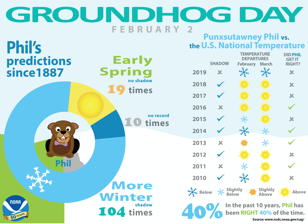
That could mean a shadow for Groundhog Day, but take any of his “forecasts” with a grain of salt, as his prognosticating has only been correct about 40 percent of the time in recent years.
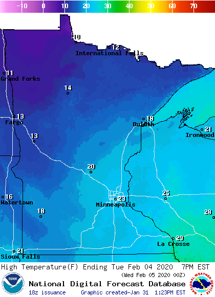
Regardless of what our rodent friend says, cold returns in the week ahead, and temperatures will be back at or slightly below average by Tuesday.
Precipitation chances
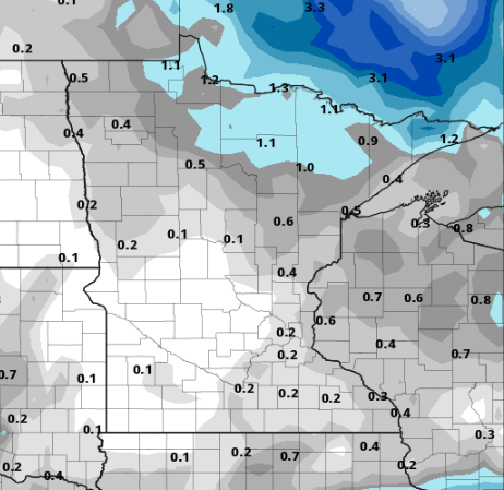
Chances for snow or any other precipitation look very limited in the week ahead. In fact, weather models going all the way to next Friday, show we could see only an inch or less of snow for the entire week.
The quieter pattern allows for a more sunshine in the week ahead, with skies varying from partly to mostly cloudy.
Have a wonderful weekend!

