
Cold air returns after record warmth on Sunday
Light snow chances by late week
Go Deeper.
Create an account or log in to save stories.
Like this?
Thanks for liking this story! We have added it to a list of your favorite stories.


After many parts of Minnesota made it into the 40s on Sunday, temperatures are noticeably cooler for Monday, with even colder air moving in for Tuesday.
The warm air on Sunday put much of Minnesota in record territory. Many highs were near records in Minnesota, and across the border in Eau Claire, Wis., they tied a record high.
Both the Twin Cities and Brainerd also saw low temperatures of 31, which tied records in both locations for the warmest lows on record for Feb. 2. Already by Sunday afternoon, winds picked up and temperatures were falling as a potent cold front moved through.
Monday’s forecast
That potent cold front is still moving brisk air into the state, and it is being reinforced by a weaker cold front moving through Monday. That means most locations around the state set their highs early Monday morning, and temperatures will remain mostly steady or fall slightly by afternoon.
Turn Up Your Support
MPR News helps you turn down the noise and build shared understanding. Turn up your support for this public resource and keep trusted journalism accessible to all.
Here are the temperatures expected Monday afternoon:
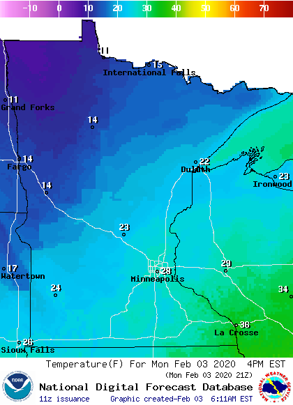
That front is also bringing back a few more clouds across the state.
Temperatures
As colder air continues to funnel in Monday, that sets up Tuesday to be the coldest day of the week, although for southern Minnesota, the colder morning could come Wednesday. Much of the state will start Tuesday in the single digits, and a few parts of northern Minnesota will dip below zero.
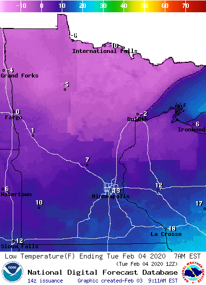
The entire state will also stay below average for Tuesday highs, ranging from the single digits to low 20s. All the state should be back in the 20s for highs on Wednesday, returning everyone to at or above average temperatures. Temperatures then remain very seasonable for early February through the end of the week.
Clouds and snow chances
We are no longer under the stagnant air mass that kept the low clouds around most of last week. After the front passing through Monday moves out, more widespread sunshine returns Tuesday, and Wednesday will be mostly sunny.
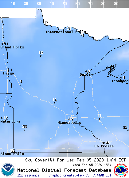
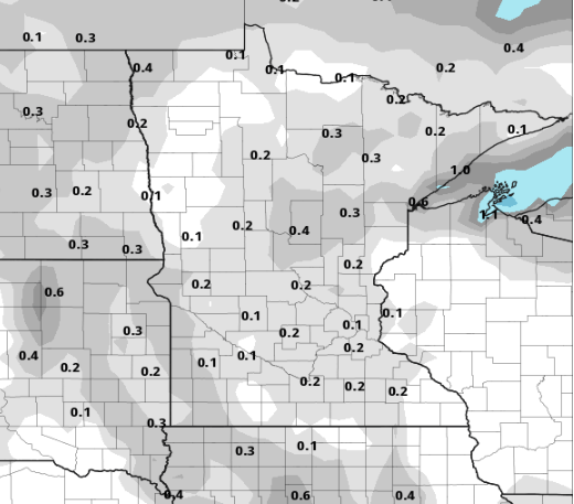
A weak area of low pressure brings more clouds back in and a very light snow chance across the state Thursday into Friday.
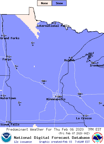
Currently, it looks like any snow would be less than a half an inch.
Programming note
You can hear my live weather updates on Minnesota Public Radio at 7:48 a.m. Monday through Friday morning.

