
Plentiful sunshine Wednesday, then clouds and snow return
Temperatures remain seasonable through the weekend
Go Deeper.
Create an account or log in to save stories.
Like this?
Thanks for liking this story! We have added it to a list of your favorite stories.


We will see another cold start Wednesday followed by a pleasant afternoon. A couple rounds of snow target the state later this week and weekend.
Temperature trend
Although only slightly below average for this time of year, northern Minnesota had a bit of a cold shock Tuesday morning, with temperatures that were 40 to 50 degrees colder than just two mornings ago.
For example, if you walked out the door in Bemidji, Minn., at 6 a.m. Sunday, it was 36, but going out the same time Tuesday morning was minus 14. That was a 50-degree drop to remind us winter certainly isn’t over!
Wednesday morning will be another cold start across the state with temperatures in the single digits for most of the state and below zero in northeast Minnesota.
Turn Up Your Support
MPR News helps you turn down the noise and build shared understanding. Turn up your support for this public resource and keep trusted journalism accessible to all.
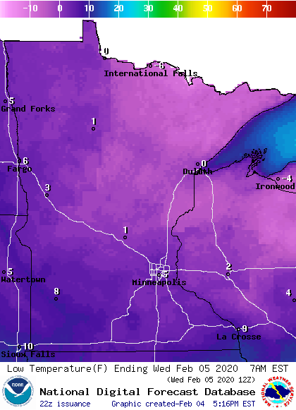
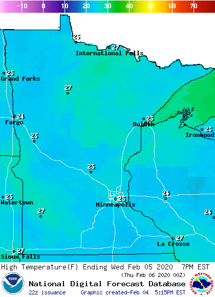
However, by Wednesday afternoon the entire state returns to at or above average temperatures, under plentiful sunshine.
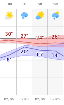
We should then continue to see seasonable temperatures through the weekend. Here is the expected temperature trend for the Twin Cites with highs in red and lows in blue:
Snow chances
High pressure sitting over Minnesota is responsible for the sunnier skies we saw Tuesday and will have into Wednesday.
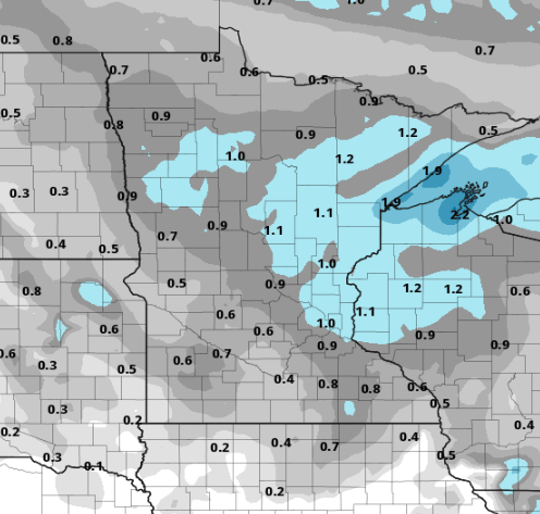
By Thursday, clouds increase again as a weak area of low pressure heads toward us, bringing light snow along with it. The snow will spread across the state Thursday, with most of Minnesota seeing chances for snow by Thursday evening.
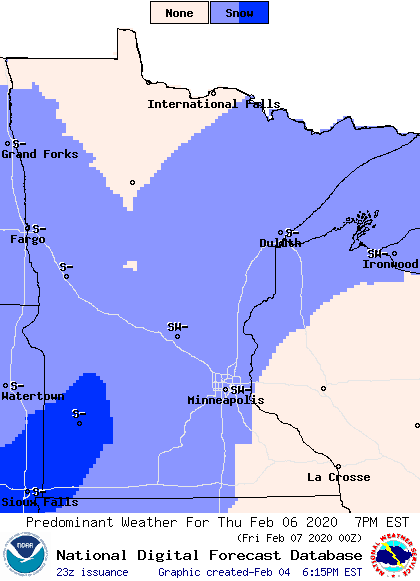
It then clears out from west to east on Friday. It looks like most of Minnesota will see around an inch of snow or less, with slightly higher amounts possible near Lake Superior.
After a quiet Saturday, another system is poised to impact predominantly southern Minnesota on Sunday.
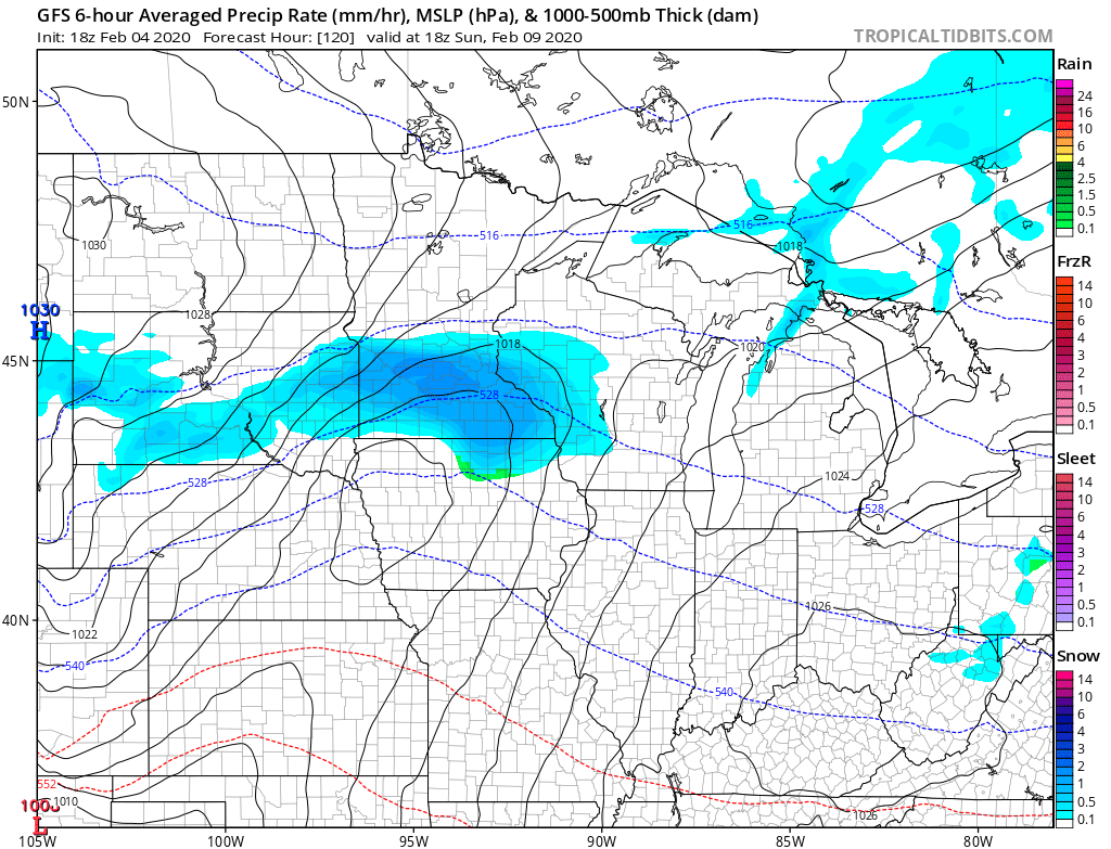
Currently the timing looks like late Saturday into early Monday and possibly 2 to 4 inches of snow, although there is still uncertainty with the snow amounts and exact locations.
We will keep you updated as the weekend approaches!

