
Two rounds of snow impact Minnesota through Sunday
Parts of the state saw big temperature swings Wednesday
Go Deeper.
Create an account or log in to save stories.
Like this?
Thanks for liking this story! We have added it to a list of your favorite stories.


All of Minnesota returned to milder weather by Wednesday afternoon, with highs in the 20s and low 30s.
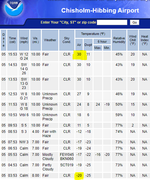
That was after most of the state started in the single digits. There were a few spots in northeast Minnesota where calm wind early Wednesday allowed temperatures to plummet below zero, causing a huge temperature swing between Wednesday morning and afternoon.
For example, Hibbing, Minn., started at minus 20 then warmed to 30, a warmup of 50 degrees.
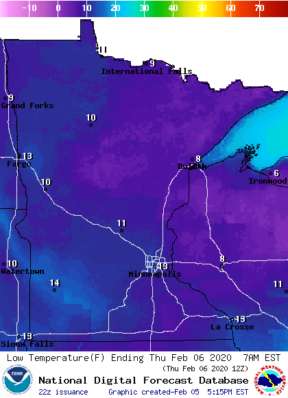
The entire state should stay above zero Wednesday night, with lows ranging from the single digits to low teens.
Turn Up Your Support
MPR News helps you turn down the noise and build shared understanding. Turn up your support for this public resource and keep trusted journalism accessible to all.
Light snow, then heavier chances
Weak low pressure brings light snow into northern Minnesota by Thursday morning, then across the state by Thursday evening.
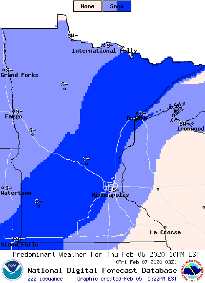
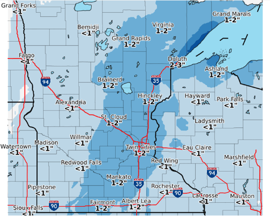
It will slowly clear Friday, but eastern parts of the state, including the Twin Cities keep light snow chances most of Friday. Most of the state will see an inch of snow or less, with some totals up to two inches in eastern Minnesota, and slightly more right along Lake Superior.
After that system clears, Saturday remains mostly quiet until a stronger system starts moving into southwestern Minnesota that night.
Through the day Sunday, southern Minnesota could see up to 6 inches of snow, thanks to a winter storm that could pass right along our southern border.
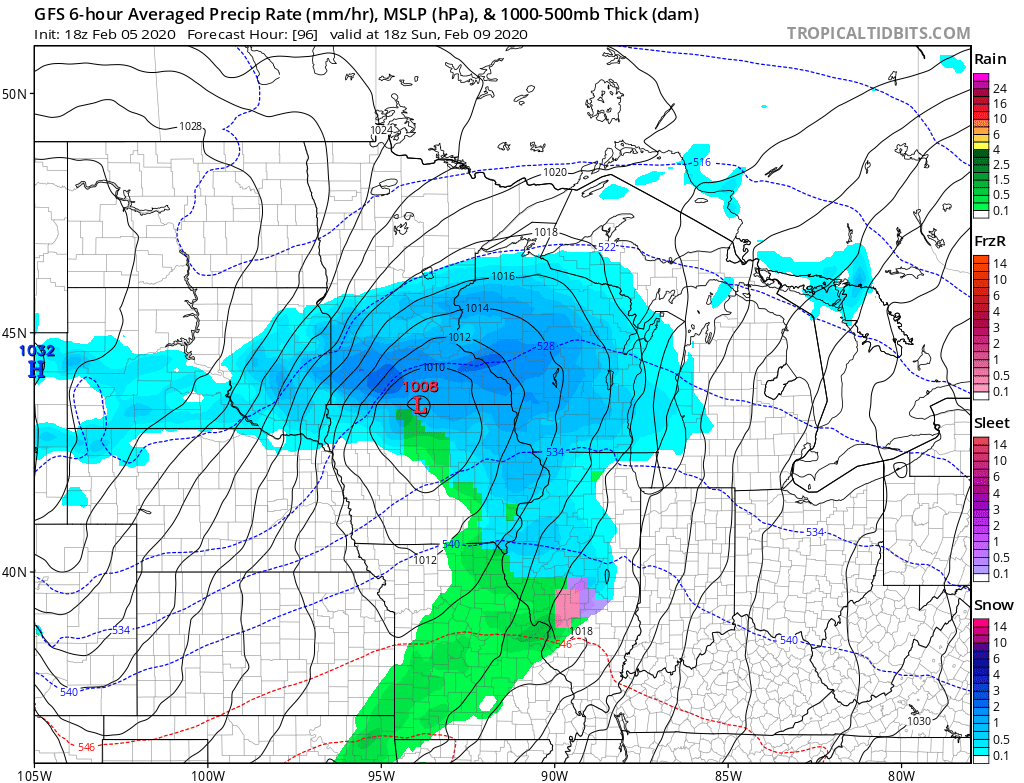
A few weather models project even higher totals, so there is still uncertainty of just how much snow will fall. Here is the NGM model showing one of the possible heavier snowfall scenarios:
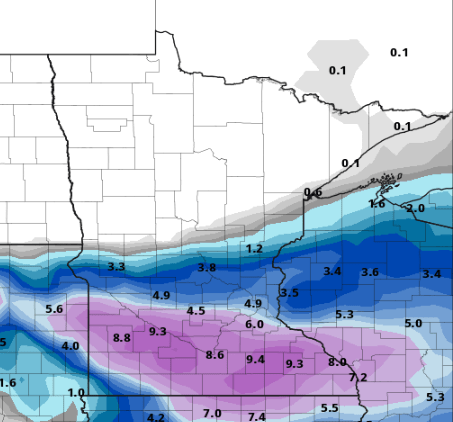
The Twin Cities could fall on the edge of the heavier snow, so we will keep you updated on storm track and snow potential as the system approaches.
Temperatures
Some cooler air will move into northern Minnesota Thursday and into Friday along with the snow.
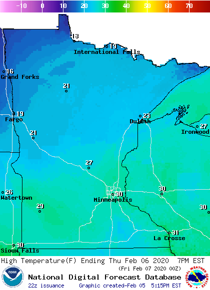
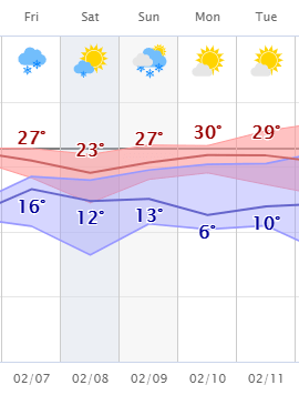
However, overall temperatures across the state remain near average in the week ahead, with no major temperatures swings likely. Here are the projected temperatures for the Twin Cities:
Programming note
You can hear my live weather updates on Minnesota Public Radio at 7:48 a.m. Monday through Friday morning.

