
Light snow moves across the state through Friday
A stronger snowstorm hits this weekend
Go Deeper.
Create an account or log in to save stories.
Like this?
Thanks for liking this story! We have added it to a list of your favorite stories.


An area of light snow moves across the state Thursday into Friday. Then a much more potent snowstorm targets southern Minnesota on Sunday.
Thursday and Friday
A weak area of low pressure is moving across Minnesota, increasing clouds and bringing flurries and light snow. As of Thursday morning, some of the snow is already moving into northeastern Minnesota. The light snow will slowly spread across the state Thursday, not making it to the Twin Cities until Thursday night.
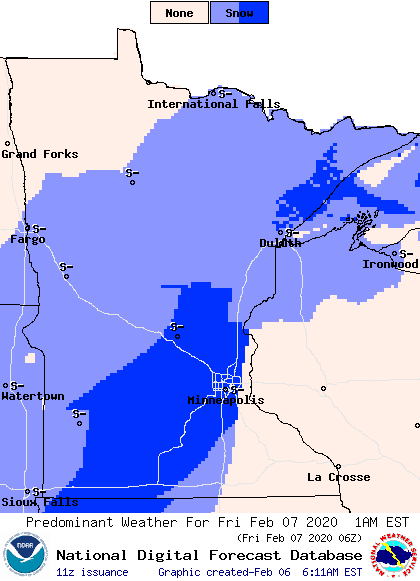
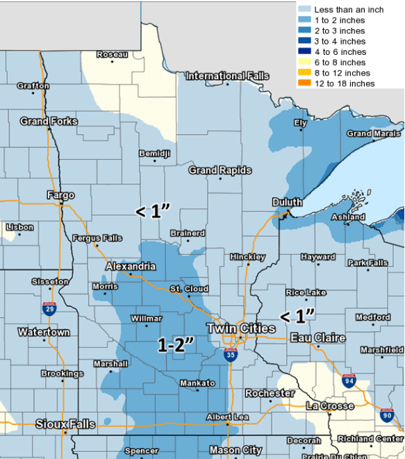
Between Thursday and when the snow moves out Friday, most of the state will see an inch or less of snow. Some isolated areas could see slightly higher amounts of snow, including the Arrowhead due to lake enhancement.
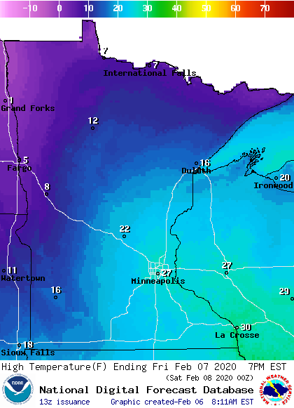
Most of the state will see highs in the 20s Thursday, with northeastern Minnesota in the teens as slightly cooler air moves in. By Friday, the cooler air becomes more widespread, with all but southeastern Minnesota seeing single digits and teens.
Turn Up Your Support
MPR News helps you turn down the noise and build shared understanding. Turn up your support for this public resource and keep trusted journalism accessible to all.
Weekend snowstorm
Saturday will remain predominantly quiet between the two rounds of snow. Already by Saturday evening, snow moves into southwestern Minnesota and spreads across southern Minnesota by Sunday morning.
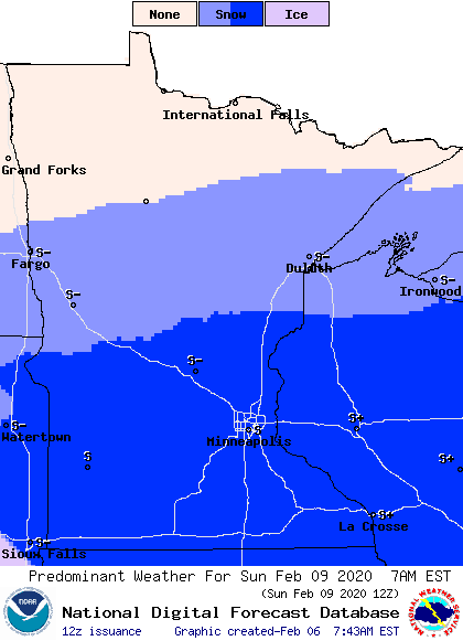
Parts of northern Minnesota may also see some light snow or flurries, being on the northern fringe of the storm. It currently looks like the center of the storm could track near our Iowa border.
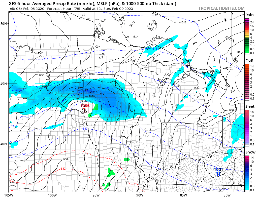
That places the heaviest snow, which could be six inches or more, in a corridor along the Minnesota River Valley and extending toward Rochester.
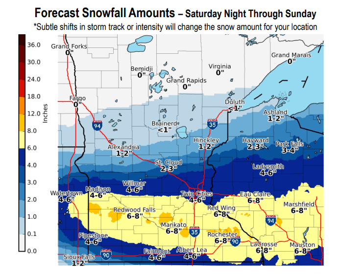
However, any slight deviation in the storm track could shift who sees the heaviest snow. All of southern Minnesota, including the Twin Cities, needs to be prepared for accumulating snow and travel disruptions Sunday. Winds will also increase on Sunday, especially for southwestern Minnesota, so blowing snow could further reduce visibility at times. The storm moves through relatively fast, clearing out the snow by Sunday evening.
Northern Minnesota may escape the snow on Sunday but is likely to see another round of light snow Monday.

Temperatures remain seasonable through the middle of next week.
Programming note
You can hear my live weather updates on Minnesota Public Radio at 7:48 a.m. Monday through Friday morning.

