
Friday brings light snow and colder temperatures
Sun returns for some parts of the state
Go Deeper.
Create an account or log in to save stories.
Like this?
Thanks for liking this story! We have added it to a list of your favorite stories.


Friday is starting off bitterly cold for northwestern Minnesota, while other parts of the state are seeing snow.
Friday’s forecast
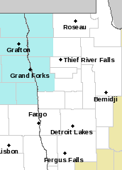
Due to a cold front that moved across Minnesota Thursday, Friday is starting off dangerously cold for northwestern Minnesota, with temperatures below zero and the wind chill making it feel minus 30 or colder at times. A wind chill advisory is up for the Northern Red River Valley until 10 a.m. (in blue).
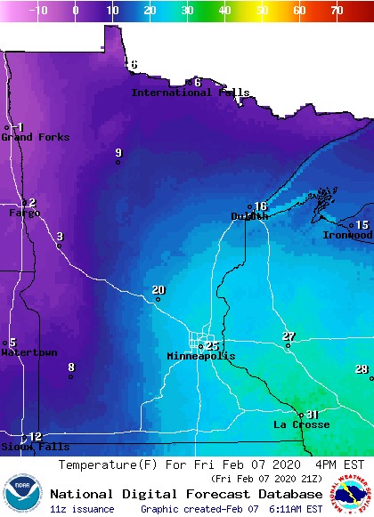
The rest of the state is above zero, with some parts of southern Minnesota still in the 20s Friday morning. The colder air means a lot of the state will not warm much on Friday and a few locations, such as Duluth, could see temperatures fall slightly into the afternoon. Here are the expected temperatures by 4 p.m.:
Light snow has also been making its way across the state, with most places seeing less than an inch of snow. The area around Duluth has seen the most widespread light snow as of Friday morning, and could see snow into the afternoon.
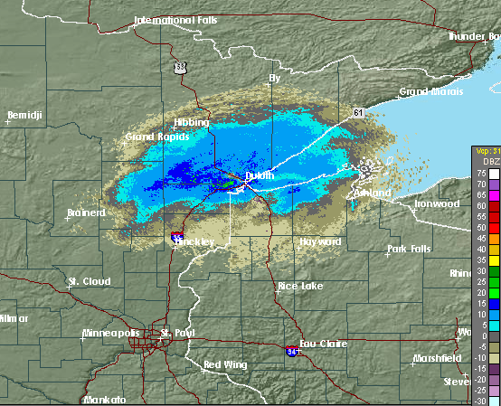
The rest of the state sees most of the snow end later in the morning, with flurries still possible for eastern Minnesota Friday afternoon. Northern and western Minnesota will see clearing skies, but for the majority of the state it remains mostly cloudy all day.
Programming note
You can hear my live weather updates on Minnesota Public Radio at 7:48 a.m. Monday through Friday morning.
Turn Up Your Support
MPR News helps you turn down the noise and build shared understanding. Turn up your support for this public resource and keep trusted journalism accessible to all.

