
Dangerous cold returns midweek
Monday brings light snow
Go Deeper.
Create an account or log in to save stories.
Like this?
Thanks for liking this story! We have added it to a list of your favorite stories.


Light snow and flurries move across Minnesota Monday, with temperatures that remain slightly above average. Arctic air will move into the state on Wednesday, bringing the entire state below zero by Thursday.
Snowstorm recap
Southern Minnesota is still digging out from the fast-moving snowstorm that brought heavy snow from Saturday night through mid-Sunday. Here are some of the higher totals from the event:
For the Twin Cities, as expected, the south metro saw larger snow totals. Bloomington had one of the highest reports for the metro area at 7.5 inches of snow.
Monday and Tuesday
Areas of fog around the state will lift through the morning, while a weak cold front starts to make its way across the state, bringing light snow.
Turn Up Your Support
MPR News helps you turn down the noise and build shared understanding. Turn up your support for this public resource and keep trusted journalism accessible to all.
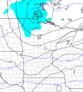
Northern Minnesota may see a light dusting of under an inch of snow, while southern Minnesota is likely to only see flurries.
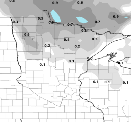
Everyone should see highs in the 20s Monday, putting the state slightly above average.
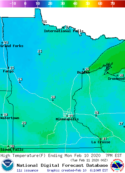
A few flurries will linger into Tuesday morning, otherwise it will be a quiet day across the state, with a bit more sunshine and highs still in the 20s. By Tuesday night, northwest Minnesota could start to see light snow as the next winter storm approaches.
Arctic blast
A strong cold front will move across the state Wednesday. It brings only light snow, with most of the state seeing an inch or less, and a few parts of northern Minnesota seeing up to 2 inches.
What it lacks in snow, it makes up for with arctic air and high winds. As the front passes through, all of Minnesota will see winds gusting at least 20 mph or greater. Western parts of the state will see winds gust over 40 mph.
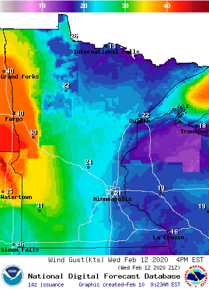
Even though the snow will be light, the high winds could cause white-out conditions at times, which already has places near the North Dakota border under a winter storm watch on Wednesday.
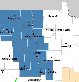
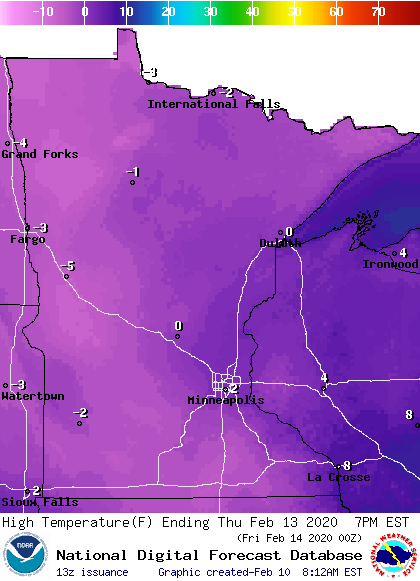
That same area could see wind chills to minus 35 Wednesday due to the high winds and falling temperatures. By Thursday, almost all of the state sees subzero highs.
Lows will be even colder, and everyone in the state will see temperatures 10 to 20 below at some point between Thursday and Friday morning.
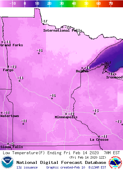
Temperatures recover quickly, with most of Minnesota back in the teens by Friday afternoon.
Programming note
You can hear my live weather updates on Minnesota Public Radio at 7:48 a.m. Monday through Friday morning.

