
Milder Saturday temps; light snow chances north and east
Above-normal highs
Go Deeper.
Create an account or log in to save stories.
Like this?
Thanks for liking this story! We have added it to a list of your favorite stories.


At 7 a.m. Friday we were dealing with arctic chill. Not so this morning, with 7 a.m. temps in the lower 20s in many spots, including the Twin Cities. Highs today reach the 30s in much of central and southern Minnesota plus western Wisconsin:
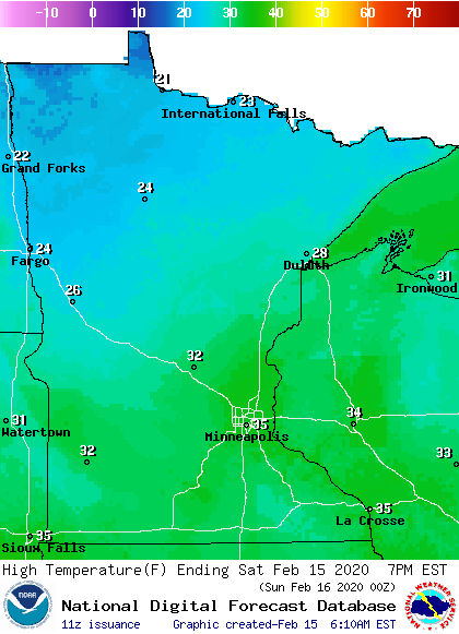
Northern Minnesota will top out in the 20s.
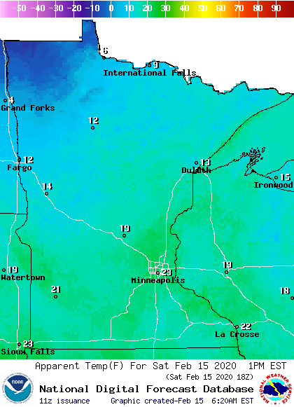
Afternoon wind chills will range from the single-digits in far northwestern Minnesota to 20s southeast:
The northern third of Minnesota plus western Wisconsin will have the best chance of occasional light snow showers today. The National Oceanic and Atmospheric Administration’s North American Mesoscale forecast model shows the potential snow pattern this Saturday:
Turn Up Your Support
MPR News helps you turn down the noise and build shared understanding. Turn up your support for this public resource and keep trusted journalism accessible to all.

Here’s a closer look at the weekend forecast for northern Minnesota and northwestern Wisconsin:
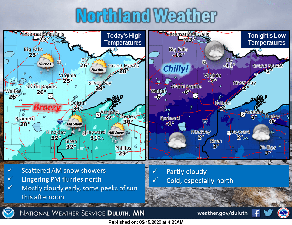
You can hear updated weather information on the MPR network, and you’ll see updated weather info on the MPR News live weather blog.
I’ll post an updated Updraft blog by 9:30 a.m. with the entire weekend forecast plus a look at the coming week.
Programming note
You can hear my live weather updates on MPR News at 7:35 a.m., 9:35 a.m. and 4:35 p.m. each Saturday and Sunday.

