
Cooler air and a chance for snow are on the way
Monday remains mild
Go Deeper.
Create an account or log in to save stories.
Like this?
Thanks for liking this story! We have added it to a list of your favorite stories.


Colder air returns mid-week after a mild Monday, and Tuesday brings a chance for snow.
Monday’s forecast
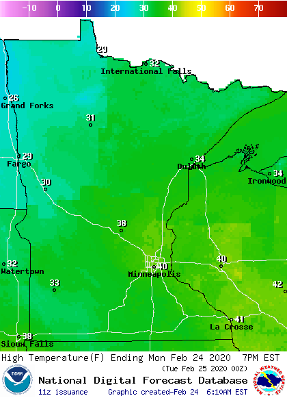
Parts of northwestern Minnesota started the day with dense fog that will lift through the morning. Otherwise, the morning will stay fairly sunny, with more clouds moving across the state in the afternoon. Much of the state will reach highs in the 30s, with a few spots including the Twin Cities, hitting 40.
Snow chances Tuesday and beyond
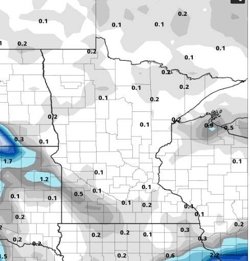
Weather that will move west and south of the state will bring a chance for light snow to western Minnesota by late Monday and across southern Minnesota Tuesday. The rest of the state may see isolated flurries. Totals should remain under one inch of snow through Tuesday night.
After that we return to a very quiet weather pattern with no big storms on the horizon.
Turn Up Your Support
MPR News helps you turn down the noise and build shared understanding. Turn up your support for this public resource and keep trusted journalism accessible to all.
Temperature trend
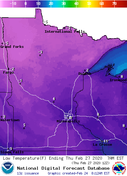
The system that brings the light snow chances on Tuesday will also bring colder air back across the state. By Wednesday, high temperatures will run slightly below average in the teens and 20s. Thursday and Friday morning could bring morning temperatures below zero for northern Minnesota.
Temperatures return to average by the weekend. Here is that temperatures trend for the Twin Cities:
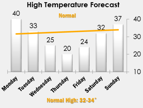
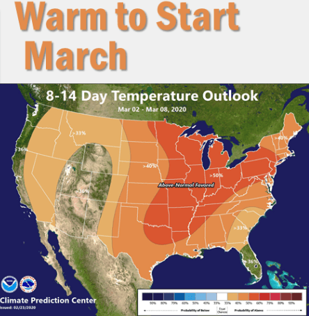
As the month of March begins, it looks like the first week is likely to stay above average.
Programming note
You can hear my live weather updates on Minnesota Public Radio at 7:48 a.m. Monday through Friday morning.

