
A temperature roller-coaster through the weekend
Snow chances remain slim
Go Deeper.
Create an account or log in to save stories.
Like this?
Thanks for liking this story! We have added it to a list of your favorite stories.


Temperatures stay above average Tuesday before colder air returns Wednesday. Precipitation chances in the week ahead remain very limited.
Tuesday’s forecast
Weather sliding west and south of the state will bring only a chance for flurries to southern Minnesota for Tuesday. A separate, minor disturbance could also bring flurries to northern Minnesota Tuesday night. Nothing more than flurries or a light dusting is expected for either area.

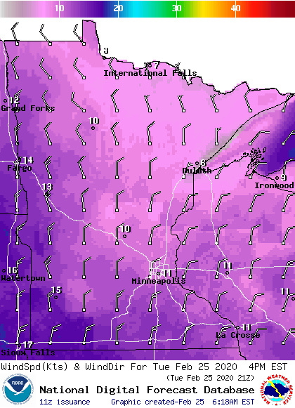
There will be a noticeable increase in winds. By Tuesday afternoon, the entire state will be breezy, with western and southern Minnesota seeing gusts over 20 mph.
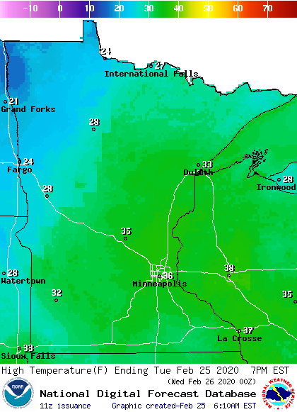
Clouds will increase some during the day, but there should be enough sunshine to bring temperatures for most of the state slightly above average again, in the 20s and 30s.
Turn Up Your Support
MPR News helps you turn down the noise and build shared understanding. Turn up your support for this public resource and keep trusted journalism accessible to all.
Briefly cooler, then mild again
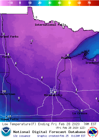
The northerly winds Tuesday will funnel cooler air into the state, causing below-average highs in the teens and 20s Wednesday and Thursday. Thursday and Friday morning could bring morning temperatures below zero for northern Minnesota.
Temperatures return to average by the weekend. Here is that temperature trend for the Twin Cities:
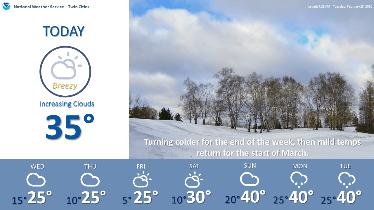
Once temperatures recover, the first week of March is likely to stay very mild.
Precipitation chances
After Tuesday’s chance for flurries, there is another chance for flurries in western Minnesota Thursday night.
Overall, the weather stays relatively quiet through the weekend, with a decent amount of sunshine. There are minor chances for rain or snow next week, including a system that could clip southern Minnesota on Monday, but currently any precipitation chances look lighter.
With the mild temperatures, sunshine, and the lack of new snow, our snowpack has been eroding quickly. Southwestern Minnesota is already starting to see snow-free patches.

More of southern Minnesota will start to see spots free of snow in the week ahead.
Programming note
You can hear my live weather updates on Minnesota Public Radio at 7:48 a.m. Monday through Friday morning.

