
Brief retreat in temps on Monday, then a rebound; snow chances north Monday night
Mild temp bias into mid-March
Go Deeper.
Create an account or log in to save stories.
Like this?
Thanks for liking this story! We have added it to a list of your favorite stories.


I saw some people walking around without coats Sunday afternoon. It was unusually warm for March 1:
The Sunday high temperature at Minneapolis-St. Paul International Airport was 50 degrees.
Our average March 1 high in the Twin Cities is 34 degrees.
50 degrees is our average Twin Cities high temperature on April 1.
Temperature trends
High temperatures retreat on Monday, then they’ll be mild the rest of this week. Monday highs will be in the 30s across most of Minnesota and western Wisconsin:
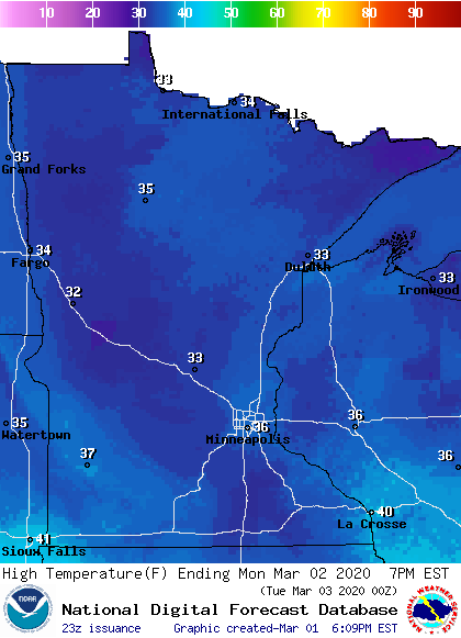
Much of the Twin Cities metro area will top out in the upper 30s during the daylight hours of Monday. Our average March 2 high is 35 degrees. Twin Cities highs are projected to be in the lower 40s Tuesday, followed by mid to upper 40s Wednesday and Thursday and lower 40s on Friday. It looks like we’ll have highs in the 50s next weekend.
Turn Up Your Support
MPR News helps you turn down the noise and build shared understanding. Turn up your support for this public resource and keep trusted journalism accessible to all.
The warmer-than-average temps may continue into the second week of March. The temperature outlook from the NWS Climate Prediction Center shows a tendency toward warmer than normal temperatures from March 9 through March 15 for most of Minnesota and Wisconsin:
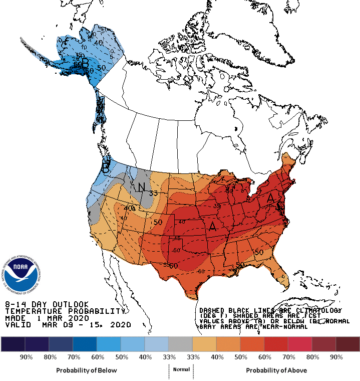
We’ll let you know if that changes.
Precipitation chances Monday into Tuesday
Far northern Minnesota may see some scattered light snow showers and/or light sprinkles Sunday night. A few scattered flurries are possible in northeastern Minnesota and northwestern Wisconsin Monday morning.
Some light snow will return to parts of northwestern Minnesota Monday afternoon, then spread across northern Minnesota and into northern Wisconsin Monday evening and Monday night. The light snow ends from west to east Tuesday morning. The National Oceanic and Atmospheric Administration’s North American Mesoscale forecast model shows the potential precipitation pattern Monday afternoon through Tuesday morning:
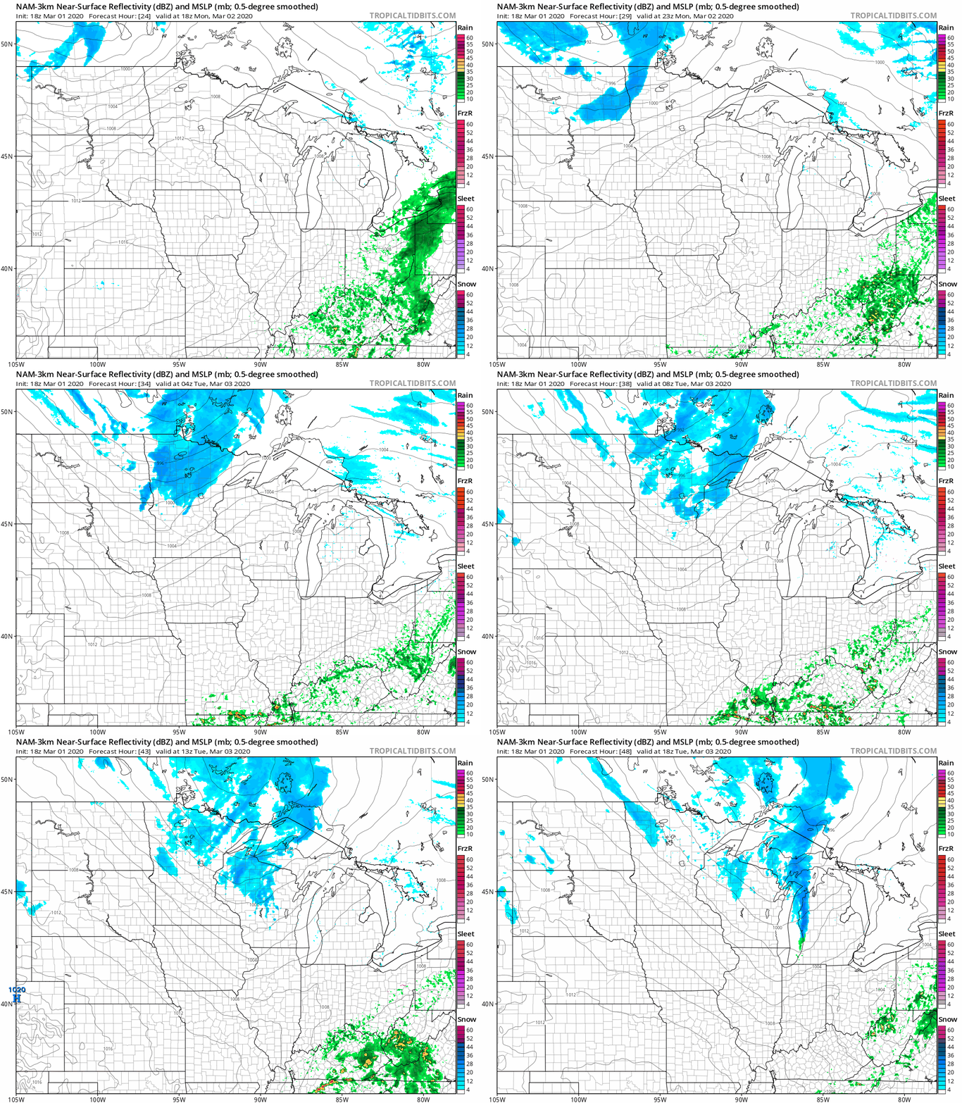
The Twin Cities metro area could see a passing flurry late Monday night or early on Tuesday.
You can hear updated weather information on the MPR network, and you’ll see updated weather info on the MPR News live weather blog.
Sunset times make a big shift

Our Twin Cities sunset was at 6:01 this Sunday. Next Sunday, our sunset time will be at 7:10 p.m. Our minutes of daylight increase this time of year, plus we switch to daylight saving time at 2 a.m. next Sunday.
I hope that you have a good week!

