
Mild temps as March begins; wind advisory Red River Valley
Flakes possible far northern Minnesota
Go Deeper.
Create an account or log in to save stories.
Like this?
Thanks for liking this story! We have added it to a list of your favorite stories.


Areas of dense fog and freezing fog are possible early Sunday morning in parts of western and central Minnesota.
Winds will pick up today, with the strongest winds to the northwest. A wind advisory includes Minnesota counties bordering the Red River from 11 a.m. to 6 p.m.:

Details of the wind advisory:
URGENT - WEATHER MESSAGE National Weather Service Grand Forks ND 252 AM CST Sun Mar 1 2020 MNZ001>004-007-029-NDZ008-016-027-030-039-052-053-020000- /O.EXB.KFGF.WI.Y.0004.200301T1700Z-200302T0000Z/ West Polk-Norman-Clay-Kittson-West Marshall-Wilkin-Pembina- Eastern Walsh-Grand Forks-Traill-Cass-Sargent-Richland- Including the cities of Crookston, East Grand Forks, Ada, Twin Valley, Halstad, Moorhead, Hallock, Karlstad, Lancaster, Warren, Stephen, Argyle, Breckenridge, Cavalier, Walhalla, Drayton, Pembina, Neche, St. Thomas, Grafton, Park River, Grand Forks, Mayville, Hillsboro, Hatton, Portland, Fargo, Gwinner, Milnor, Forman, Rutland, and Wahpeton 252 AM CST Sun Mar 1 2020 ...WIND ADVISORY IN EFFECT FROM 11 AM THIS MORNING TO 6 PM CST THIS EVENING... * WHAT...Northwest winds 20 to 30 mph with gusts up to 50 mph expected. * WHERE...Portions of northwest and west central Minnesota and northeast and southeast North Dakota. * WHEN...From 11 AM this morning to 6 PM CST this evening. * IMPACTS...Gusty winds will blow around unsecured objects. Tree limbs could be blown down and a few power outages may result. * ADDITIONAL DETAILS...Blowing and drifting snow could lead to minor travel impacts. PRECAUTIONARY/PREPAREDNESS ACTIONS... Use extra caution when driving, especially if operating a high profile vehicle. Secure outdoor objects.
Temps and wind chills
Turn Up Your Support
MPR News helps you turn down the noise and build shared understanding. Turn up your support for this public resource and keep trusted journalism accessible to all.
We’ll start meteorological spring with Sunday highs in the 40s across much of Minnesota and western Wisconsin:
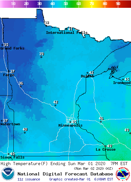
Our average March 1 high temp is 34 degrees in the Twin Cities, so a high in the mid-40s is quite a bit warmer than average. Most of west-central and northwestern Minnesota can expect Sunday highs in the 30s.
Sunday afternoon wind chills will be mainly in the 30s in the east, with 20s to the west:
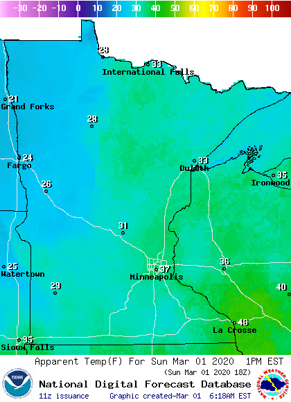
Flake chance north
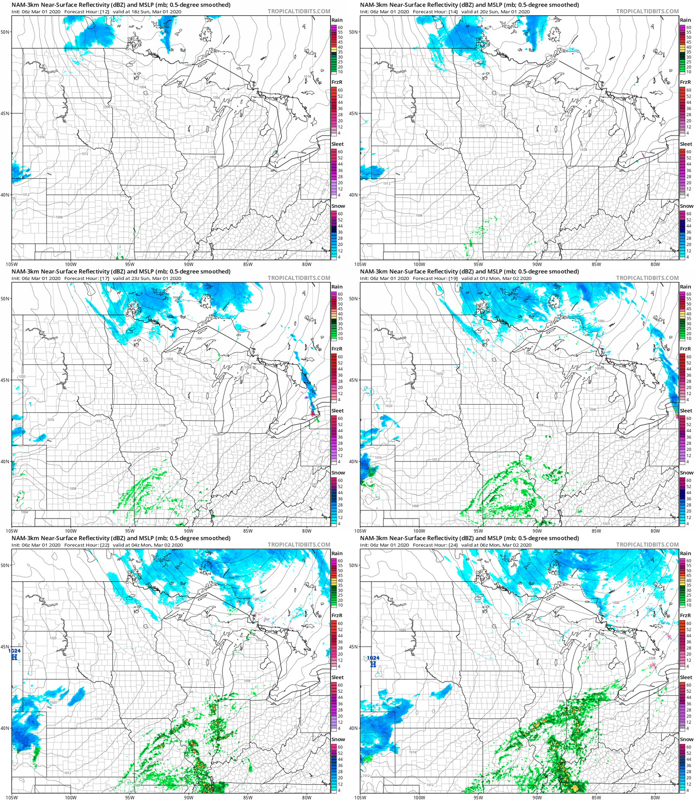
Far northern Minnesota has a chance of flurries or a bit of drizzle this Sunday morning. The far north could also see areas of light snow showers, flurries and sprinkles Sunday afternoon and evening. The National Oceanic and Atmospheric Administration’s North American Mesoscale forecast model shows the potential precipitation pattern Sunday afternoon and evening:
You can hear updated weather information on the MPR network, and you’ll see updated weather info on the MPR News live weather blog.
An updated Updraft with updated details about today plus the weather for this coming week will be posted by 9:30 this morning.
Programming note
You can hear my live weather updates on MPR News at 7:35 a.m., 9:35 a.m. and 4:35 p.m. each Saturday and Sunday.

