
Light snow returns for much of Minnesota Monday
Highs will be cooler than the past couple days
Go Deeper.
Create an account or log in to save stories.
Like this?
Thanks for liking this story! We have added it to a list of your favorite stories.


Monday sees temperatures return closer to average after a mild weekend and light snow will move across northern Minnesota.
Monday’s weather
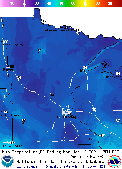
Monday is starting off very mild for this time of year, with much of the state in the 20s, thanks in part to cloud cover that lingered through the overnight. However, because a cold front passed through on Sunday, high temperatures in the 30s will not be as warm as some places saw over the weekend, although that is still above average.
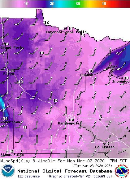
Skies for all but parts of southern Minnesota will stay mostly cloudy Monday, and it will remain breezy, especially for northwestern Minnesota.
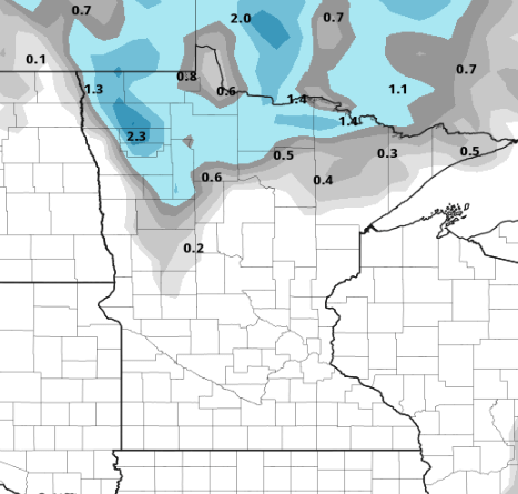
Light snow will move into northern Minnesota by the afternoon, with a couple snowflakes possibly making it as far south as the Twin Cities by late Monday night.

Accumulation will remain light, with the highest amounts possible for northwestern Minnesota at one to two inches of snow.
Programming note
You can hear my live weather updates on Minnesota Public Radio at 7:48 a.m. Monday through Friday morning.
Turn Up Your Support
MPR News helps you turn down the noise and build shared understanding. Turn up your support for this public resource and keep trusted journalism accessible to all.

