
Weekend weather: 60s Sunday across southern Minnesota
Precipitation is likely to remain light
Go Deeper.
Create an account or log in to save stories.
Like this?
Thanks for liking this story! We have added it to a list of your favorite stories.


Sunshine has returned for Friday, and temperatures will rise over the weekend. Precipitation chances in the week ahead remain limited.
Friday’s forecast
Thursday’s storm moved out quickly, but not without leaving some new snow. Parts of northern Minnesota, especially in the Arrowhead and along the Canadian border, saw several inches of new snow.
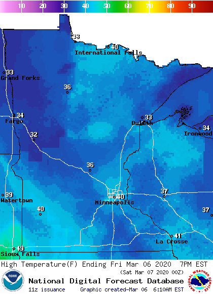
Skies have now cleared and winds have died down behind that storm. Although northern parts of the state started the day cold, the entire state will warm above average under plentiful sunshine, with highs in the 30s and low 40s.
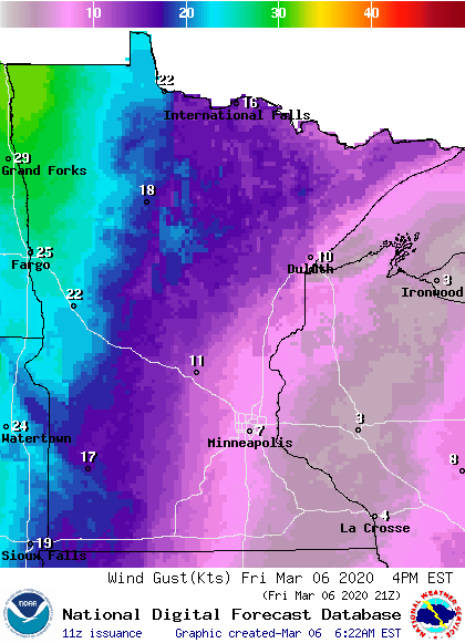
Winds will also stay much lighter, but western Minnesota will see breezy conditions pick back up into the afternoon.
Turn Up Your Support
MPR News helps you turn down the noise and build shared understanding. Turn up your support for this public resource and keep trusted journalism accessible to all.
Weekend warmup
Sunshine continues Saturday, with highs shooting into the 40s and 50s across the state.
Clouds start moving in Saturday night as the next storm approaches, and a cold front slicing across the state Sunday will keep temperatures in northern Minnesota similar to Saturday; mostly in the 40s, with the northwestern corner of the state in the 30s.
Meanwhile, southern Minnesota stays under the influence of a warmer wind flow, putting that part of the state in the 50s and 60s. This will cause a large temperature contrast across the state on Sunday.
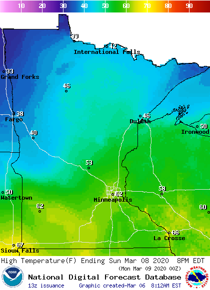
In southern Minnesota, many of the temperatures Sunday will be the warmest seen since last October. By Monday, all of the state returns to temperatures more typical of early March, but that will feel noticeably cooler compared to Sunday’s warmth.
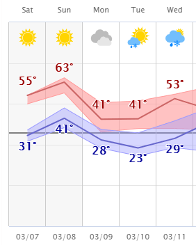
Even with the temperature drop Monday, most of the coming week will stay at or above average.
Precipitation
There are a couple chances for precipitation in the week ahead, but currently it looks like predominantly light rain or snow.
The system that passes through Sunday brings a very isolated rain and snow chance across the state Sunday into early Monday, with the best chances for precipitation being light snow in northern Minnesota.
Another system clips the state mid-week with a new, light precipitation chance. The entire snow forecast for the coming week keeps us likely to stay under an inch of snow.
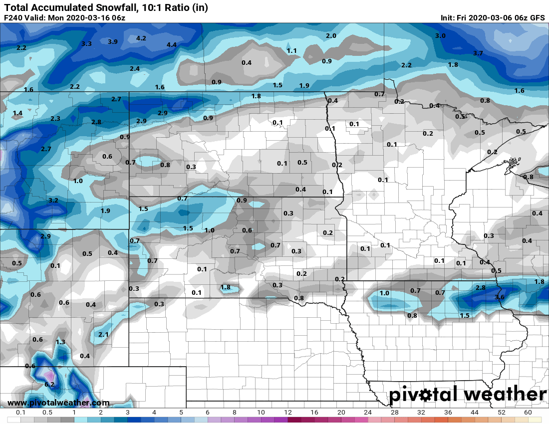
Any areas seeing rain are likely to see less than a quarter of an inch total.
Programming note
You can hear my live weather updates on Minnesota Public Radio at 7:48 a.m. Monday through Friday morning.

